Quick Update On Hurricane Barry At 11:00 AM
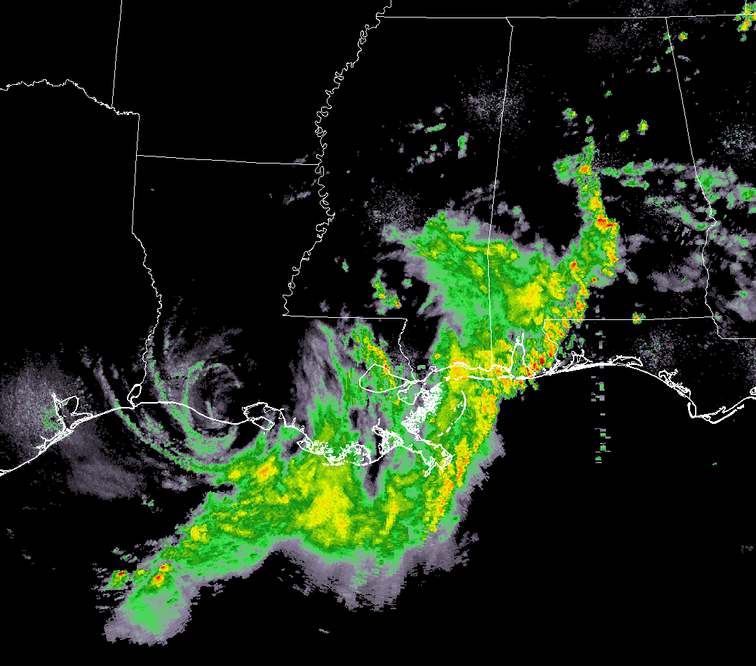
Hurricane Barry’s mid-level center of circulation is now onshore over the extreme southern parts of Louisiana south of Lafayette with maximum sustained winds of 75 MPH and gusts up to 90 MPH possible. We can also see that a band of tropical showers with some heavy downpours lined up from Montevallo southward to Maplesville to Autaugaville to Fort Deposit. These are moving northward at a quick pace around 25-30 MPH. So far, there has not been any lightning showing up.
The major rainfall is occurring over the western parts of the Florida Panhandle westward across southwestern Alabama, southeastern Mississippi, and across southeastern Louisiana.
At this point, I have not seen any reports of tornadoes recently. There was a tornado warning earlier for parts of Jackson County, Mississippi.
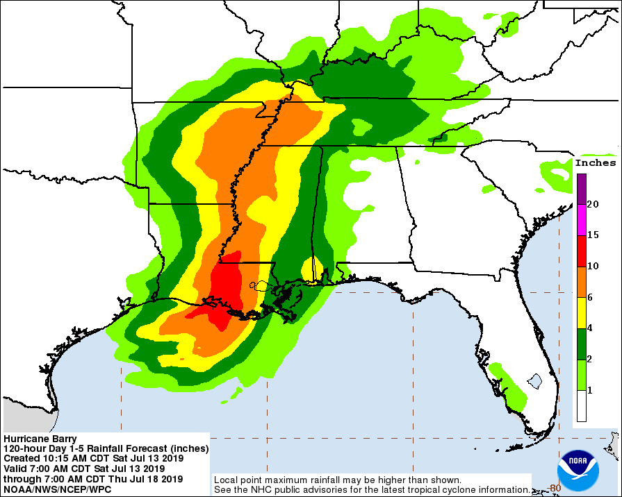
Total rainfall accumulations of 10-20 inches over south-central and southeast Louisiana and southwest Mississippi, with isolated maximum amounts of 25 inches possible with Hurricane Barry. Lower Mississippi Valley, total rain accumulations of 4-8 inches are expected, with isolated maximum amounts of 12 inches.
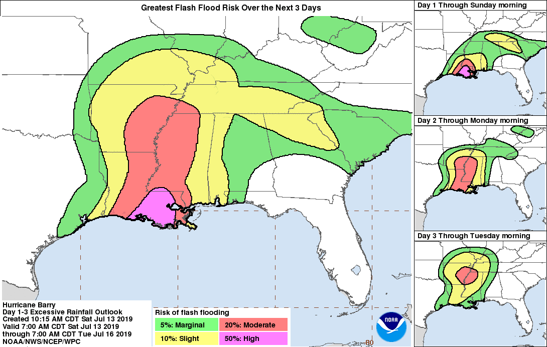
Life-threatening, significant flash flooding and river flooding will become increasingly likely later today and tonight as Barry moves inland, especially across portions of south-central and southeast Louisiana and into Mississippi.
We are already seeing reports that a levee in Myrtle Grove, Louisiana (Plaquemines Parish) south of New Orleans is overtopping from the storm surge.
Well away from the center, we are getting a minor flood report of overwash covering the roadway in Cape San Blas, FL with some debris left behind.
Also, some low lying roads in Baldwin and Mobile counties and Dauphin Island are closed due to saltwater intrusion and flooding. Good news is that everything occurring is expected and manageable.
A peak wind gust of 65 MPH has been reported at LSU’s Tiger Stadium at 9:50 am.
Storm surge along the coast just south of St. Mary and Morgan City was up to 7.35 feet above mean water levels.
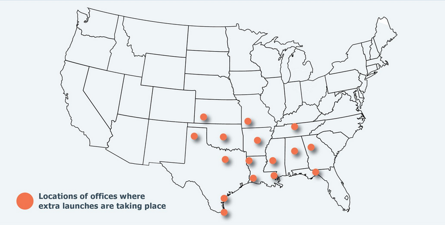
Many NWS offices are launching extra radiosonde balloons in an effort to improve the weather model forecasts on Hurricane Barry.
Category: Alabama's Weather, ALL POSTS, Severe Weather, Tropical
About the Author (Author Profile)
Scott Martin is an operational meteorologist, professional graphic artist, musician, husband, and father. Not only is Scott a member of the National Weather Association, but he is also the Central Alabama Chapter of the NWA president. Scott is also the co-founder of Racecast Weather, which provides forecasts for many racing series across the USA. He also supplies forecasts for the BassMaster Elite Series events including the BassMaster Classic.Subscribe
If you enjoyed this article, subscribe to receive more just like it.


