Late Night Look at Alabama’s Weather
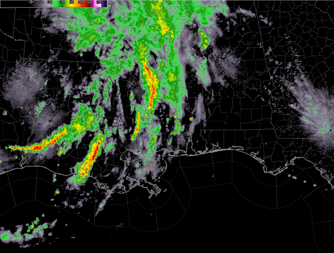
Showers and storms tonight across Alabama have gone downhill. The heaviest action at 10:30 p.m. is over parts of Walker County, where moderate to heavy rain continues from near Carbon Hill south to Oakman and The Wye. This activity will push through Jasper and into Winston and western Walker County.
Moderate rain continues over the western Tennessee Valley. All warnings in Alabama have expired.
Rainfall has intensified over the past hour from Kosciusko down to Forest and Newton to the west of Laurel. This is an area that does nt need additional heavy rain. This activity is moving north northeast and should weaken before it gets into Northwest Alabama later tonight.
Additional rains are increasing in two strong feeder bands tonight between Lafayette and Lake Charles. It is common for rainfall rates in remnant tropical cyclones to increase at night so this is not unexpected. This activity will continue to move north northeast and cause additional flooding problems in Mississippi. Some of this activity could get into Alabama tomorrow. More bands of showers and storms are likely on Monday even as the remnants of Barry remain back over Arkansas.
Category: Alabama's Weather, ALL POSTS
About the Author (Author Profile)
Bill Murray is the President of The Weather Factory. He is the site's official weather historian and a weekend forecaster. He also anchors the site's severe weather coverage. Bill Murray is the proud holder of National Weather Association Digital Seal #0001 @wxhistorianSubscribe
If you enjoyed this article, subscribe to receive more just like it.


