Only a Few Showers Out There at Midday
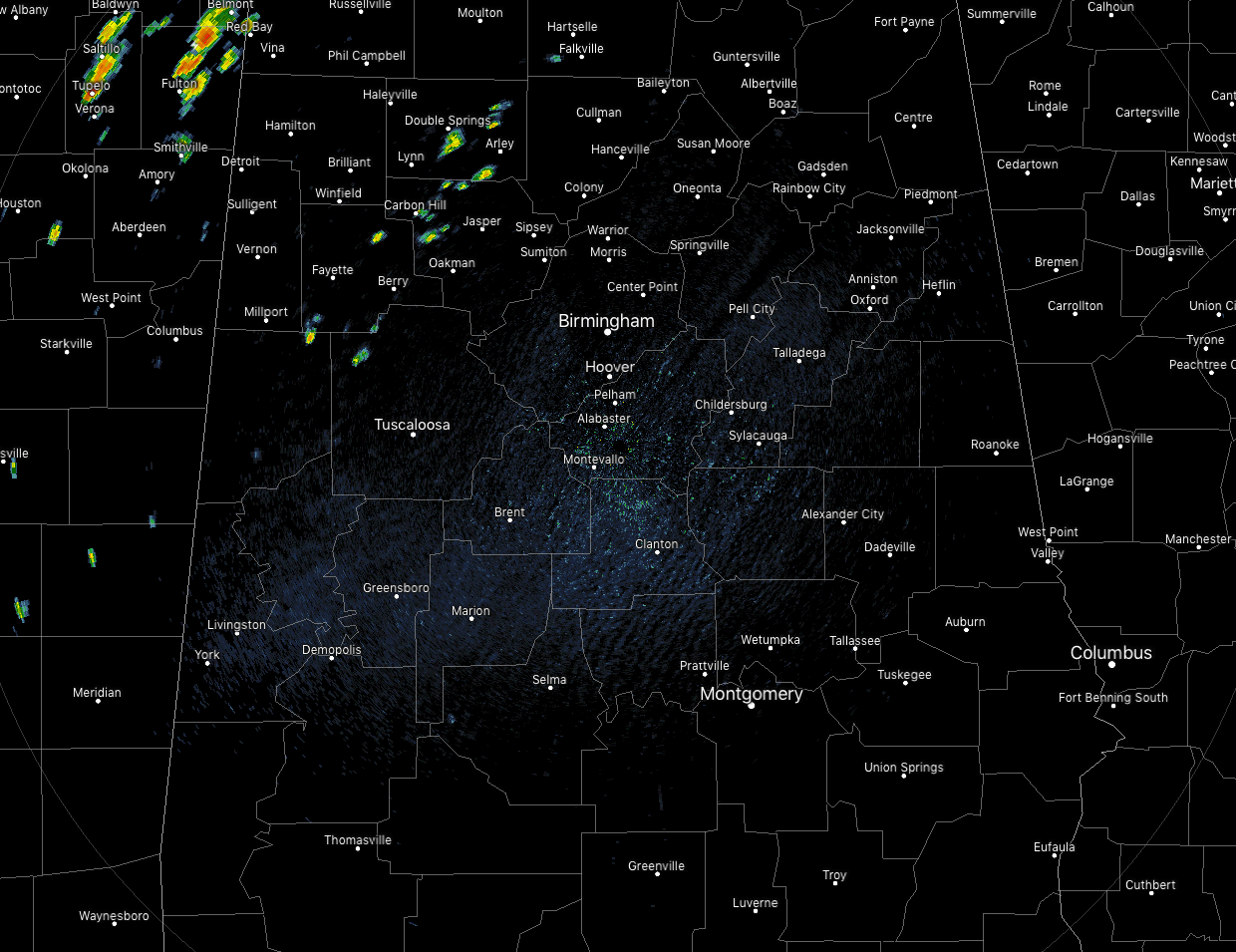
Skies have cleared out somewhat across much of Central Alabama at 12:00 pm, but we do see a few isolated showers over the northwestern parts of the area especially over parts of Tuscaloosa, Fayette, Waler, and Winston counties. The rest of the area is dry. Temperatures are in the mid-80s to the lower 90s across the area at this point.
There is a very small risk of a few isolated afternoon showers and storms for locations mainly north and west of the I-59 corridor, but the extreme northwestern corner of the area could see some scattered storms move in from a trailing band associated with Barry. That will roughly be north and west of a line from Sulligent to Brilliant to Double Springs to Addison. Highs will range from the upper 80s to the mid-90s across the area from northwest to southeast.
For tonight, there is a very small risk of an isolated shower or storm lingering into the evening hours for locations mainly north and west of the I-59 corridor, but a disturbance that will be wrapping around the southern circulation of Barry is expected to bring a good chance of showers and storms to the extreme northwestern corner of the area before sunrise. Lows will be in the lower to mid-70s.
Rain Chances Ramp Back Up For Wednesday
A trough along with the disturbance will continue to move through the area throughout the day on Wednesday that will have rain chances elevated roughly for locations north of the I-20 corridor while drier low-level air will keep locations south of that will keep rain chances much lower. We can expect a small risk of isolated to scattered mainly afternoon showers and storms for locations in the south, while scattered to numerous showers and storms can be expected throughout the day in the north. Afternoon highs will be in the mid-80s to the mid-90s from northwest to southeast.
Good News For Beach Goers This Week
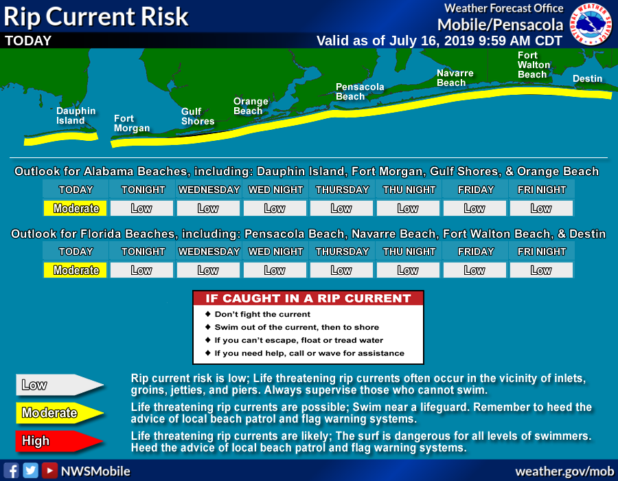
If you are planning on a beach trip this week, conditions will be greatly improving especially with the rough water situation. While rip currents are expected to stay in the high-risk category for the day today, that will drop into the moderate risk category for tonight through Wednesday night. Thursday and Friday will see nice and calm waters along the Gulf Coast as the rip current threat will be in the low-risk category.
Weather-wise, you can expect plenty of sunshine today through Friday with a very small chance of an isolated shower or storm during the afternoon hours on Friday. Highs will be right around 90 degrees along the Alabama Gulf Coast and eastward down to Pensacola.
Get the latest weather and rip current forecasts for the beaches from Fort Morgan to Panama City on our Beach Forecast Center page. There, you can select the forecast of the region that you are interested in.
Category: Alabama's Weather, ALL POSTS
About the Author (Author Profile)
Scott Martin is an operational meteorologist, professional graphic artist, musician, husband, and father. Not only is Scott a member of the National Weather Association, but he is also the Central Alabama Chapter of the NWA president. Scott is also the co-founder of Racecast Weather, which provides forecasts for many racing series across the USA. He also supplies forecasts for the BassMaster Elite Series events including the BassMaster Classic.Subscribe
If you enjoyed this article, subscribe to receive more just like it.


