Scattered Storms Firing Across Mississippi, Moving into Northwest Alabama
Scattered showers and storms are occurring this afternoon over western Tennessee and northern Mississippi on the eastern side of the remnant circulation from Barry that is centered over Arkansas.
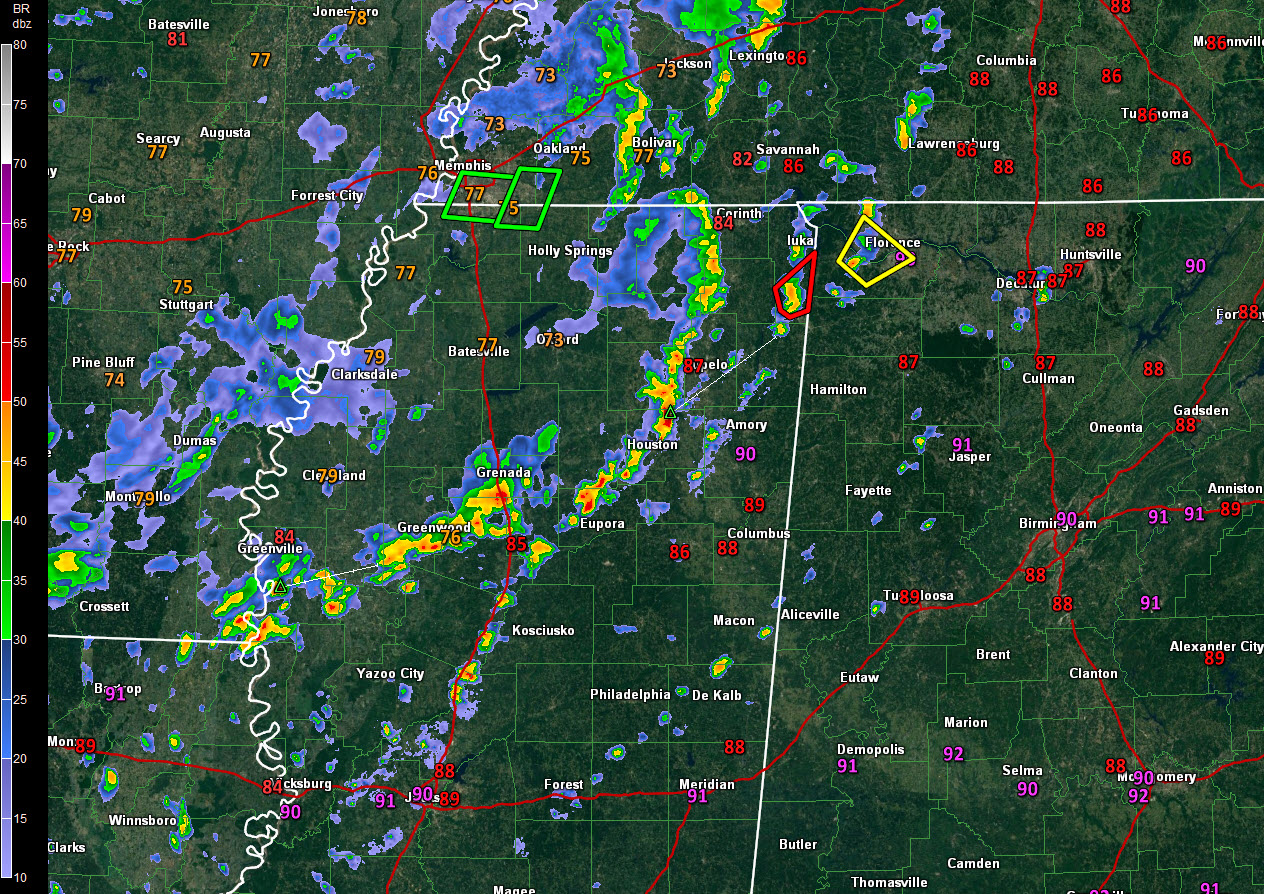
A tornado warning is in effect for Tishomingo County in northeastern Mississippi until 1:30, when it will be allowed to expire. This cell will be moving into western Colbert County in Northwest Alabama. There was a report of a tornado touchdown near Victoria, Mississippi. That is just north of I-22 northwest of Holly Springs a little earlier.
Storms west of Okalona and Eupora have a good bit of lightning in them and seem to be intensifying.
A severe thunderstorm warning is in effect for parts of Colbert and Lauderdale Counties in Northwest Alabama. That storm is approaching Florence.
All of this activity is associated with the trough that is the remnants of Barry. It will be pushing just to our north through today and tomorrow.
Scattered storms should get into Alabama this afternoon and evening before contracting after the heating of the day is lost.
Severe weather isn’t likely, but a few of the stronger storms could produce damaging wind gusts, and with old tropical cyclones, you have to be alert to the possibility that they can spin up a brief tornado.
Category: Alabama's Weather, ALL POSTS
About the Author (Author Profile)
Bill Murray is the President of The Weather Factory. He is the site's official weather historian and a weekend forecaster. He also anchors the site's severe weather coverage. Bill Murray is the proud holder of National Weather Association Digital Seal #0001 @wxhistorianSubscribe
If you enjoyed this article, subscribe to receive more just like it.


