It’s Hot & Mostly Sunny At This Point Just After Midday
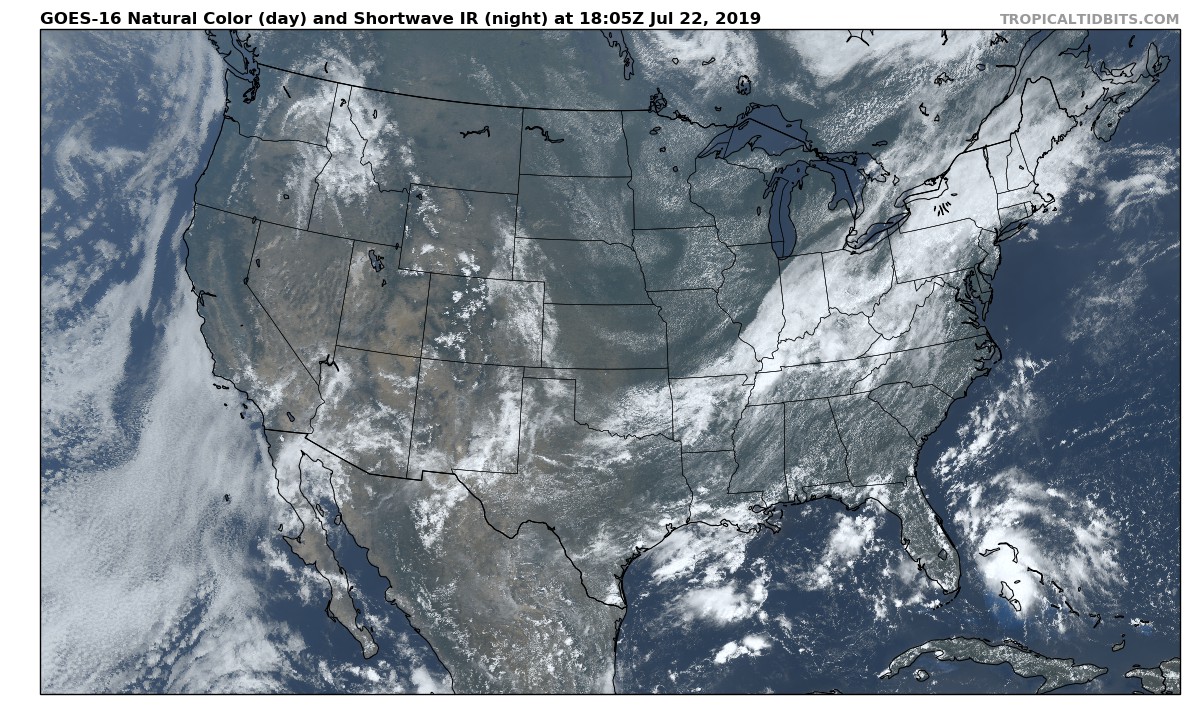
Not too bad across Central Alabama at 1:20 pm as we have mostly clear skies and nearly a clean sweep on the radar. The only showers that are showing up are in the northwestern corner of the area near Double Springs and over Addison. These are very small showers at this point and no lightning is occurring at the moment. These are moving off to the northeast.
We’ll continue to have mostly clear to partly cloudy skies throughout the rest of the daylight hours with a chance of scattered afternoon showers and thunderstorms popping up, with the higher chances occurring over the extreme northern and extreme southern parts of the area. Afternoon highs will be in the upper 80s to the mid-90s from northwest to southeast across the area.
A cold front will enter the northwestern parts of the area and will move southeast through the northern half of the area during the late-night and overnight hours. Along and ahead of the front, scattered to numerous showers and thunderstorms will be likely. A few scattered showers and storms will be possible over the southern half of the area through the overnight hours. Lows will be in the upper 60s to the mid-70s.
On Tuesday, the cold front will start off around or just south of the I-59 corridor at daybreak and will move southeastward throughout the day. Scattered to numerous showers and thunderstorms will be likely along and ahead of the front. A few scattered showers and storms will be possible during the morning up to the noon hours north and west of the I-59 corridor, but those chances will drop and will be dry during the late afternoon through the remainder of the day. Highs will be in the lower to mid-80s.
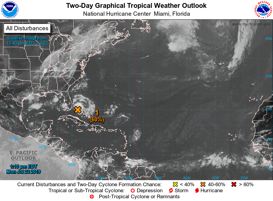
THE TROPICS
An area of low pressure, now called Invest 94L, is located near Andros Island in the Bahamas and has a medium potential of becoming a tropical depression later today or tonight. The good news is that it is not expected to strengthen any more than that and will eventually curve back off to the north and northeast away from the US Mainland within the next couple of days. We’ll keep an eye on it just in case there is a major change in the forecast. The rest of the Atlantic Basin is quiet at this point.
Category: Alabama's Weather, ALL POSTS
About the Author (Author Profile)
Scott Martin is an operational meteorologist, professional graphic artist, musician, husband, and father. Not only is Scott a member of the National Weather Association, but he is also the Central Alabama Chapter of the NWA president. Scott is also the co-founder of Racecast Weather, which provides forecasts for many racing series across the USA. He also supplies forecasts for the BassMaster Elite Series events including the BassMaster Classic.Subscribe
If you enjoyed this article, subscribe to receive more just like it.


