Cooler & Drier Air Moving In Behind The Cold Front At Midday
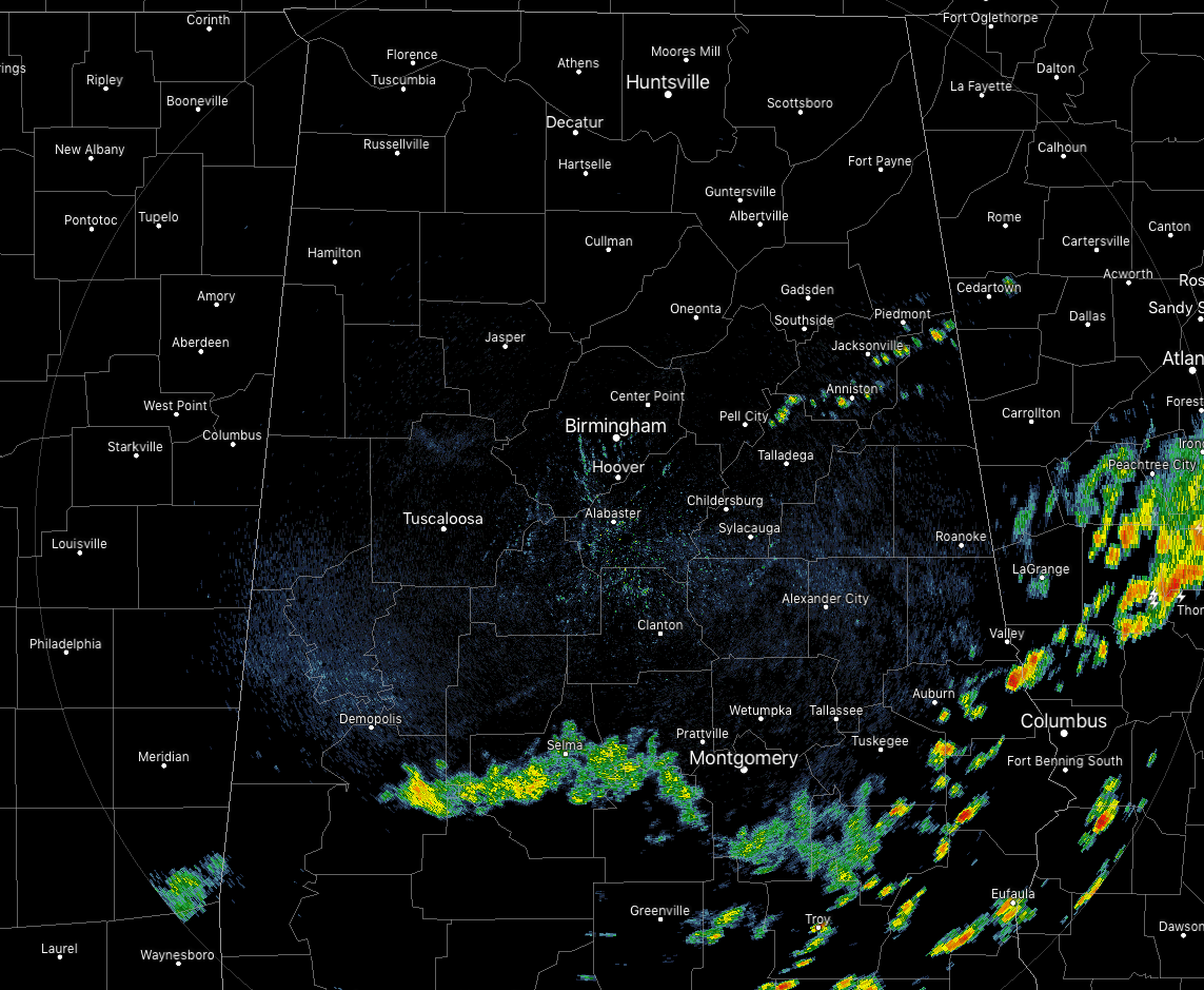
At 11:40 am, the cold front continues to march slowly southward through Central Alabama as it now draped over the southern pars of the area most likely from Chatom (Washington Co.) to Hayneville (Lowndes Co.) to Ranburne (Cleburne Co.). We have a few showers just north of the front in the eastern parts of the area while there are scattered showers ahead of the front in the southern parts of the area. At this point, the heavier activity is located across the central portions of Georgia.
Temperatures across Central Alabama were in the lower 70s to the lower 80s across the area from northwest to southeast. Haleyville was the cool spot at 73 degrees. A few locations out ahead of the front were tied at 82 degrees as the warm spots. Birmingham was at 77 degrees. Out ahead of the front, dewpoints were still in the lower to mid-70s, while behind the front, dewpoints were in the mid to upper 60s.
For the remainder of the day, any shower and thunderstorm activity will continue to shift southeast as the cold front continues to move southward through Central Alabama. Skies will be mostly cloudy with conditions drying out north and west of I-59, with increasing rain chances as you move southeast south of I-59. Afternoon highs should top out in the lower to mid-80s across the area. A few lingering showers can be expected south of the I-85 corridor later this evening but should be out of the area by midnight. Cooler temperatures along with much drier air move in with lows dipping into the upper 50s to the upper 60s across Central Alabama.
What a fantastic summer day for Central Alabama on Wednesday… We’ll have plenty of sunshine with surface winds out of the northeast at 5-10 MPH. While the afternoon highs will be in the mid to upper 80s across the area, it will feel much more comfortable with dewpoints in the upper 50s to the mid-60s. Clear skies and cool for a late-July evening as lows will be in the upper 50s to the mid-60s.
MISCHIEF POSSIBLY BREWING IN THE GULF
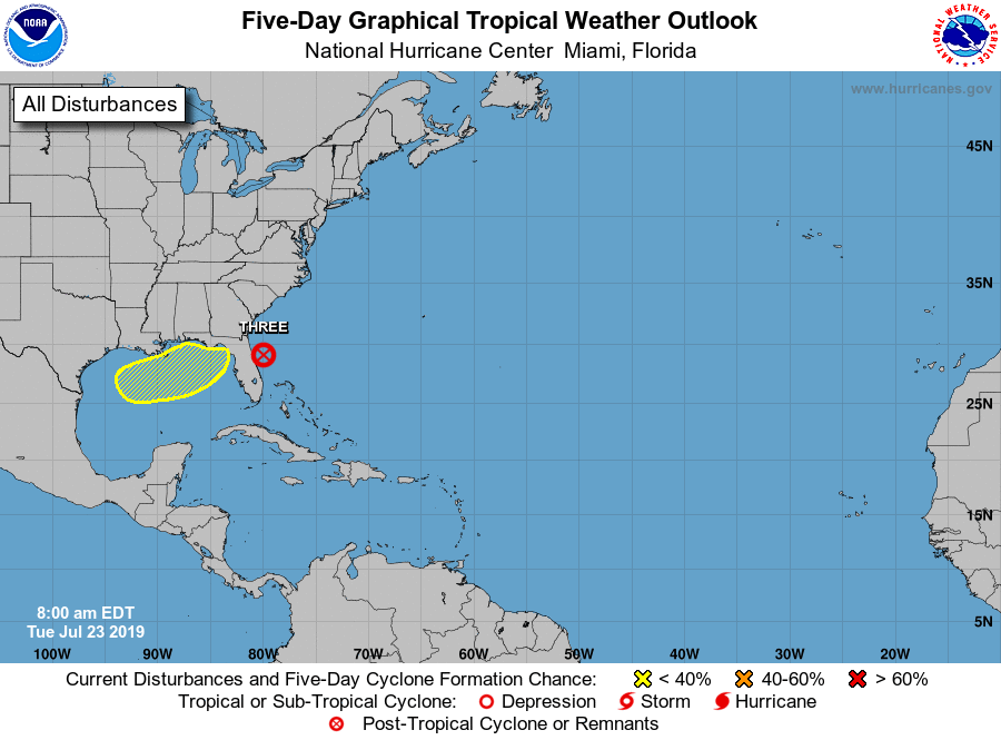
A non-tropical low-pressure area could form over the northern Gulf of Mexico by late Wednesday or Thursday from the cold front that is moving through the southern parts of Central Alabama. Thereafter, conditions could become marginally conducive for some subtropical or tropical development as it moves slowly northeastward through the end of the week. The National Hurricane Center is giving it very low odds that it forms into a depression within the next five days, around 20%.
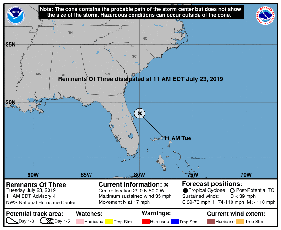
As for Tropical Depression Three… it has dissipated into a trough of low pressure as it has lost the surface circulation. The remnants are likely to continue producing gusty winds through tonight along with possible rainfall amounts of 1 to 3 inches across the northwest Bahamas today.
ON THIS DAY IN WEATHER HISTORY
1788 – A weather diary kept by George Washington recorded that the center of a hurricane passed directly over his Mount Vernon home. The hurricane crossed eastern North Carolina and Virginia before moving into the Central Appalachians. Norfolk, VA, reported houses destroyed, trees uprooted, and crops leveled to the ground.
BEACH FORECAST CENTER
Get the latest weather and rip current forecasts for the beaches from Fort Morgan to Panama City on our Beach Forecast Center page. There, you can select the forecast of the region that you are interested in.
ALREADY OFF TO A HOT START IN 2019! ADVERTISE WITH THE BLOG!
We have enjoyed over 11 MILLION page views on AlabamaWx.com so far in 2019! Don’t miss out! We can customize a creative, flexible and affordable package that will suit your organization’s needs. Contact Bill Murray at (205) 687-0782.
E-FORECAST
Get the Alabama Wx Weather Blog’s Seven-Day Forecast delivered directly to your inbox by email twice daily. It is the most detailed weather forecast available in Central Alabama. Subscribe here… It’s free!
CONNECT WITH THE BLOG ON SOCIAL MEDIA
You can find the AlabamaWx Weather Blog on the major social media networks:
Facebook
Twitter
Instagram
WEATHERBRAINS
Don’t forget you can listen to our weekly 90 minute netcast anytime on the web at WeatherBrains.com or on iTunes, Stitcher, or Spotify. This is the show all about weather featuring many familiar voices, including the meteorologists at ABC 33/40.
Category: Alabama's Weather, ALL POSTS
About the Author (Author Profile)
Scott Martin is an operational meteorologist, professional graphic artist, musician, husband, and father. Not only is Scott a member of the National Weather Association, but he is also the Central Alabama Chapter of the NWA president. Scott is also the co-founder of Racecast Weather, which provides forecasts for many racing series across the USA. He also supplies forecasts for the BassMaster Elite Series events including the BassMaster Classic.Subscribe
If you enjoyed this article, subscribe to receive more just like it.


