Midday: A Few Showers Over Eastern Parts Of The Area
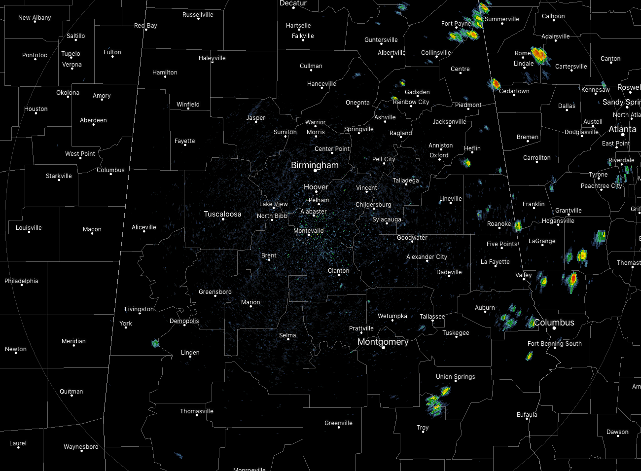
As of 12:20 pm, we do have a few isolated showers that have popped up mainly in the eastern parts of the area. A few are over the southeastern parts of the area over parts of Pike, Bullock, Lee, and Russell counties. A few more are dotting the radar up in the northeastern parts of the area over portions of Etowah, Cherokee, Cleburne, and Randolph counties.
Temperatures are currently in the upper 80s to the lower 90s across the area with a few outliers out there. Uniontown and Jasper are both in the mid-90s, but I have a feeling that those numbers are not correct since the other locations nearby are in the upper 80s to just over 90 degrees. Birmingham was at 91 degrees. The cool spot was Alexander City at 86 degrees.
We’ll continue to have mostly clear to partly cloudy skies with a very small chance of a few isolated showers over the eastern parts of the area. Highs will top out in the lower to mid-90s across the area. All afternoon activity will dissipate just before sunset and we’ll be dry through the late-night hours. After midnight, a few showers will be possible over the northwestern parts of the area as a trough will be moving into the state. All of the area south and east of I-59 will stay dry while rain chances will increase from 20% to 40% as you move north and west of I-59. Lows will be in the upper 60s to the lower 70s.
The trough arrives on Tuesday and will be attempting to pull a cold front into the area, but it will wash out and stop north of the state. We’ll have an increased risk of scattered showers and thunderstorms north of the I-59 corridor while the standard summertime risk of isolated to scattered afternoon showers and storms will be in place south of I-59. Highs will be in the upper 80s to the mid-90s.
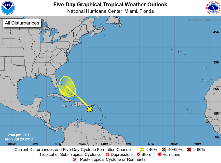
THE TROPICS
Invest 95L is struggling to stay together as shower activity has decreased since yesterday. Weather conditions along with effects from moving over land will keep any development from occurring as it moves northwest over the next few days. While we do need to keep our eyes on this disturbance, it is only given a 10% chance of developing into a depression within the next five days.
ON THIS DAY IN WEATHER HISTORY
1981 – Fifty cattle, each weighing 800 pounds, were killed by lightning near Vance, AL. The lightning struck a tree and then spread along the ground killing the cattle.
BEACH FORECAST CENTER
Get the latest weather and rip current forecasts for the beaches from Fort Morgan to Panama City on our Beach Forecast Center page. There, you can select the forecast of the region that you are interested in.
ALREADY OFF TO A HOT START IN 2019! ADVERTISE WITH THE BLOG!
After a record-setting 2018 with over 19.7 million page views, AlabamaWx.com is already well on its way to setting another record as we’re nearing 12 million page views so far in 2019! Don’t miss out! We can customize a creative, flexible and affordable package that will suit your organization’s needs. Contact Bill Murray at (205) 687-0782.
E-FORECAST
Get the Alabama Wx Weather Blog’s Seven-Day Forecast delivered directly to your inbox by email twice daily. It is the most detailed weather forecast available in Central Alabama. Subscribe here… It’s free!
CONNECT WITH THE BLOG ON SOCIAL MEDIA
You can find the AlabamaWx Weather Blog on the major social media networks:
Facebook
Twitter
Instagram
WEATHERBRAINS
Don’t forget you can listen to our weekly 90 minute netcast anytime on the web at WeatherBrains.com or on iTunes, Stitcher, or Spotify. This is the show all about weather featuring many familiar voices, including the meteorologists at ABC 33/40.
Category: Alabama's Weather, ALL POSTS
About the Author (Author Profile)
Scott Martin is an operational meteorologist, professional graphic artist, musician, husband, and father. Not only is Scott a member of the National Weather Association, but he is also the Central Alabama Chapter of the NWA president. Scott is also the co-founder of Racecast Weather, which provides forecasts for many racing series across the USA. He also supplies forecasts for the BassMaster Elite Series events including the BassMaster Classic.Subscribe
If you enjoyed this article, subscribe to receive more just like it.


