Scattered Showers Out There Over Parts Of Central Alabama At Midday
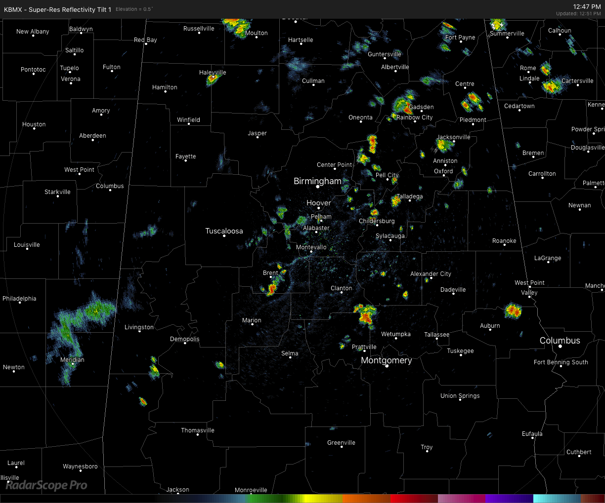
At 12:50 pm, we have some scattered showers mostly across the east-central and northeastern parts of the area with most of the activity located along and just south of the I-59 corridor with only a couple of returns over the western half of the area. Some of these are putting down some decent rainfall but none are strong or showing any lightning at this point. Temperatures are currently in the upper 70s to the mid-90s across the area. The cool spot is Bessemer at 79 degrees with rain-cooled air while Maxwell Air Force Base in Montgomery is the hot spot at 94 degrees. Birmingham was at 88 degrees.
WEATHER FOR THE REST OF TODAY
Clouds will continue to be on the increase with the heating of the day and scattered showers and thunderstorms will continue to develop as well. Rain chances across the are will be highest north of the I-85 corridor (around 30-40%) while south of that will only have a small chance of a few isolated showers. Highs will top out in the mid-80s to the mid-90s. Much of the activity will dissipate during the evening and late-night hours, but a few isolated to scattered showers may linger around for a few more hours and possibly well into the overnight hours. Lows will be in the upper 60s to the lower 70s.
WEDNESDAY’S WEATHER
On Wednesday, a trough will work deeper into Central Alabama and will be pulling a cold front into the extreme northwestern parts of the state. This will give us a little increase in the chance of showers and thunderstorms across the area, especially locations along and surrounding the I-59 and I-20 corridors. For those locations along and south of the I-85 corridor, a few isolated to scattered afternoon showers and storms will be possible. Highs will be in the upper 80s to the mid-90s.
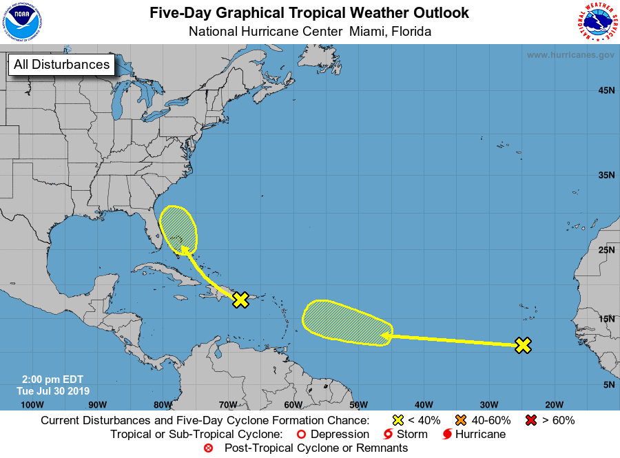
THE TROPICS
And the tropics are getting active as we have two areas of concern on the board. Invest 95L continues to struggle over the eastern Caribbean Sea and is not likely to get organized over the next few days. As it approaches Florida and the Bahamas, conditions may become conducive enough for some development to take place. NHC is sticking with a 10% chance of developing into a depression over the next five days. The second wave moved off the African coast on Monday and is moving westward over the far eastern Atlantic Ocean. It’s not expected to develop any over the next few days, but conditions will become more favorable by the weekend and some development may occur. NHC is only giving it a 20% chance of developing into a depression over the next five days.
ON THIS DAY IN WEATHER HISTORY
1979 – A forty-minute hailstorm bombed Fort Collins, CO, with baseball to softball size hail. Two thousand homes and 2500 automobiles were damaged, and about 25 persons were injured, mainly when hit on the head by the huge stones. A three-month-old baby died later of injuries.
BEACH FORECAST CENTER
Get the latest weather and rip current forecasts for the beaches from Fort Morgan to Panama City on our Beach Forecast Center page. There, you can select the forecast of the region that you are interested in.
ALREADY OFF TO A HOT START IN 2019! ADVERTISE WITH THE BLOG!
After a record-setting 2018 with over 19.7 million page views, AlabamaWx.com is already well on its way to setting another record as we’re nearing 12 million page views so far in 2019! Don’t miss out! We can customize a creative, flexible and affordable package that will suit your organization’s needs. Contact Bill Murray at (205) 687-0782.
E-FORECAST
Get the Alabama Wx Weather Blog’s Seven-Day Forecast delivered directly to your inbox by email twice daily. It is the most detailed weather forecast available in Central Alabama. Subscribe here… It’s free!
CONNECT WITH THE BLOG ON SOCIAL MEDIA
You can find the AlabamaWx Weather Blog on the major social media networks:
Facebook
Twitter
Instagram
WEATHERBRAINS
Don’t forget you can listen to our weekly 90 minute netcast anytime on the web at WeatherBrains.com or on iTunes, Stitcher, or Spotify. This is the show all about weather featuring many familiar voices, including the meteorologists at ABC 33/40.
Category: Alabama's Weather, ALL POSTS
About the Author (Author Profile)
Scott Martin is an operational meteorologist, professional graphic artist, musician, husband, and father. Not only is Scott a member of the National Weather Association, but he is also the Central Alabama Chapter of the NWA president. Scott is also the co-founder of Racecast Weather, which provides forecasts for many racing series across the USA. He also supplies forecasts for the BassMaster Elite Series events including the BassMaster Classic.Subscribe
If you enjoyed this article, subscribe to receive more just like it.


