At Midday: All Dry Across Central Alabama… For Now
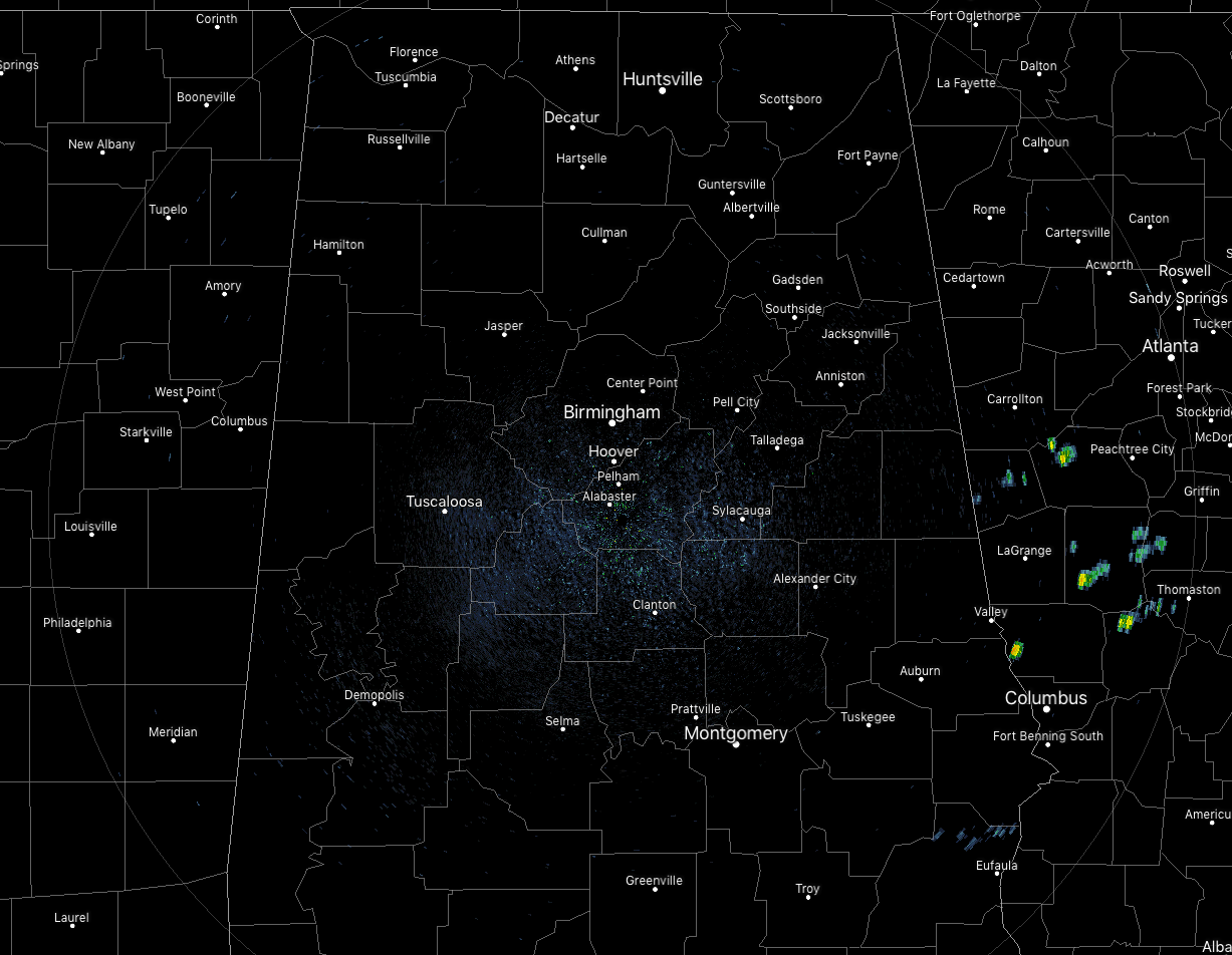
At 12:15 pm, it is nearly a complete clean sweep on radar across Central Alabama with the exception of a dissipating return over the northern parts of Barbour County. Temperatures are in the upper 70s to the upper 80s across the area. Birmingham was at 82 degrees. Haleyville and Cullman were tied as the cool spots at 79 degrees. The warm spots were Tuscaloosa, Alabaster, and Uniontown, all tied at 88 degrees.
We’ll have a chance of isolated to scattered showers and thunderstorms through the rest of the afternoon and into the early evening hours north of the I-20 corridor, while south of that, scattered to numerous showers and thunderstorm are possible, becoming more likely as you move farther south. Afternoon highs should top out in the mid to upper 80s across the area.
For tonight and through the overnight hours, we’ll continue to have some isolated to scattered showers and thunderstorms until the sun goes down, then much of the activity will diminish soon after. A few showers and storms may linger for a while until just before midnight. Higher rain chances will be over the southeastern parts of the area. Lows will be in the upper 60s to the lower 70s.
Tuesday will be a partly cloudy day with more isolated to scattered showers and thunderstorms possible for the northern two-thirds of the area, while scattered to numerous showers and thunderstorms will be possible in the southern third of the area (mainly along and south of the I-85 and US-80 corridors). Highs will be hotter, up in the upper 80s to the lower 90s.
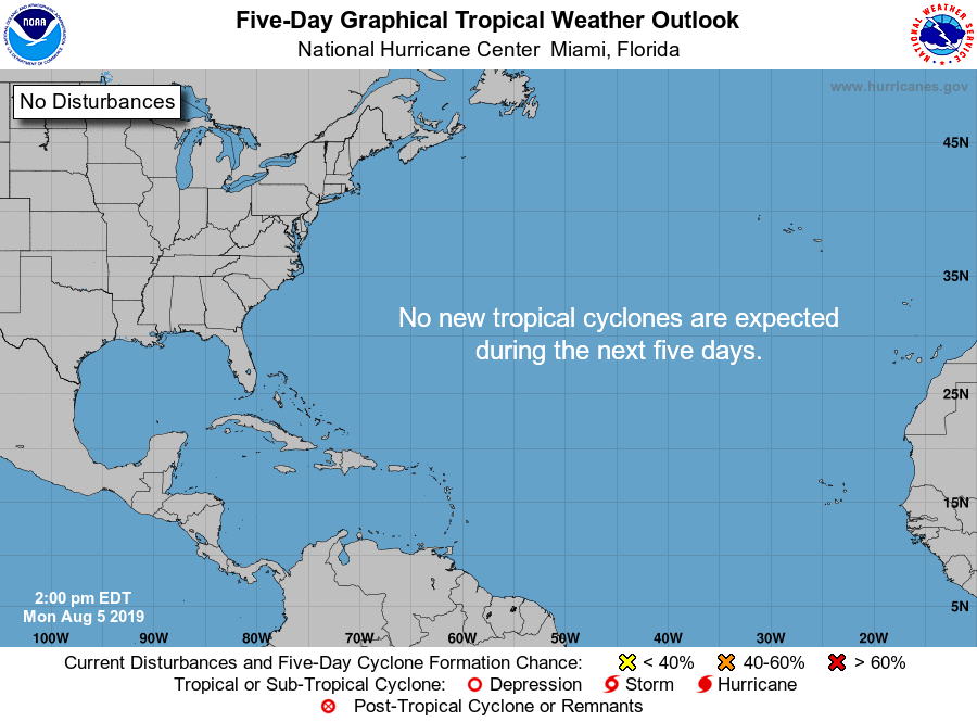
All clear across the tropical Atlantic Ocean, Caribbean Sea, and the Gulf of Mexico. No new tropical systems are expected to develop over the next five days.
![]()
WEATHERREADY FEST IS COMING TO HUNTSVILLE
WeatherReady Fest is coming to Huntsville, Alabama on September 7, 2019, from 10:00 am to 4:00 pm on the campus of UAH, the perfect venue for the event! The campus will be transformed into a preparedness and resiliency hub with exciting learning activities, informative exhibits, engaging speakers and luminary celebrities. An exciting array of Emergency Response Vehicles will set the stage when attendees arrive at the facility. Admission is FREE but get your timed tickets now. For tickets and more information, please visit the WeatherReady Fest website.
ON THIS DAY IN WEATHER HISTORY
1843 – A spectacular cloudburst near Philadelphia turned the small creeks and streams entering the Delaware River into raging torrents. As much as sixteen inches of rain fell in just three hours. Flooding destroyed thirty-two county bridges, and caused nineteen deaths. It is believed that several small tornadoes accompanied the torrential rains, one of which upset and sank more than thirty barges on the Schuylkill River.
BEACH FORECAST CENTER
Get the latest weather and rip current forecasts for the beaches from Fort Morgan to Panama City on our Beach Forecast Center page. There, you can select the forecast of the region that you are interested in.
ALREADY OFF TO A HOT START IN 2019! ADVERTISE WITH THE BLOG!
After a record-setting 2018 with over 19.7 million page views, AlabamaWx.com is already well on its way to setting another record as we’re just topped 12 million page views so far in 2019! Don’t miss out! We can customize a creative, flexible and affordable package that will suit your organization’s needs. Contact Bill Murray at (205) 687-0782.
E-FORECAST
Get the Alabama Wx Weather Blog’s Seven-Day Forecast delivered directly to your inbox by email twice daily. It is the most detailed weather forecast available in Central Alabama. Subscribe here… It’s free!
CONNECT WITH THE BLOG ON SOCIAL MEDIA
You can find the AlabamaWx Weather Blog on the major social media networks:
Facebook
Twitter
Instagram
WEATHERBRAINS
Don’t forget you can listen to our weekly 90 minute netcast anytime on the web at WeatherBrains.com or on iTunes, Stitcher, or Spotify. This is the show all about weather featuring many familiar voices, including the meteorologists at ABC 33/40.
Category: Alabama's Weather, ALL POSTS
About the Author (Author Profile)
Scott Martin is an operational meteorologist, professional graphic artist, musician, husband, and father. Not only is Scott a member of the National Weather Association, but he is also the Central Alabama Chapter of the NWA president. Scott is also the co-founder of Racecast Weather, which provides forecasts for many racing series across the USA. He also supplies forecasts for the BassMaster Elite Series events including the BassMaster Classic.Subscribe
If you enjoyed this article, subscribe to receive more just like it.


