

A Quick Check On Our Weather Situation Just After The Midday Hour
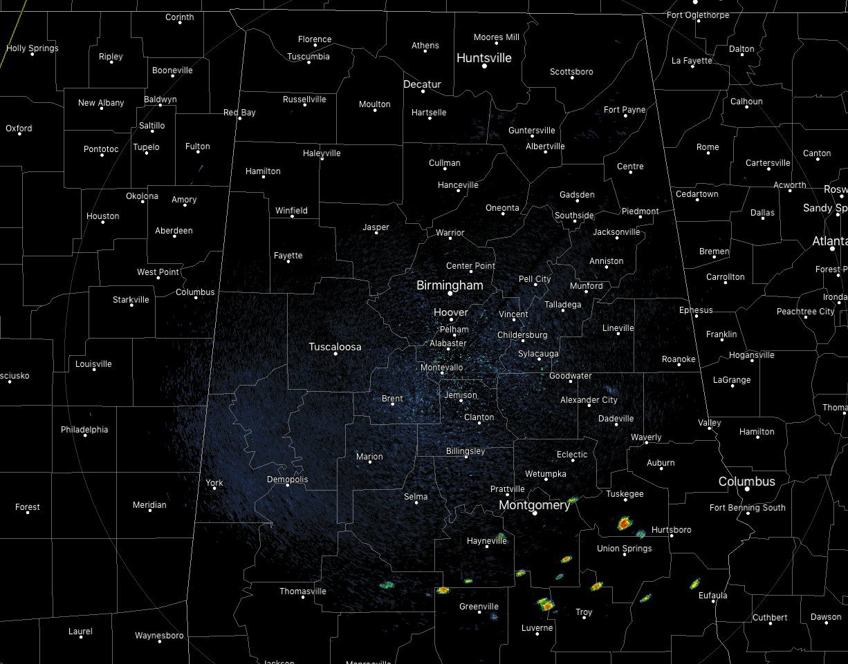
As of 1:00 pm, much of North and Central Alabama remains dry with the exception of a few isolated showers that have popped up over the southeastern parts of the area. Our main focus will be north of a boundary that was leftover from an MCS that dissipated over the northern parts of the area during the pre-dawn hours.
We’ll have to watch for convection that forms in the northeastern parts of Mississippi and the northwestern parts of Alabama this afternoon that would move southeastward into the northern parts of the area. With drier air aloft, downdraft CAPE values running around 1300 J/kg and surface-based instability in the 4000-4500 J/kg range, and bulk shear in the 30-35 knot range, storms potentially could become organized and form into line segments.
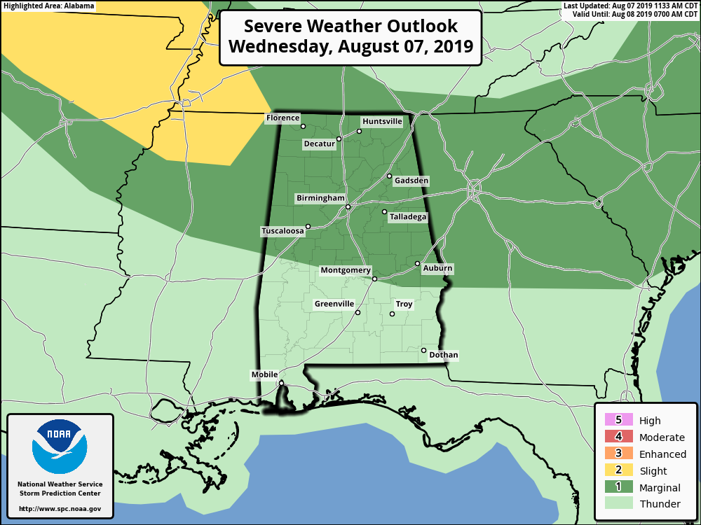
The northern two-thirds of the area had been placed in a Marginal Risk for severe storms through the rest of the daylight hours and into the night. The threat will be from damaging thunderstorm wind gusts up to and possibly over 60 MPH. The timing for stronger to severe storms will be from 2:00 pm this afternoon until 10:00 pm tonight.
Skies will be partly cloudy throughout the rest of the daylight hours with a chance of scattered showers and thunderstorms across the area with the higher chances being over the northwestern parts of the area. Afternoon highs will be in the lower to mid-90s with heat indices reaching the 100-105 degree range in the west and southern parts. Showers and thunderstorms that have formed will continue for several hours after sunset, especially the ones that formed over the northwestern parts of the area. Coverage of those should decrease by midnight. Lows will be in the lower to mid-70s.
Thursday will be a very hot day with highs reaching the mid to upper 90s across nearly all of the area with heat indices reaching or exceeding 105 degrees in the southern and western parts of the area. Skies will be partly cloudy and we’ll have a chance of isolated to scattered showers and thunderstorms mainly during the afternoon hours.
Category: Alabama's Weather, ALL POSTS, Severe Weather
About the Author (Author Profile)
Scott Martin is an operational meteorologist, professional graphic artist, musician, husband, and father. Not only is Scott a member of the National Weather Association, but he is also the Central Alabama Chapter of the NWA president. Scott is also the co-founder of Racecast Weather, which provides forecasts for many racing series across the USA. He also supplies forecasts for the BassMaster Elite Series events including the BassMaster Classic.Subscribe
If you enjoyed this article, subscribe to receive more just like it.


