Storms Forming Ahead Of Line In Jefferson County & Well Down To The Southeast
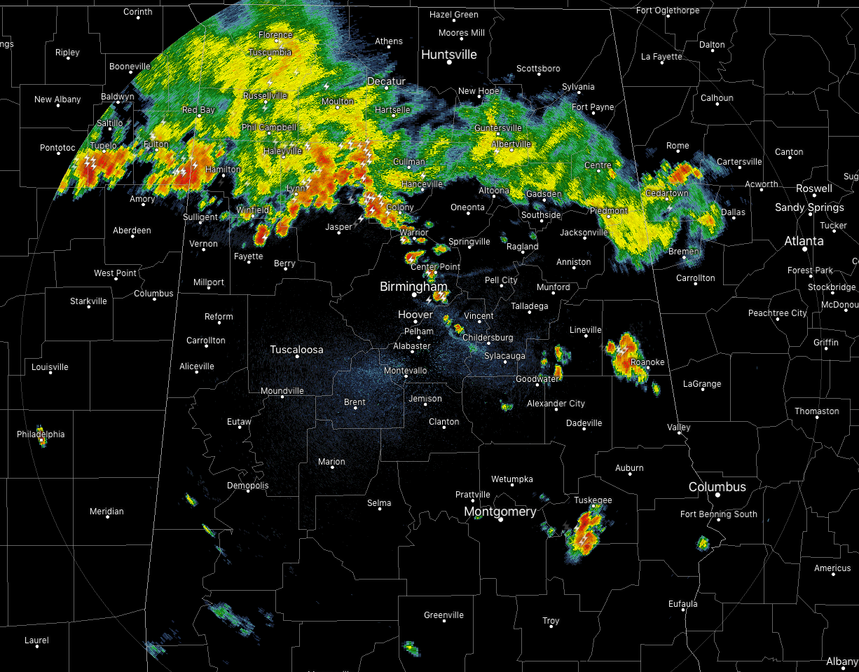
At 7:30 PM, while the main activity continues to push more southward through the northern parts of Central Alabama, more storms are forming along an outflow boundary that is moving through the eastern half of Jefferson County. A broken line has formed from as far north as Warrior and continues southeastward through Center Point and Irondale, with more even farther southeast located just east of Chelsea. More decent thunderstorms are affecting parts of Macon and Bullock counties, along with portions of Clay, Randolph, Chambers, and Tallapoosa counties.
CAPE values continue to be in the 2500-3500 J/kg range out ahead of the main line of storms, while downdraft CAPE values remain in the 1000-1400 J/kg range. Bulk shear values have dropped down around 20 knots throughout the area, which will lessen the severe threat some, but we’ll continue to have a threat of stronger to severe storms along and ahead of the line of storms throughout the remainder of the evening to around 10:00 pm.
These will start to diminish in coverage during the late-night and overnight hours, but we’ll have to keep our eyes on these storms until conditions improve enough that the threat of strong to severe storms will have ended.
Category: Alabama's Weather, ALL POSTS
About the Author (Author Profile)
Scott Martin is an operational meteorologist, professional graphic artist, musician, husband, and father. Not only is Scott a member of the National Weather Association, but he is also the Central Alabama Chapter of the NWA president. Scott is also the co-founder of Racecast Weather, which provides forecasts for many racing series across the USA. He also supplies forecasts for the BassMaster Elite Series events including the BassMaster Classic.Subscribe
If you enjoyed this article, subscribe to receive more just like it.


