Strong Storms About To Move Into North Alabama
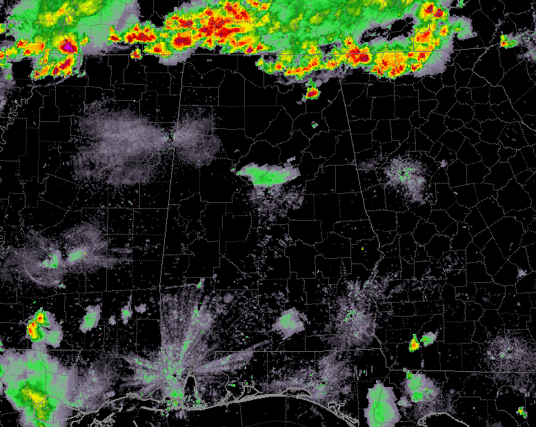
At 7:55 pm, a line of strong thunderstorms is pushing across the AL/TN state line and will soon bring some cooling relief to the northern counties of the state. Unfortunately, a few of these storms could become strong to severe. Places like Fyffe, Pleasant Groves, and Stevenson are receiving some decent rainfall while most of the rest of the line is still north of the border.
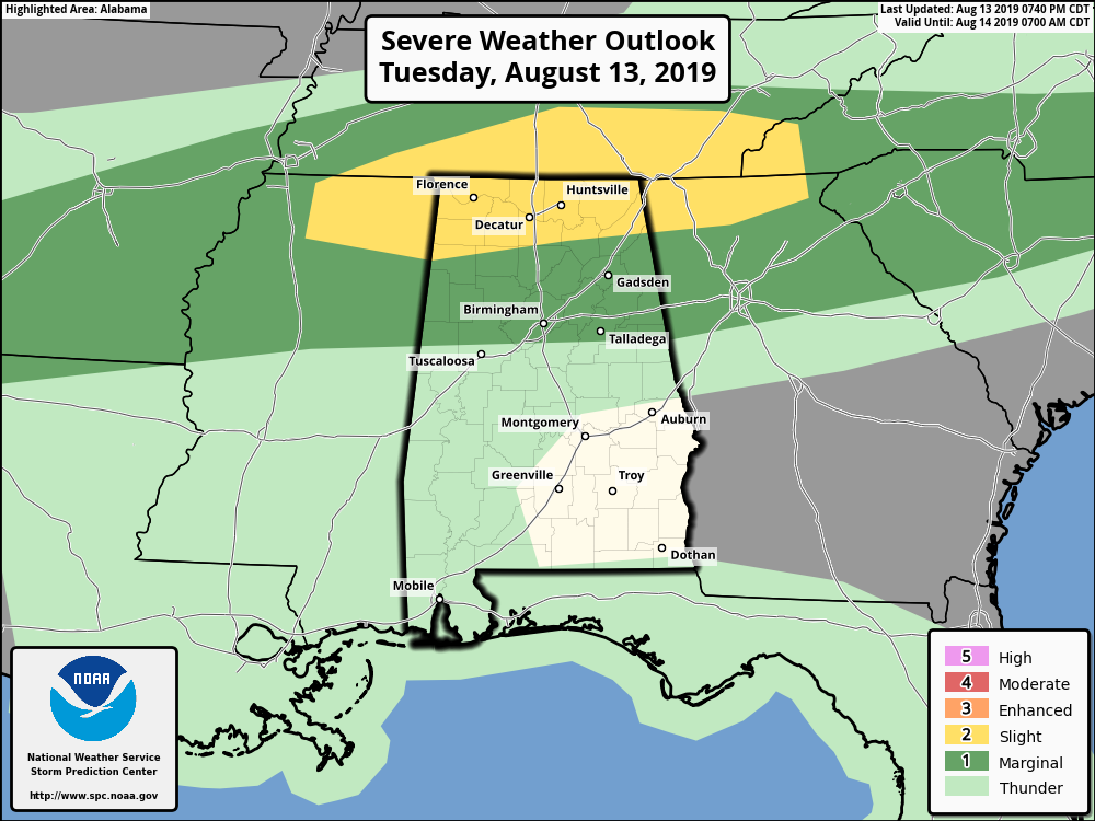
As for tonight, a Slight Risk for severe storms is up for nearly all of North Alabama and the extreme northern parts of Central Alabama while a Marginal Risk is up for locations south of the Slight Risk down to a line from Aliceville to Calera to Roanoke. The main window for severe storms will be from roughly now until 2:00 am. Isolated damaging winds up to 60 MPH will be the main threat with any storm that becomes severe. Much of the activity will die off before the break of dawn on Wednesday morning.
By far, this was the hottest day we have seen around these parts in a good while. Nearly all of the major reporting stations across Central Alabama topped out at or just over 100 degrees. Here are today’s high temperatures reported to NWS Birmingham:
Anniston… 101 degrees
Birmingham… 101 degrees
Montgomery… 101 degrees
Shelby Co. Airport… 102 degrees
Troy… 97 degrees
Tuscaloosa… 100 degrees
The good news is that while temperatures will still be up in the lower to mid-90s for the most part on Wednesday, moisture levels will drop behind a cold front that will be working into the northern parts of the area later tonight and into the overnight hours. By tomorrow evening, that cold front will be over the southern parts of the state. Throughout the afternoon and evening hours, scattered to numerous showers and thunderstorms will be likely for the southern half of the area while isolated to scattered showers and storms will be possible for the northern half.
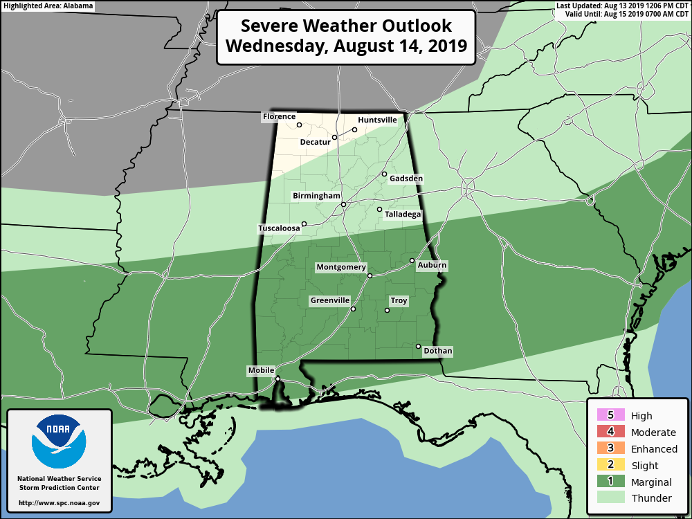
A few strong to severe storms may occur over the southern half of the area and the Storm Prediction Center has included a Marginal Risk of severe storms in their latest graphics update. Isolated damaging winds up to 60 MPH will be the main threat with any storm that becomes severe.
Category: Alabama's Weather, ALL POSTS, Severe Weather
About the Author (Author Profile)
Scott Martin is an operational meteorologist, professional graphic artist, musician, husband, and father. Not only is Scott a member of the National Weather Association, but he is also the Central Alabama Chapter of the NWA president. Scott is also the co-founder of Racecast Weather, which provides forecasts for many racing series across the USA. He also supplies forecasts for the BassMaster Elite Series events including the BassMaster Classic.Subscribe
If you enjoyed this article, subscribe to receive more just like it.


