Notes on Dorian Just Before 5 p.m.
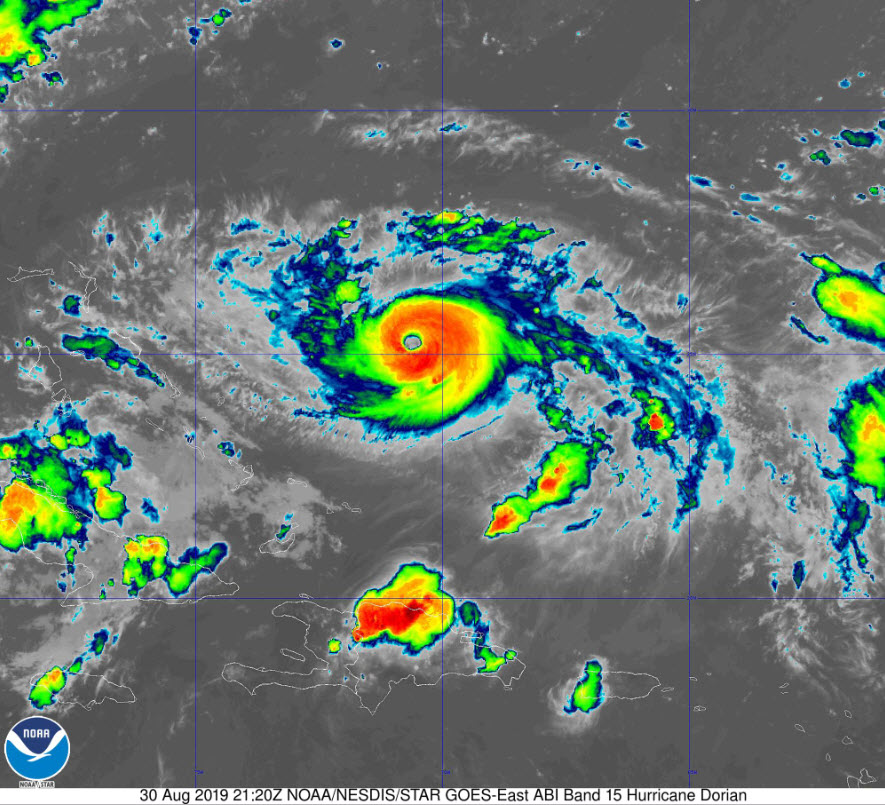
Hurricane Dorian continues to look more organized and symmetrical on satellite imagery this afternoon. It has a clearly defined eye with deep convection surrounding it. The hurricane is beginning to take on the all-too-familiar buzzsaw shape.
There is no plane in the storm right now. AF mission 19 aborted and went back to base at Keesler for some reason. The NOAA P3 is approaching the center now. Another Air Force plane has departed Keesler and is enroute to the storm. The last central pressure reported was 970 millibars just after noon today.
The westward turn seems to have commenced. The storm has turned to the west-northwest and slowed slightly. The storm is reacting to the building high-pressure ridge to the north. The ridge should start to break down in 3-4 days. This will allow the hurricane to turn back to the north.
Here is the spaghetti plot of model tracks:
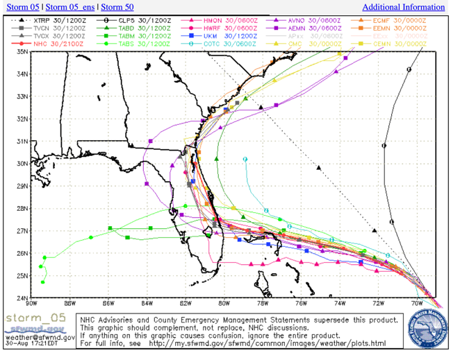
There is a tremendous amount of uncertainty in the forecast. Deterministic model output has been shifting some as the steering currents collapse. The NHC forecast track has been shifted east in anticipation that the hurricane will turn northward and track along the coast. This would bring a prolonged surge, wind, and rain event to much of the east coast of Florida from Fort Lauderdale to Jacksonville and increases the threat to Savannah and Charleston. Small changes in the eventual direction can have big impacts along the coast.
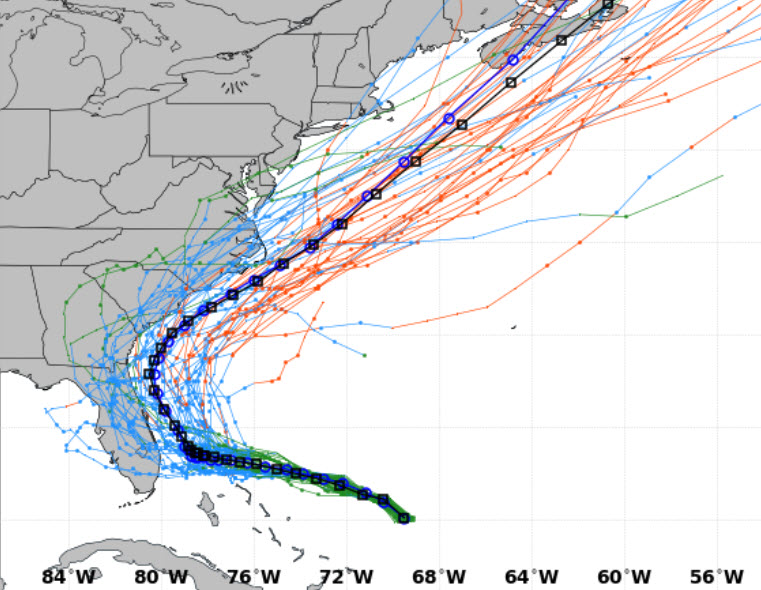
Here is the European ensemble, showing the ensemble mean and control in the darker blue and black lines.
Dorian could make landfall Tuesday as a 140 mph hurricane on Tuesday. It could be even a little higher.
Hurricane watches may be issued for the coast late tonight, or more likely on Saturday morning. Hurricane and Tropical Storm watches are issued when there is a 40% probability that hurricane or tropical storm-force winds are possible within 48 hours. Tropical storm winds could start arriving on the Florida coast Sunday evening.
The good news for Alabama is that it appears the track of Dorian will cause no impacts for Alabama other than some gusty winds as we stay well on the western, drier side of the storm’s circulation. The only impact along the beautiful beaches of Alabama and Northwest Florida should only be gusty northerly winds, particularly Tuesday night and Wednesday.
About the Author (Author Profile)
Bill Murray is the President of The Weather Factory. He is the site's official weather historian and a weekend forecaster. He also anchors the site's severe weather coverage. Bill Murray is the proud holder of National Weather Association Digital Seal #0001 @wxhistorianSubscribe
If you enjoyed this article, subscribe to receive more just like it.


