A Late Night Look at Hurricane Dorian
The evening run of the GFS is out to 117 hours and we are watching with bated breath as the output slowly comes in. It’s one model run, but we are all anxious to get some sort of feel for where this hurricane is going to go.
I fear that we won’t know for some time, although I do fear also that it will affect a large swath of coast with large surge, battering waves, very heavy rains, and high winds.
This GFS run stalls the storm ominously off the East Coast of Florida slows the storm to a crawl as it turns it northwest on Sunday, then picks it up and carries it to the South Carolina coast by Wednesday night. This would look like a very bad scenario for Charleston.
That’s one scenario. Here is a rogue’s gallery of other ones:
12km NAM: Landfall late Monday night near Port St. Lucie
3 km NAM: Takes it north of Nassau Sunday night and brings it to a point about 125 miles east of Port St. Lucie early Monday (ends at 60 hours)
UKMET: Much faster, brings it to coast near Port St. Lucie Sunday morning
European: Takes it across the northern Bahamas late Sunday then turns it sharply northwest, hugging the coast to North Carolina with no landfall
HWRF: Landfall Tuesday night near Titusville, north of Cape Canaveral as a weakening 953 millibar storm
HMON: Only out to 30 hours
Canadian: Glancing blow to the coast near Titusville then hugging coast all the way to North Carolina
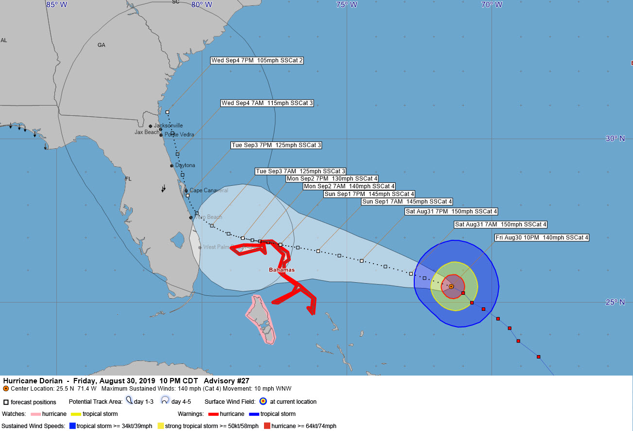
Needless to say, there are lots of scenarios on the table. Most of them are plausible. We just have to wait til we get consensus. This is when you don’t envy Ken Graham and his team at the National Hurricane Center. Those folks are the best. Here is their best current guess with the center likely ending up somewhere in that cone around the track:
Tonight, the convection around Dorian’s eyewall looks much more robust and intense after appearing to get a little more ragged this evening. I fear this means that when we see a reconnaissance plane back in the storm, the central pressure will have again dropped some more. This after a 22 millibar drop in just about 7 hours this afternoon and evening. Here is the latest satellite image:
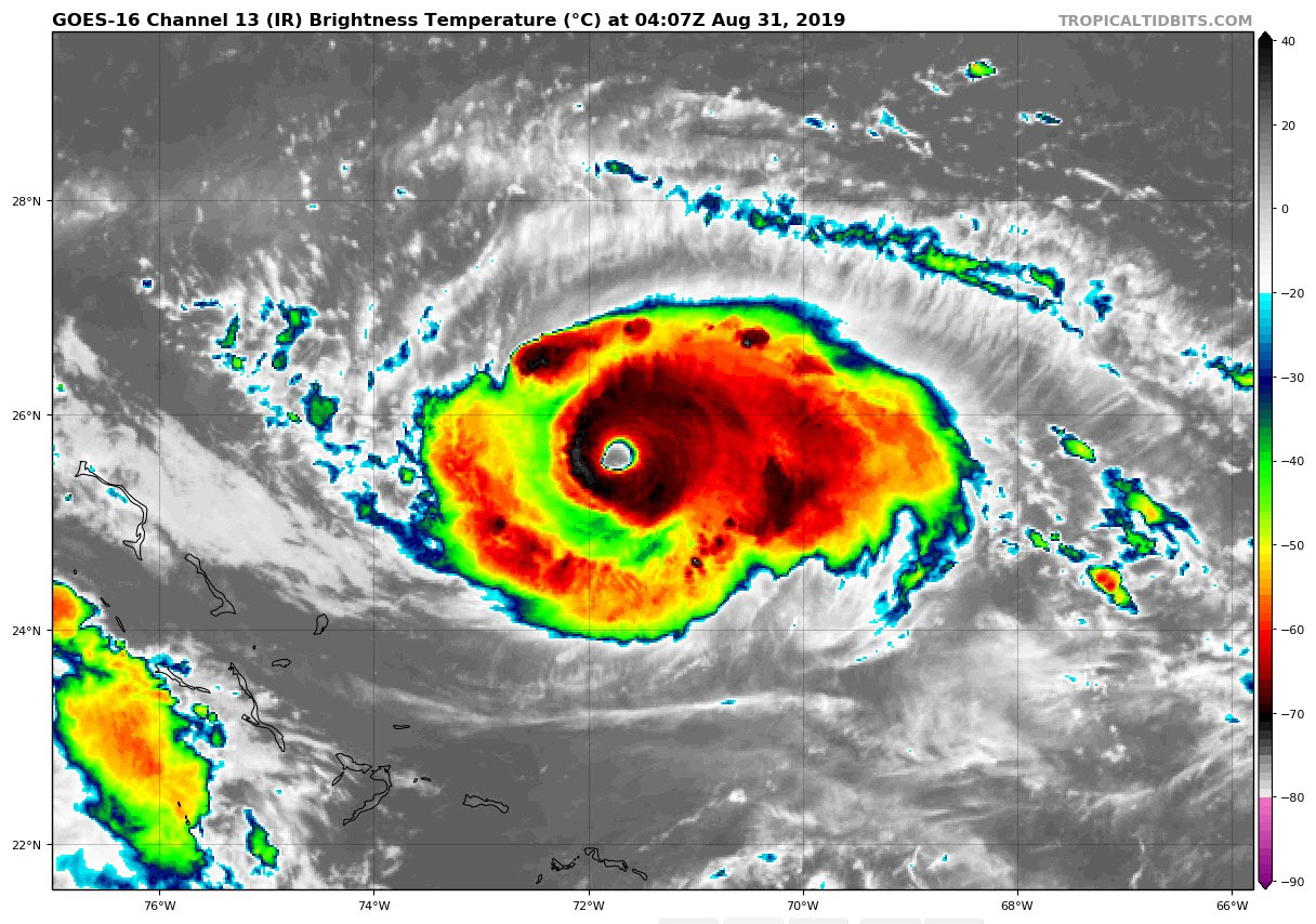
That’s a mean look.
About the Author (Author Profile)
Bill Murray is the President of The Weather Factory. He is the site's official weather historian and a weekend forecaster. He also anchors the site's severe weather coverage. Bill Murray is the proud holder of National Weather Association Digital Seal #0001 @wxhistorianSubscribe
If you enjoyed this article, subscribe to receive more just like it.


