An Early Look at Dorian: Still 150 mph Cat Four, Central Pressure Down to 935mb
Hurricane Dorian is 260 miles east of West Palm Beach early this morning, moving to the west at 8 mph.
This movement is expected to continue through tonight, carrying the core of the storm across Abaco and Great Inagua in the Bahamas.
It may intensify a bit today as it moves through the very warm waters around the islands, which have very high oceanic heat content. SHear is expected to be very low as well, also favoring intensification.
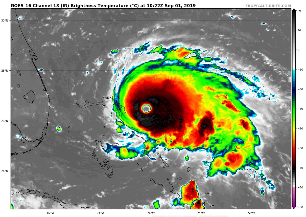
The hurricane still looks very impressive on satellite, with a large distinct eye and a very large, centra, dense overcast with very cold cloud tops indicating deep convection.
There is good consensus between the GFS and Euro as to the track, paralleling the coast all the way from Florida to North Carolina. The mean of both models never has it making landfall The control of the Euro does brush the Outer Banks. The control of the GFS does deal a swiping blow to the North Carolina coast.
The good news is that the hurricane will be certainly weaker by that time, more like 100 mph, but that is still a dangerous hurricane.
Tropical Storm force winds could reach the coast tonight in the Tropical Storm Warning area from Deerfield Beach to Sebastian Inlet and through tomorrow in the Tropical Storm Watch area from north of Golden Beach to Deerfield Beach.
Tropical storm force winds may spread up the coast on Tuesday, causing those watches and warnings to have to be extended northward. In fact, I wouldn’t be surprised if tropical storm conditions were not felt all the way from Boynton Beach to the Outer Banks of North Carolina.
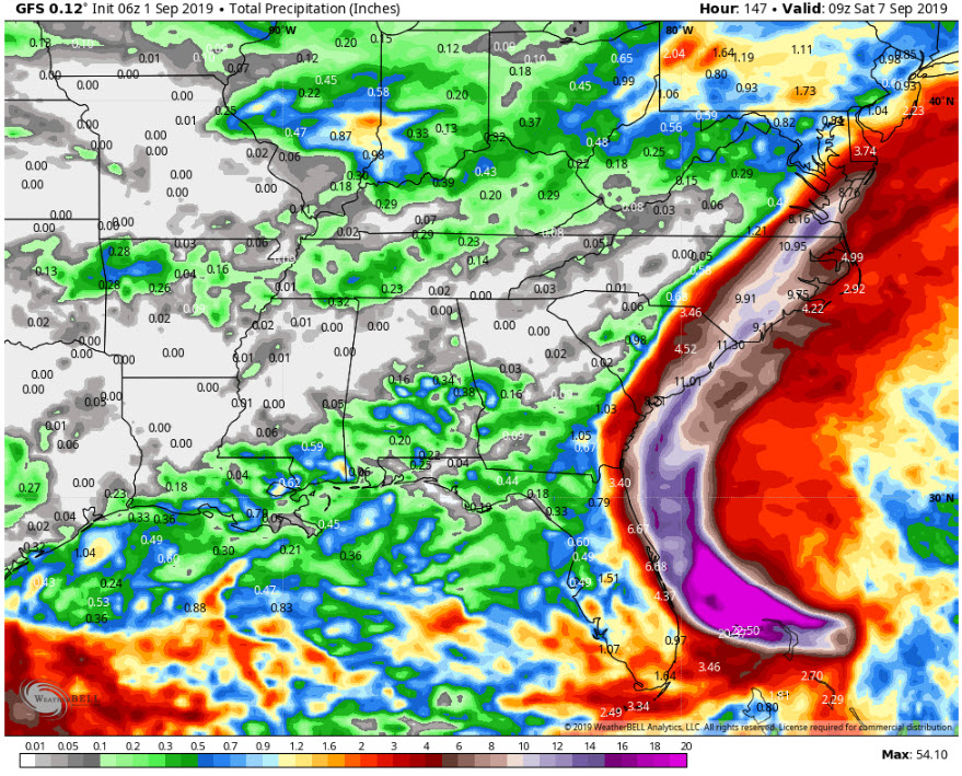
It looks like the storm’s heavy precipitation could be limited to the coastal counties of eastern Florida, Georgia, and South Carolina, but heavy rain could be widespread across eastern North Carolina. Stop me if you have heard that before. North Carolina has a terrible history of extreme flood events in the past few decades from hurricanes. Here are rainfall totals off the GFS:
There is no plane flying low-level reconnaissance in the storm right now. The last vortex data report we had was at 11:42 last night, when the plane found a pressure of 935 millibars (lowest so far) and estimated surface winds off the SFMR instrument at 165 mph.
There have been several category five wind reports over the last couple of days. Suffice to say, Dorian is a strong cat four, borderline cat five storm.
It will bring tremendous devastation to the Bahamas, but Florida may dodge a bullet. Still, we caution Floridians to keep their guard up and for residents from coastal Georgia to southeastern Virginia to be sitting on ready with their hurricane plans.
Category: ALL POSTS
About the Author (Author Profile)
Bill Murray is the President of The Weather Factory. He is the site's official weather historian and a weekend forecaster. He also anchors the site's severe weather coverage. Bill Murray is the proud holder of National Weather Association Digital Seal #0001 @wxhistorianSubscribe
If you enjoyed this article, subscribe to receive more just like it.


