Hurricane Dorian Essentially Stationary
We haven’t had any low-level recon data on Hurricane Dorian since a little after midnight.
The center of intense Hurricane Dorian is located 110 miles east of West Palm Beach, Florida at this hour. Here is the current composite image of Dorian from coastal radars:
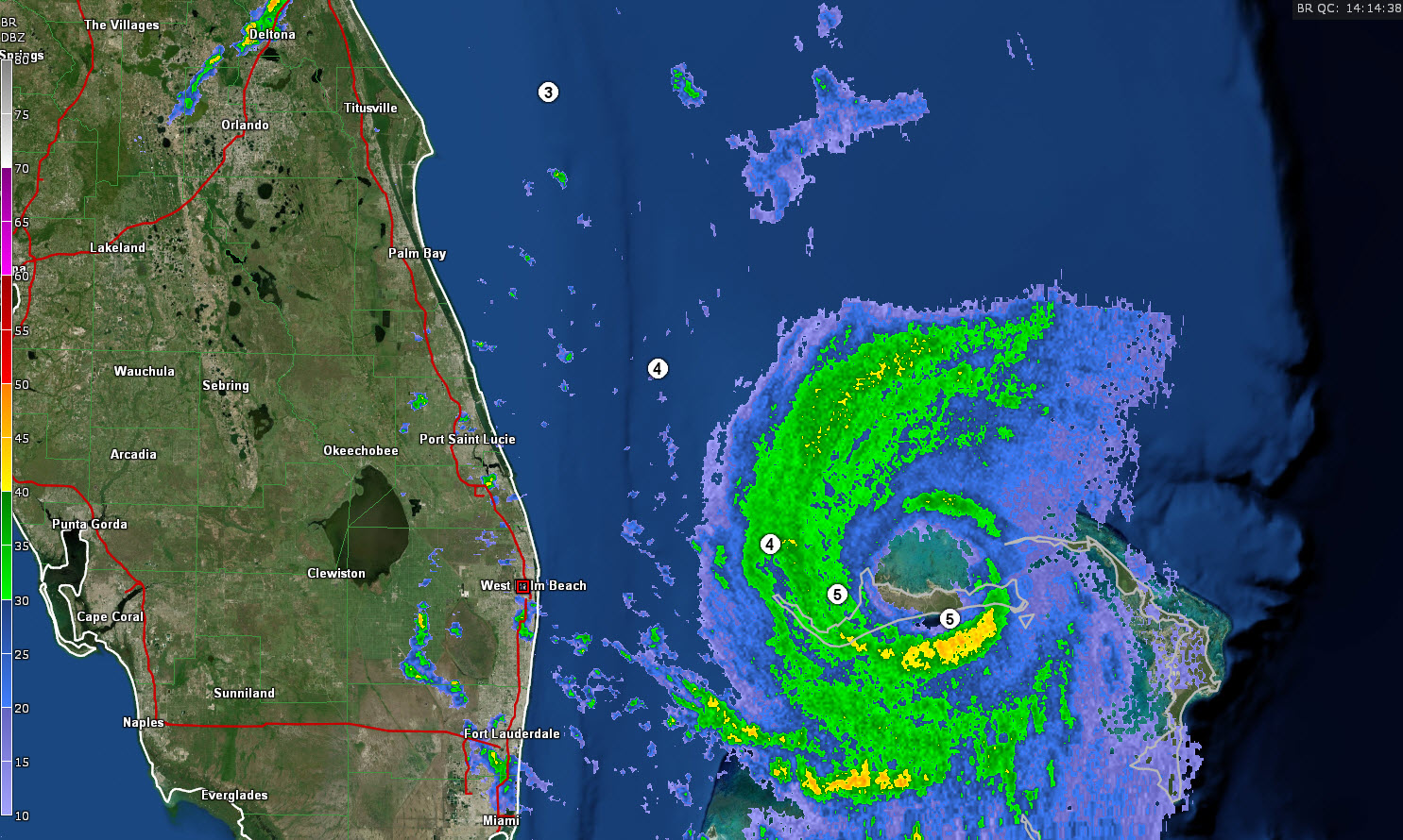
The NHC says the top winds are now 160 mph. The storm is moving very slowly west or west-northwest at 1 mph.
The NWS Melbourne just issued a Nowcast:
…GUSTY WINDS AND HEAVY DOWNPOURS POSSIBLE AS DORIAN’S OUTER RAIN
BANDS CONTINUE TO MOVE INLAND…
AS OF 10 AM, THE CENTER OF MAJOR HURRICANE DORIAN WAS LOCATED
APPROXIMATELY 125 MILES EAST-SOUTHEAST OF STUART, FLORIDA WITH
DORIAN BEING NEARLY STATIONARY. DORIAN’S OUTERMOST RAIN BANDS WILL
CONTINUE TO MOVE OVER EAST CENTRAL FLORIDA THROUGH THE REST
OF THIS MORNING. RAIN BANDS WILL BE MOVING AT 25 TO 30 MPH NORTH
OF THE CAPE AND 35 TO 40 MPH TO THE SOUTH. BRIEF TORRENTIAL
DOWNPOURS WILL BE POSSIBLE ALONG WITH WIND GUSTS OF 40 TO 50 MPH.
SOME WEATHER STATIONS HAVE ALREADY RECEIVED WIND GUSTS OF 40 TO 45
MPH ASSOCIATED WITH THESE RAIN BANDS/SQUALLS.
They also made this statement this morning about the threat to eastern Florida:
Conditions along the coast will rapidly deteriorate after sunset today and across the region by tomorrow. Final preparations need to be completed today. If you have been ordered to evacuate, leave before conditions become unsafe. Residents should be prepared for anywhere between 12 to 24 hours of damaging winds, flooding rain, and coastal flooding at their location as Dorian moves near the coast.
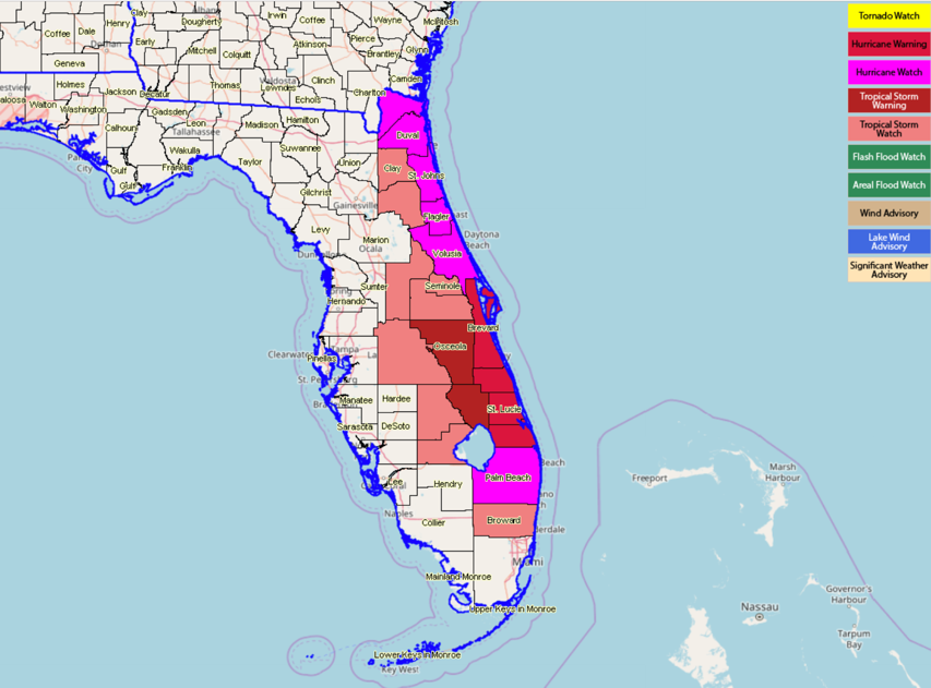
Here are current warnings:
About the Author (Author Profile)
Bill Murray is the President of The Weather Factory. He is the site's official weather historian and a weekend forecaster. He also anchors the site's severe weather coverage. Bill Murray is the proud holder of National Weather Association Digital Seal #0001 @wxhistorianSubscribe
If you enjoyed this article, subscribe to receive more just like it.


