Beautiful Labor Day in Progress Across Alabama; A Few Noon Notes on Dorian
Skies are partly cloudy across Alabama at this hour and radars are free of any precipitation. The best cumulus buildups are over the Tennessee Valley. Some of those may grow into a few isolated showers as they drop toward the I-59 corridor this afternoon.
There is a slight chance of a few isolated showers this afternoon, but the chance is very small.
Temperatures are in the upper 80s for the most part, heading toward highs in the lower 90s.
The rest of the week looks hot and dry with little or no rain chances through the weekend. Highs will be in the lower 90s. Lows will be n the upper 60s to near 70F through Thursday morning. The circulation of Dorian will bring drier air into Alabama by Thursday, allowing morning lows Friday to be in the lower 60s.
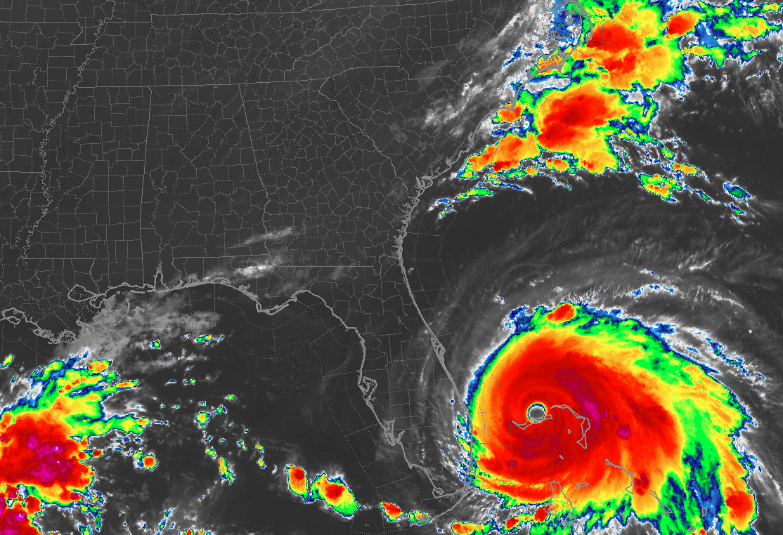
DORIAN NOTES
…An Air Force Reserve Hurricane Hunter plane is approaching the storm from the northwest now. We will have an idea of the strength of the storm in about an hour.
…The hurricane has apparently undergone an eyewall replacement cycle and this will probably weaken it. Its slow motion is probably increasing the upwelling of the ocean around the storm, cooling the water, and robbing the hurricane of its high octane fuel.
…Nonetheless, Dorian is expected to remain a major hurricane for the next two days, at least.
…Evacuations are underway in parts of Georgia and South Carolina now. I-26 is in contraflow mode from Charleston to Columbia. I-16 in Georgia will be reversed tomorrow from Savannah to Dublin.
Category: Alabama's Weather, ALL POSTS, Tropical
About the Author (Author Profile)
Bill Murray is the President of The Weather Factory. He is the site's official weather historian and a weekend forecaster. He also anchors the site's severe weather coverage. Bill Murray is the proud holder of National Weather Association Digital Seal #0001 @wxhistorianSubscribe
If you enjoyed this article, subscribe to receive more just like it.


