Tropical Mischief Possible In The Gulf Late In The Weekend Into Early Next Week
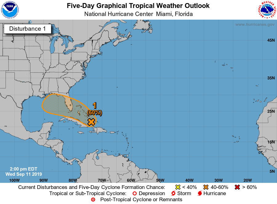
Tuesday was actually the peak of the Atlantic Hurricane Season and as you have seen, it has been active as of late. No different today as we have a disturbance (now known as Invest 95L) located over eastern parts of Cuba and the southeastern Bahamas. Conditions are favorable for development to occur through the end of the week and a depression is likely to form as early as Friday close to South Florida and the northwestern Bahamas.
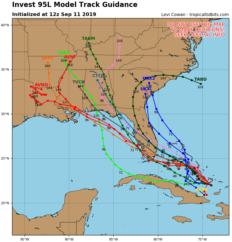
The latest ensemble models show 95L crossing over the southern Florida Peninsula and making its way over the Gulf of Mexico. Most of those members have it moving northwest over the northern Gulf and moving onshore somewhere on the Gulf Coast between Bay St. Louis, Mississippi and St. Marks, Florida. within the next 90 to 110 hours (between midday Sunday and midday Monday).
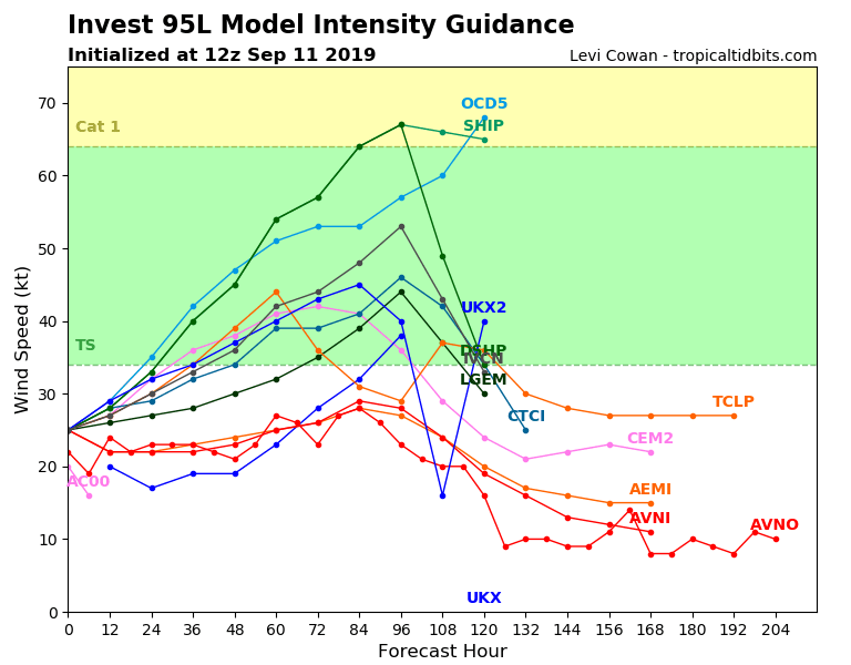
Most of those model members also keep 95L well below hurricane strength, maxing out as a low to mid-grade tropical storms. Most of the remaining models keep it as a depression, while only a couple have it topping out as category one hurricane.
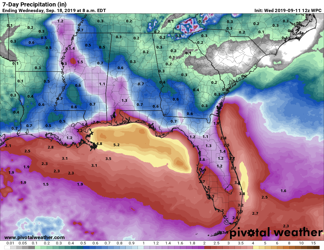
Once this system gets better organized, we can get a better idea of what we can expect in movement and intensity. For us in Central Alabama, we could possibly see an increase in the rain potential starting late on Saturday night and possibly persisting through at least late Monday or early Tuesday. At this point, the best potential for tropical rain from this system will be over the southwestern parts of the area and over into Central Mississippi.
At this point, I do not believe there will be a need to cancel your trip to the beach if you have plans, but you can expect some rain at times and a little bit of wind. Like I said earlier, we’ll get a better handle on this system as it gets better organized and we get closer to the weekend. Thinking on 95L can and probably will change as we go through the remainder of the week. Stay tuned.
Category: Alabama's Weather, ALL POSTS, Tropical
About the Author (Author Profile)
Scott Martin is an operational meteorologist, professional graphic artist, musician, husband, and father. Not only is Scott a member of the National Weather Association, but he is also the Central Alabama Chapter of the NWA president. Scott is also the co-founder of Racecast Weather, which provides forecasts for many racing series across the USA. He also supplies forecasts for the BassMaster Elite Series events including the BassMaster Classic.Subscribe
If you enjoyed this article, subscribe to receive more just like it.


