Humberto Is Now A Hurricane, Moving Away From The US
SUMMARY OF 1100 PM EDT…0300 UTC…INFORMATION
———————————————–
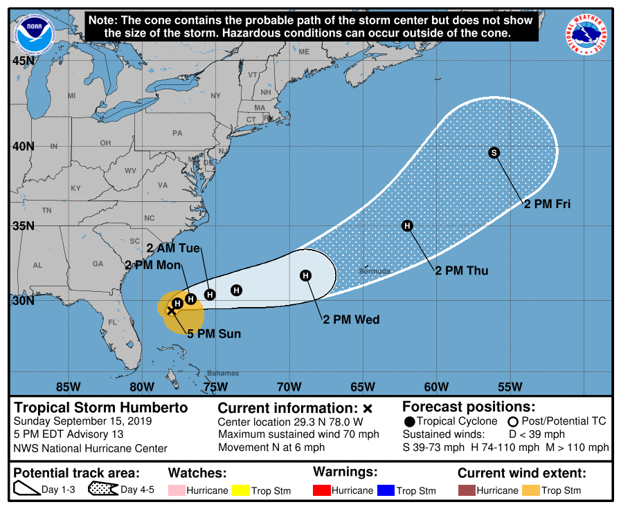
LOCATION…29.4N 77.6W
ABOUT 785 MI…1260 KM W OF BERMUDA
MAXIMUM SUSTAINED WINDS…75 MPH…120 KM/H
PRESENT MOVEMENT…NE OR 40 DEGREES AT 3 MPH…6 KM/H
MINIMUM CENTRAL PRESSURE…988 MB…29.18 INCHES
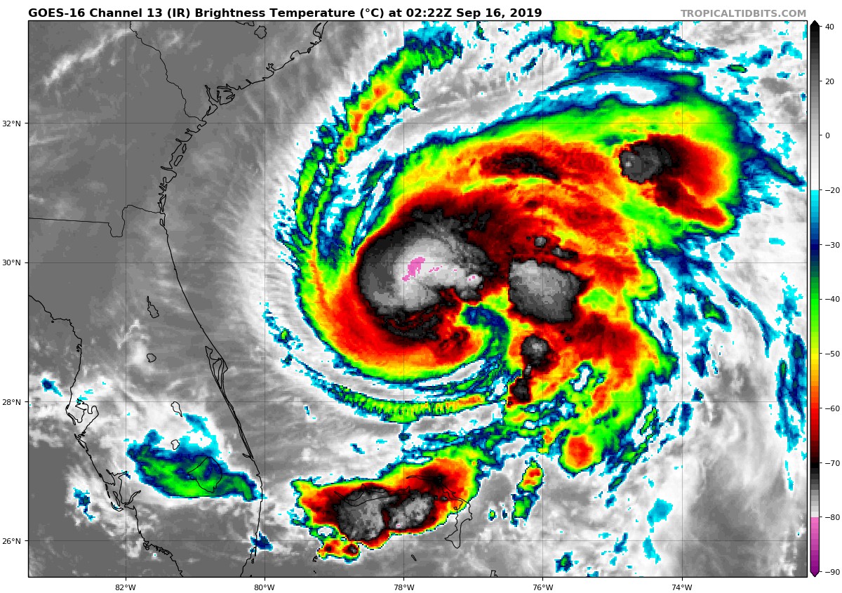
700 MB flight-level wind data from an NOAA P-3 Hurricane Hunter aircraft investigating Humberto indicate that the system’s intensity is now 65 kt. This is also supported by Dvorak classifications from TAFB and SAB, and it makes the cyclone the third hurricane of the 2019 Atlantic season. Humberto’s cloud pattern has continued to gradually become better organized, with increasing coverage and intensity of deep convection, and pronounced upper-level outflow over the eastern semicircle of the circulation. The hurricane is expected to traverse warm Gulf Stream waters for the next several days, but the dynamical models forecast a significant increase in southwesterly vertical shear through 72 hours. In spite of the latter unfavorable factor, numerical guidance generally shows intensification. This is likely at least partially due to some baroclinic forcing caused by a strong mid-latitude trough to the north and northeast of Humberto. The official forecast is a blend of the latest simple and corrected consensus models and is very similar to the previous one.
Humberto continues to move very slowly and the latest aircraft and satellite center fixes indicate that the motion is now northeastward or 040/3 kt. The hurricane has just rounded the western periphery of a subtropical anticyclone and steering currents are likely to remain weak for the next couple of days. An east-northeastward track with a very gradual increase in forward speed is expected for much of the period while Humberto moves between the subtropical high and stronger westerlies associated with the trough to the north. The new NHC track forecast is a little slower than the previous one in 4-5 days, but not as slow as the latest ECMWF and GFS global model runs.
Large swells from Humberto will affect portions of the northwestern Bahamas and the southeastern United States coast during the next few days. These swells are expected to produce dangerous surf conditions and life-threatening rip currents. See products issued by your local weather office for additional information.
About the Author (Author Profile)
Scott Martin is an operational meteorologist, professional graphic artist, musician, husband, and father. Not only is Scott a member of the National Weather Association, but he is also the Central Alabama Chapter of the NWA president. Scott is also the co-founder of Racecast Weather, which provides forecasts for many racing series across the USA. He also supplies forecasts for the BassMaster Elite Series events including the BassMaster Classic.Subscribe
If you enjoyed this article, subscribe to receive more just like it.


