Tropical Storm Imelda Will Bring Heavy Rainfall To Parts Of Texas & Louisiana
BULLETIN
Tropical Storm Imelda Advisory Number 2
NWS National Hurricane Center Miami FL AL112019
400 PM CDT Tue Sep 17 2019
HEAVY RAINFALL AND LIFE-THREATENING FLASH FLOODING TO SPREAD INLAND OVER THE NEXT DAY OR TWO
SUMMARY OF 400 PM CDT…2100 UTC…INFORMATION
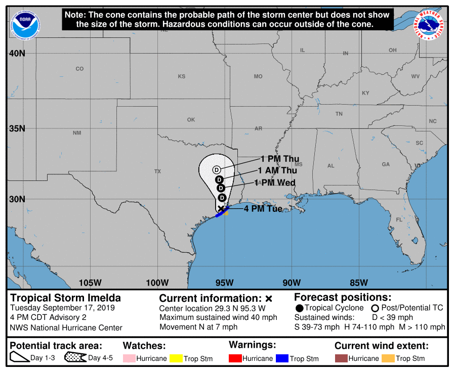
LOCATION…29.3N 95.3W
ABOUT 30 MI…50 KM W OF GALVESTON TEXAS
ABOUT 30 MI…45 KM SSE OF HOUSTON TEXAS
MAXIMUM SUSTAINED WINDS…40 MPH…65 KM/H
PRESENT MOVEMENT…N OR 360 DEGREES AT 7 MPH…11 KM/H
MINIMUM CENTRAL PRESSURE…1006 MB…29.71 INCHES
WATCHES AND WARNINGS
SUMMARY OF WATCHES AND WARNINGS IN EFFECT:
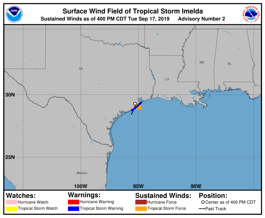
A Tropical Storm Warning is in effect for Sargent, TX to Port Bolivar, TX.
DISCUSSION AND OUTLOOK
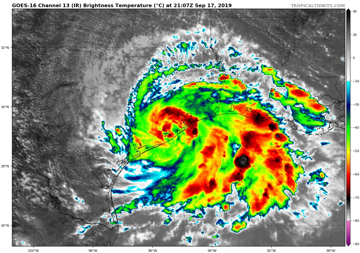
At 400 PM CDT (2100 UTC), the center of Tropical Storm Imelda was located near latitude 29.3 North, longitude 95.3 West. Imelda is moving toward the north near 7 mph (11 km/h) and this general motion is expected to continue through early Wednesday. A north-northwestward motion is expected Wednesday night and Thursday. On the forecast track, the center of Imelda will continue to move farther inland across eastern Texas tonight and Wednesday.
Maximum sustained winds are near 40 mph (65 km/h) with higher gusts. Imelda is expected to weaken to a tropical depression as it moves farther inland.
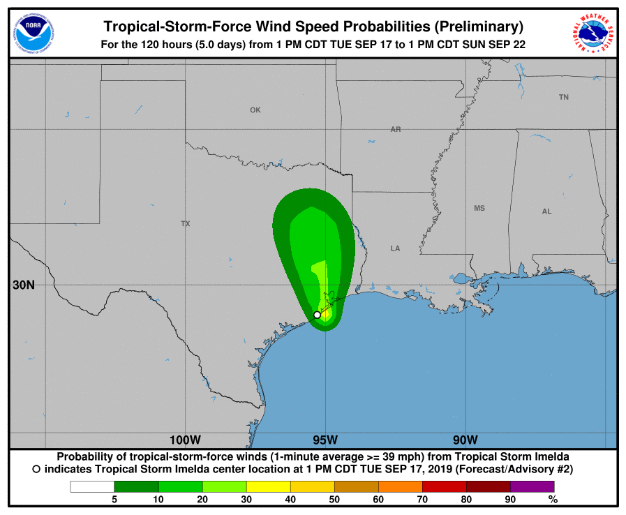
Tropical-storm-force winds extend outward up to 45 miles (75 km) mainly to the southeast of the center over water. A wind gust to 40 mph (65 km/h) was recently reported in Galveston, Texas.
The estimated minimum central pressure is 1006 mb (29.71 inches).
HAZARDS AFFECTING LAND
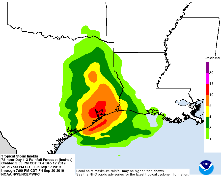
RAINFALL: Imelda is expected to produce total rainfall accumulations of 6 to 12 inches with isolated maximum amounts of 18 inches across the upper coastal region of Texas, including the Houston and Galveston areas. Rainfall amounts of 4 to 6 inches with isolated totals of 10 inches are possible across portions of southeast Texas and southwest Louisiana through Thursday.
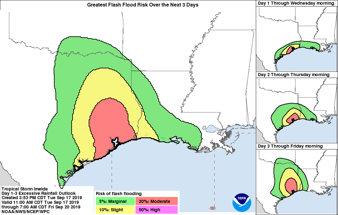
This rainfall may produce significant to life-threatening flash floods.
WIND: Tropical storm conditions are expected somewhere within the warning area this afternoon and evening.
About the Author (Author Profile)
Scott Martin is an operational meteorologist, professional graphic artist, musician, husband, and father. Not only is Scott a member of the National Weather Association, but he is also the Central Alabama Chapter of the NWA president. Scott is also the co-founder of Racecast Weather, which provides forecasts for many racing series across the USA. He also supplies forecasts for the BassMaster Elite Series events including the BassMaster Classic.Subscribe
If you enjoyed this article, subscribe to receive more just like it.


