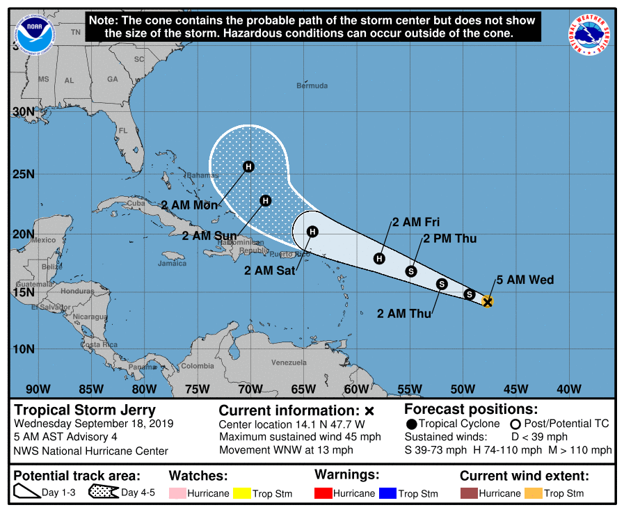
Tropical Storm Jerry Becomes The Tenth Named Storm Of The Season
SUMMARY AS OF 4:00 AM CT
LOCATION…14.1N 47.7W
ABOUT 960 MI…1545 KM E OF THE LEEWARD ISLANDS
MAXIMUM SUSTAINED WINDS…45 MPH…75 KM/H
PRESENT MOVEMENT…WNW OR 290 DEGREES AT 13 MPH…20 KM/H
MINIMUM CENTRAL PRESSURE…1004 MB…29.65 INCHES
FORECAST DISCUSSION AS OF 4:00 AM CT
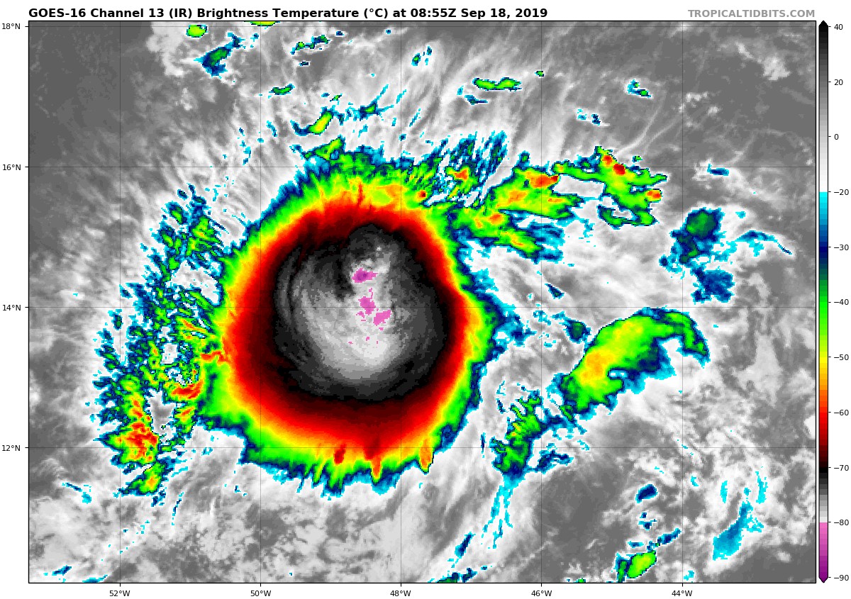
Enhanced BD-curve infrared imagery and a 0431 UTC AMSR2 microwave pass indicate that the cyclone has become better organized during the pass several hours. Although the surface center is still situated near the northeastern edge of the convective mass, the deep convection has expanded in the form of curve bands in the south portion of the cyclone. Based on the increased subjective and objective satellite intensity estimates, and the improved microwave presentation, the initial intensity is raised to 40 kt making the system the tenth named storm of the season.
Even though the shear is low and the sea surface temperatures are warm, GOES-16 sounder data and the GFS/ECMWF SHIPS intensity models indicate that the environment surrounding the cyclone is still a little dry and stable. Therefore, only gradual intensification is forecast. The shear is forecast to increase after 24 hours or so, to the point where it should slow, or halt development, and this is reflected in the official forecast. It should be noted that the forecast still calls for the cyclone to become a hurricane as it approaches the northern Leeward Islands.
The initial motion is estimated to be west-northwestward, or 290/11 kt, within the low to mid-tropospheric steering flow produced by a subtropical ridge to the north of the tropical storm. This general motion is expected to continue during the next 3 to 4 days. Afterward, a northwest to north-northwestward turn, influenced by a growing weakness in the aforementioned ridge, is expected. The NHC track forecast is basically an update from the previous advisory and lies in the middle of the guidance suite, and hedged toward the HCCA multi-model consensus.
KEY MESSAGE
Jerry is expected to strengthen and be a hurricane when its moves near the northern Leeward Islands Friday, although it is too soon to determine if there will be any direct impacts in the islands. Interests there should ensure they have their hurricane plan in place and monitor the progress of this system.
Next update from the National Hurricane Center will be out around 10:00 am CT this morning.
About the Author (Author Profile)
Scott Martin is an operational meteorologist, professional graphic artist, musician, husband, and father. Not only is Scott a member of the National Weather Association, but he is also the Central Alabama Chapter of the NWA president. Scott is also the co-founder of Racecast Weather, which provides forecasts for many racing series across the USA. He also supplies forecasts for the BassMaster Elite Series events including the BassMaster Classic.Subscribe
If you enjoyed this article, subscribe to receive more just like it.


