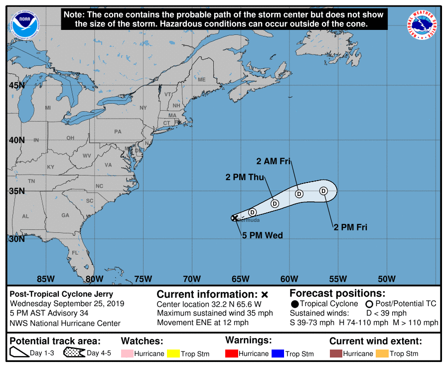
Jerry Has Become A Remnant Low, Sustained Winds Drop Below Tropical Storm Strength
SUMMARY OF 400 PM CDT INFORMATION
LOCATION…32.2N 65.6W
ABOUT 45 MI…75 KM W OF BERMUDA
MAXIMUM SUSTAINED WINDS…35 MPH…55 KM/H
PRESENT MOVEMENT…ENE OR 70 DEGREES AT 12 MPH…19 KM/H
MINIMUM CENTRAL PRESSURE…999 MB…29.50 INCHES
The Bermuda Weather Service has discontinued the Tropical Storm Warning for Bermuda.
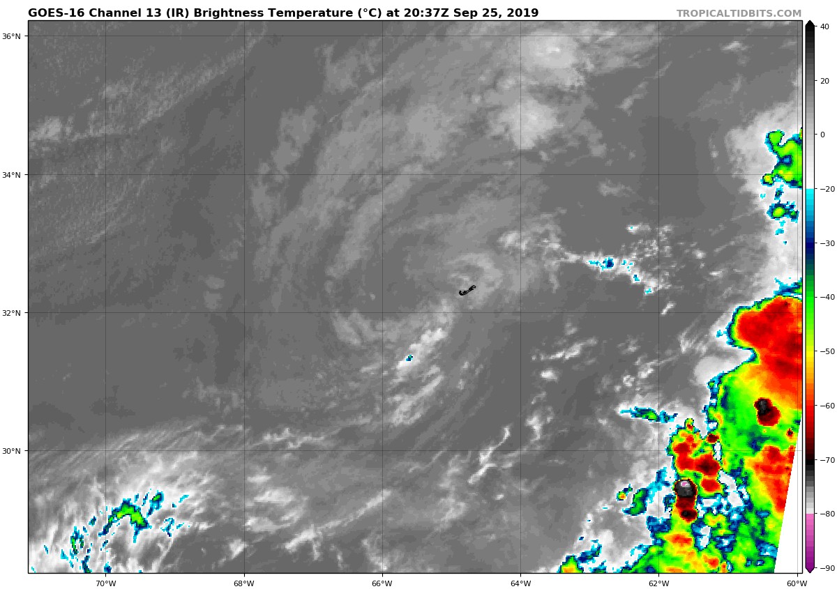
Multiple scatterometer passes over Jerry indicate that the cyclone no longer has sustained tropical-storm-force winds. Therefore Jerry is now a remnant low, and the Bermuda Weather Service has discontinued the Tropical Storm Warning for Bermuda. However, wind gusts to tropical storm force are still possible on the island during the next few hours, especially at elevated observing sites. Based on the scatterometer data, the current intensity is estimated to be 30 kt. The low-cloud swirl is becoming less well-defined, and since the system will continue moving through a hostile environment of strong shear and dry mid-level air, steady weakening is likely. The cyclone should dissipate in 2-3 days. The NHC intensity forecast is close to the latest intensity model consensus.
The system is moving east-northeastward at a slightly faster clip or 070/10 kt. A gradual turn to the east and east-southeast is forecast as the cyclone moves along the southern edge of the band of mid-latitude westerlies and then turns to the right along the northeastern periphery of a subtropical anticyclone before dissipating.
This is the last advisory on Jerry.
About the Author (Author Profile)
Scott Martin is an operational meteorologist, professional graphic artist, musician, husband, and father. Not only is Scott a member of the National Weather Association, but he is also the Central Alabama Chapter of the NWA president. Scott is also the co-founder of Racecast Weather, which provides forecasts for many racing series across the USA. He also supplies forecasts for the BassMaster Elite Series events including the BassMaster Classic.Subscribe
If you enjoyed this article, subscribe to receive more just like it.


