

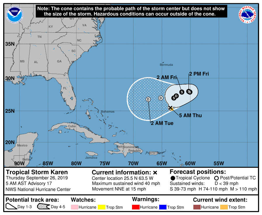
Karen Barely Hangs On To Tropical Storm Status
SUMMARY OF 400 AM CDT INFORMATION
LOCATION…25.5N 63.5W
ABOUT 475 MI…765 KM S OF BERMUDA
ABOUT 520 MI…835 KM NNE OF SAN JUAN PUERTO RICO
MAXIMUM SUSTAINED WINDS…40 MPH…65 KM/H
PRESENT MOVEMENT…NNE OR 15 DEGREES AT 15 MPH…24 KM/H
MINIMUM CENTRAL PRESSURE…1004 MB…29.65 INCHES
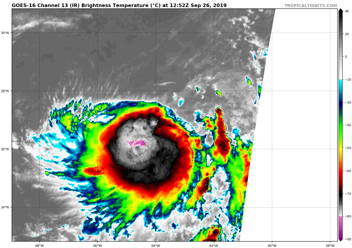
Karen is barely a tropical storm. A pair of ASCAT passes from several hours ago showed maximum winds between 30 and 35 kt in the southeastern quadrant of the storm. Those passes also indicate that the circulation is quite broad and weak on the west side. Based on the ASCAT data and the TAFB Dvorak classification, the initial wind speed is held at 35 kt. The storm appears quite disheveled in satellite images, with an elongated east to west convective pattern and a lack of well-defined banding features.
Karen has not been able to take advantage of the relatively favorable environment that it has been in during the past day or so, which was well anticipated by the dynamical models but poorly forecast by the statistical-dynamical aids. The storm will remain in generally favorable conditions through tonight, so it should be able to maintain its intensity or perhaps strengthen slightly during that time. After that, however, the models show a steady increase in shear and drier air in the vicinity of the cyclone. These conditions should cause weakening and will likely lead to the system either losing its deep convection and becoming a remnant low or dissipating entirely in 3 or 4 days when it moves into a region of strong westerly shear. The NHC intensity forecast is the same as the previous one and leans more on the GFS and ECMWF guidance.
The tropical storm is still moving north-northeastward at 13 kt steered by the flow between a mid-level ridge to its east and a mid- to upper-level low to its west over the Bahamas. The low is expected to weaken and lift out during the next few days allowing a low- to mid-level ridge to strengthen and build to the north of Karen. This change in the steering flow should cause Karen, or its remnants, to move slower to the northeast and east through Friday, followed by a motion to the west-southwest this weekend. Only minor changes were made to the previous NHC track forecast, and this one lies closest to the HCCA model.
About the Author (Author Profile)
Scott Martin is an operational meteorologist, professional graphic artist, musician, husband, and father. Not only is Scott a member of the National Weather Association, but he is also the Central Alabama Chapter of the NWA president. Scott is also the co-founder of Racecast Weather, which provides forecasts for many racing series across the USA. He also supplies forecasts for the BassMaster Elite Series events including the BassMaster Classic.Subscribe
If you enjoyed this article, subscribe to receive more just like it.


