It’s The Noon Hour & It’s Mighty Fine Out There
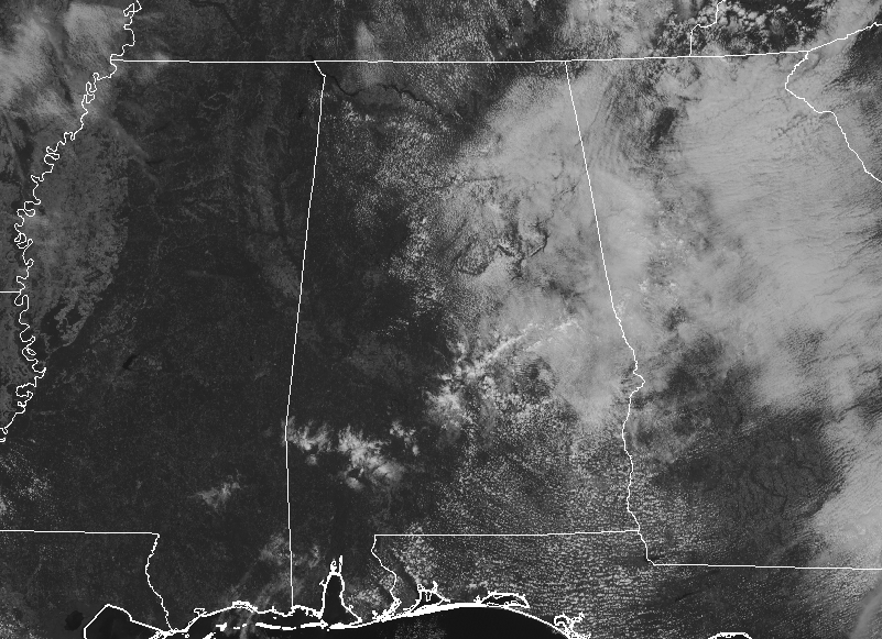
Skies are becoming mostly sunny across the western half of Central Alabama while a good bit of cloud cover continues to hang on over the eastern half. While most of the area is dry at this point, we do have a few light returns showing up over the southeastern parts of the area and moving to the northeast. Those returns are very hard to see, but they are moving over a very small part of Lowndes, Elmore, Montgomery, and Tallapoosa counties. They may not even be reaching the ground. Temperatures are currently in the lower 70s to the lower 80s across the area. Troy was the warm spot at 84 degrees while the cool spots were Anniston and Gadsden at 73 degrees. Birmingham was at 79 degrees.
While there is a very small risk of a few isolated showers over much of the southern half of Central Alabama this afternoon, much of the area will stay dry with partly to mostly sunny skies. Highs will top out in the 80s across the area. For this evening and through the night time hours, we’ll have fair weather with only a few passing clouds. Lows will be in the lower to mid-60s for most.
Thursday will be another grand but mighty warm day across Central Alabama as skies will be mostly clear and nearly everyone remaining dry. Only a very small risk of an isolated shower or two are possible over the extreme western parts of the area late in the afternoon. Highs will be in the mid-80s to right at 90 degrees across the area.

THE TROPICS
A non-tropical disturbance is located about 1000 miles east of Bermuda is producing winds to near gale force. This system could still become a tropical or subtropical storm while it moves slowly westward through today. However, upper-level winds are expected to become unfavorable for further development by tonight. Formation chance through 5 days is medium at 40%.
A disturbance located off the mid-Atlantic coast of the United States is producing gale-force winds. This system is forecast to strengthen as a non-tropical low off the east coast of
the United States during the next day or so. Environmental conditions are now forecast to be less conducive for significant subtropical or tropical cyclone development through the end of the week as it meanders offshore the United States. Regardless of development, this system is expected to bring strong winds, coastal flooding, and rough surf to portions of the mid- Atlantic and northeastern United States coasts through late week. Formation chance through 5 days is low at 20%.
A smaller disturbance located about 250 miles southeast of Cape Hatteras, North Carolina is producing showers and thunderstorms well east of the center. Upper level winds are only marginally favorable for some additional development today. By tonight, the system is forecast to merge with the low off the east coast of the United States. Formation chance through 5 days is low at 20%.
Category: Alabama's Weather, ALL POSTS
About the Author (Author Profile)
Scott Martin is an operational meteorologist, professional graphic artist, musician, husband, and father. Not only is Scott a member of the National Weather Association, but he is also the Central Alabama Chapter of the NWA president. Scott is also the co-founder of Racecast Weather, which provides forecasts for many racing series across the USA. He also supplies forecasts for the BassMaster Elite Series events including the BassMaster Classic.Subscribe
If you enjoyed this article, subscribe to receive more just like it.


