Risk Of Severe Weather Continues For The Southwestern Parts Of Central Alabama
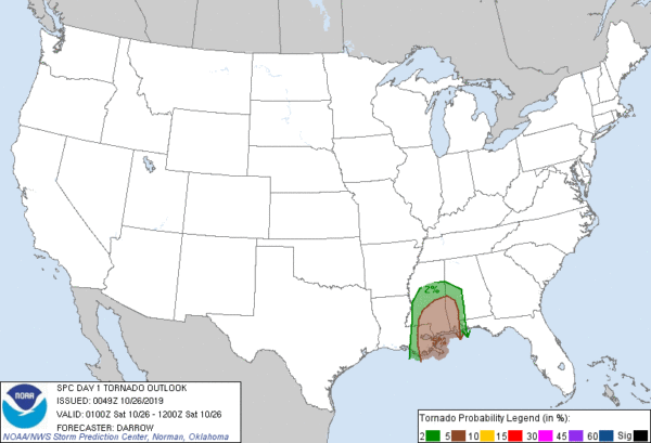
Probability of a tornado within 25 miles of a point.
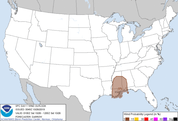
Probability of damaging thunderstorm winds or wind gusts of 50 knots or higher within 25 miles of a point.
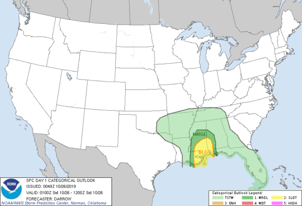
THERE IS A SLIGHT RISK OF SEVERE THUNDERSTORMS ACROSS THE CENTRAL GULF COAST STATES.
SUMMARY
A couple of tornadoes and isolated damaging winds will be possible through tonight across portions of the central Gulf Coast States.
8:00 PM UPDATE
Scattered supercells remain concentrated within a corridor of low-level warm advection that is focused across the central Gulf Coast region. The latest radar data depicts at least half a dozen longer-lived supercells from southeast MS into southwest AL. This activity has produced tornadoes earlier this evening and warm frontal interactions remain favorable for additional tornado development. Additionally, Tropical Storm Olga is forecast to move onshore along the LA coast later tonight and LLJ should strengthen across southeast LA into western MS in response to this cyclone. While ongoing convection is currently concentrated along the advancing warm front, new supercell activity is possible later in association with strengthening wind fields in response to Olga.
Category: Alabama's Weather, ALL POSTS, Severe Weather, Tropical
About the Author (Author Profile)
Scott Martin is an operational meteorologist, professional graphic artist, musician, husband, and father. Not only is Scott a member of the National Weather Association, but he is also the Central Alabama Chapter of the NWA president. Scott is also the co-founder of Racecast Weather, which provides forecasts for many racing series across the USA. He also supplies forecasts for the BassMaster Elite Series events including the BassMaster Classic.Subscribe
If you enjoyed this article, subscribe to receive more just like it.


