Not A Bad Midday For Most, But Rain Is Affecting The Northwestern Parts Of The Area
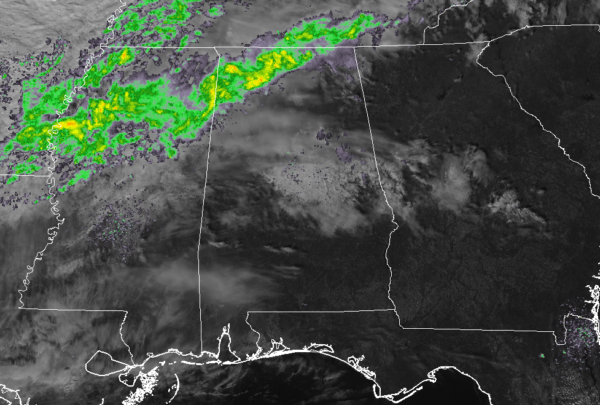
We have showers moving through the extreme northern and northwestern parts of the state as of 12:00 pm which is affecting the northwestern parts of Marion and Lamar counties. Nothing too heavy at this point, just some light to moderate rain. The line is slowly pushing eastward while the activity within the line is moving northeast. Temperatures at this time were in the 60s and into the lower 70s across the area. Montgomery and Selma were the warm spots at 72 degrees, while Haleyville and Pell City were tied as the cool spots at 61 degrees. Birmingham was at 63 degrees.
The forecast for the rest of the day will be increasing clouds from the west and northwest with skies becoming mostly cloudy to overcast for much of Central Alabama before sunset. Showers will be possible north of the I-59 corridor mainly over the northernmost locations of the area. Afternoon highs will top out in the upper 60s to the lower 70s across the area but may be held back a little in the northwest where thicker cloud cover and showers will be occurring.
For tonight, we’ll continue with a chance of showers north of the I-59 corridor while the rest of Central Alabama looks to remain dry. Skies will be mostly cloudy and lows will be in the upper 40s to the lower 50s.
Rain chances will increase throughout the day across Central Alabama on Friday from northwest to southeast as a cold front will begin to approach the area. Showers will be likely north of the I-59 corridor with decent chances reaching as far south as Selma to Clanton to Auburn. Skies will be mostly cloudy to overcast when not raining and highs will be in the mid-60s to the mid-70s. Pretty much the same story through the evening hours with the rain chances with temperatures starting off in the lower to mid-60s at 6:00 pm and dropping into the upper 50s to the mid-60s by 10:00 pm. Rain chances will slowly spread across the remainder of Central Alabama for the overnight hours with all of the area’s chances becoming likely. Lows will be in the mid-50s to the lower 60s.
Here are the models to help show what we can expect for the next 24-36 hours, and through much of the day on Saturday…
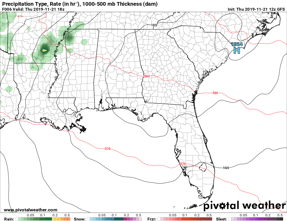
The latest run of the GFS is keeping nearly all of the rainfall out of Central Alabama through the remainder of the day and into the morning hours on Friday, with rain moving into the northwestern parts of the area by the late morning hours. Rain chances will continue to stay with us as a cold front will slide through the area and will finally exit during the mid-evening hours on Saturday.
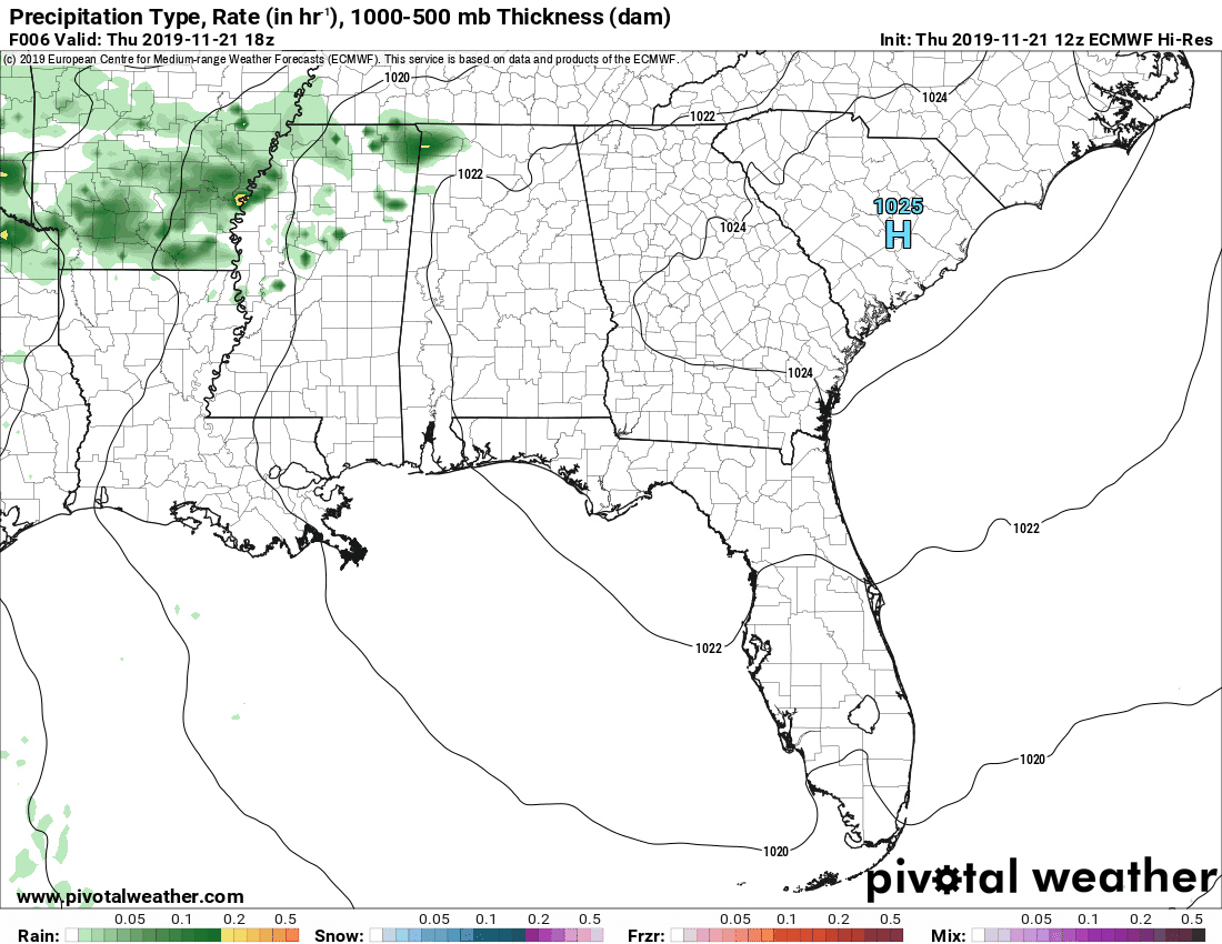
The latest run of the high-resolution European model shows some spotty shower activity forming as early as midday today but staying mainly north and west of the area through sunset. More organized shower look to form around midday on Friday and will affect much of Central Alabama through the mid-evening hours on Saturday.
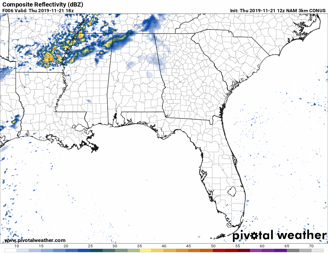
The latest run of the high-resolution NAM shows some shower activity over the extreme northwestern parts of the area as early as the midday hour today and moving across the northern parts of the area through the daylight hours. Activity drops off during the overnight hours but begins to pick back up from the northwest during Friday morning. Just like with the previous two models above, showers will affect much of Central Alabama from midday Friday through the mid-evening hours on Saturday before exiting into Georgia.
Category: Alabama's Weather, ALL POSTS
About the Author (Author Profile)
Scott Martin is an operational meteorologist, professional graphic artist, musician, husband, and father. Not only is Scott a member of the National Weather Association, but he is also the Central Alabama Chapter of the NWA president. Scott is also the co-founder of Racecast Weather, which provides forecasts for many racing series across the USA. He also supplies forecasts for the BassMaster Elite Series events including the BassMaster Classic.Subscribe
If you enjoyed this article, subscribe to receive more just like it.


