

A Very Nice Thanksgiving Midday Across Central Alabama
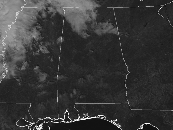
While most of Central Alabama has mainly sunny skies as of 11:00 am, we will have clouds begin to move into the north and northwestern parts of the area throughout the day. The good news is that we will stay dry and we can continue to enjoy the holiday without worrying about umbrellas. Temperatures are in the lower 50s to the lower 60s across the area at this point and should continue to warm into the upper 50s to right at 70s degrees across the area from northwest to southeast for the afternoon highs.
We’ll stay dry with mostly cloudy skies for the northern half of the area through the evening hours, while the southern half stays mainly clear. Temperatures will start off in the upper 40s to the upper 50s at 6:00 pm and fall into the mid-40s to the lower 50s by 9:00 pm.
BLACK FRIDAY: We’ll have partly to mostly cloudy skies throughout the entire day for the northern half of the area while the southern half will enjoy mostly sunny skies. Temperatures will start off in the mid to upper 40s for most at midnight and fall into the lower to mid-40s by daybreak. Temperatures will warm nicely throughout the morning hours and will top out in the lower 60s to the lower 70s across the area for the afternoon highs. Temperatures will steadily fall throughout the evening and late-night hours and lows will bottom out in the mid to upper 40s for most across the area.
IRON BOWL SATURDAY: Rain looks to continue to hold off for much of the day across Central Alabama which will be great news for the big game down on the plains in Auburn. Skies will be partly to mostly cloudy across the area with clouds on the increase later in the day. Afternoon highs will top out in the mid-60s to the mid-70s across the area. Kickoff temperature at 2:30 pm will be around 71 degrees and will fall into the 60s throughout the game.
After the game is where we are going to have to be on our toes as rain and thunderstorms will begin to move into the area, bringing a potential for strong to severe storms. At this point, there is a marginal risk for severe storms for all locations along and west of I-65 all of the way down to the I-85 corridor. Most locations south of I-85 are also included in the marginal risk. Timing looks to be from 6:00 pm Saturday night through 6:00 am Sunday from west to east with the threats being damaging winds up to 60 MPH and brief tornadoes. Lows will be in the upper 40s to the upper 50s.
THE FIRST OF DECEMBER: Much, if not all of the activity, should be out of Central Alabama by mid-morning, and the rest of your Sunday will be dry with skies becoming mainly sunny by the afternoon. Highs will be in the upper 50s to the upper 60s.
THE TROPICS: Only two days are left in the 2019 Atlantic Hurricane Season and it looks like we should close out the season on a quiet note. All is quiet across the Atlantic Basin and no new tropical cyclones are expected to develop over the next five days.
Category: Alabama's Weather, ALL POSTS, Severe Weather
About the Author (Author Profile)
Scott Martin is an operational meteorologist, professional graphic artist, musician, husband, and father. Not only is Scott a member of the National Weather Association, but he is also the Central Alabama Chapter of the NWA president. Scott is also the co-founder of Racecast Weather, which provides forecasts for many racing series across the USA. He also supplies forecasts for the BassMaster Elite Series events including the BassMaster Classic.Subscribe
If you enjoyed this article, subscribe to receive more just like it.


