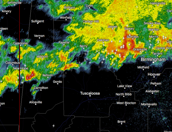
Strong Storms Affecting Tuscaloosa, Pickens, Fayette, & Lamar Counties

At 912 PM CST, Doppler radar was tracking a strong thunderstorm over
Ethelsville, or 11 miles west of Reform, moving northeast at 75 mph.
Penny size hail and winds in excess of 40 mph will be possible with
this storm.
Locations impacted include…
Reform, Millport, Berry, Kennedy, Ethelsville, Ashcraft Corner,
Bankston, Stone Wall, McShan, Fayette County Public Lake, Shaw and
New Lexington.
PRECAUTIONARY/PREPAREDNESS ACTIONS…
Torrential rainfall is also occurring with this storm, and may lead
to localized flooding. Do not drive your vehicle through flooded
roadways.
Frequent cloud to ground lightning is occurring with this storm.
Lightning can strike 10 miles away from a thunderstorm. Seek a safe
shelter inside a building or vehicle.
Category: Alabama's Weather, ALL POSTS, Severe Weather


