

Very Nice Temperatures At Midday With Some Clouds; Rain Invades Tonight
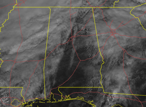
Much of the I-65 corridor is bathed in a good bit of sunshine at 11:15 am this morning, while much of the west and portions of the eastern parts of Central Alabama has a good bit of cloud cover. Radar is free from any shower activity at this point, but that may change as we progress through the afternoon and evening hours.
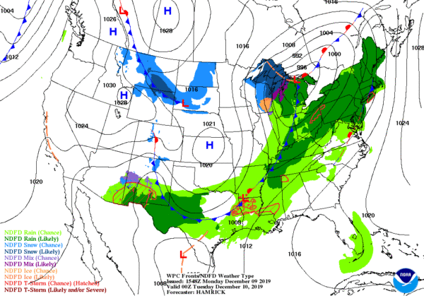
A cold front is moving in our direction which will bring much cooler temperatures to the area starting on Tuesday. As for today, we’ll be in the warm and moist air that is being advected into Central Alabama out ahead of the front. That will lead to a good bit of cloud cover for most of the time across the area and we could see a few showers form across the area through the afternoon and evening hours. It will be a mild day across the area with highs reaching the mid-60s to the mid-70s across the area.
The front gets closer and will move into the northwestern parts of the area during the late-night and overnight hours. By daybreak, the front will probably be right along the I-59 corridor. Rain will move in from the northwest and will begin to move across Central Alabama. All of the area will have a decent chance of rain during the overnight and pre-dawn hours, but most of the activity will be along and north of the I-59 corridor. Lows will be in the mid-40s to the mid-60s across the area.
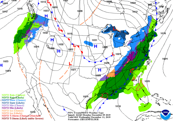
Periods of rain will continue through nearly all of Tuesday and temperatures will begin to quickly fall with the passage of the cold front. By 6:00 pm, the cold front should be exiting the southeastern corner of the state moving through Dothan. Daytime highs look to top out in the lower 50s to the upper 70s across the area from northwest to southeast, but some of those highs in the northern and northwestern parts of the area will occur prior to sunrise. There may be a few claps of thunder over the southeastern parts of the area, but severe weather is not expected.
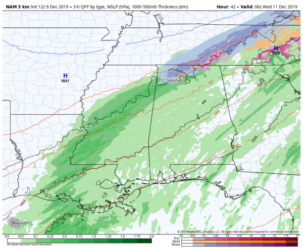
High-Resolution NAM valid at 12:00 am Wednesday.
The latest run of the high-resolution NAM is showing the potential for a changeover to a wintry mix to snow showers on the back edge of the rain as it begins to move through the state. We may see the change occur starting around 6:00 pm Tuesday evening in the extreme northwestern parts of the state, with much of North Alabama possibly seeing some snow at midnight, and coming to an end before 6:00 am Wednesday morning. While there may be a few light snow showers mixed in over the northwestern parts of Central Alabama, no travel issues are expected as surface temperatures will remain well above freezing even though lows could drop into the upper 20s to the lower 30s. Lows across the area will bottom out in the upper 20s to the mid-40s from northwest to southeast. Rain should be completely out of the area by Wednesday evening.
Category: Alabama's Weather, ALL POSTS
About the Author (Author Profile)
Scott Martin is an operational meteorologist, professional graphic artist, musician, husband, and father. Not only is Scott a member of the National Weather Association, but he is also the Central Alabama Chapter of the NWA president. Scott is also the co-founder of Racecast Weather, which provides forecasts for many racing series across the USA. He also supplies forecasts for the BassMaster Elite Series events including the BassMaster Classic.Subscribe
If you enjoyed this article, subscribe to receive more just like it.


