A Quick Check At 9:00 PM: Tornado Watch Has Expired
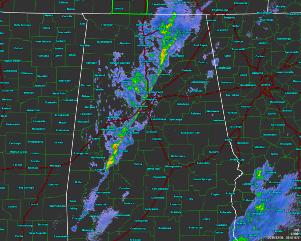
As of 8:57 pm, the line of storms was right ahead of the cold front and was stretching from Scottsboro in the northeast corner of North/Central Alabama down to the southwest through Birmingham and down to just east of Linden in Marengo County.
No severe warnings are currently in effect for anyone in North/Central Alabama.
At this point, it looks like both of the Nation Weather Service offices in Birmingham and in Huntsville will allow the Tornado Watch to expire at 9:00 pm. This will bring to an end the threat of organized severe weather, but we could still have a storm or two ramp up and briefly become strong to severe.
As the line passed over my neighborhood, there were a few minutes of gusty wind around 20-25 MPH along with a brief shot of moderate rainfall. I now have light rain falling.
Atmospheric conditions along and ahead of the front have settled down. Instability continues to weaken and the threat of severe storms is becoming less likely as the line continues to move eastward and weaken with time.
Unless there are any other warnings issued tonight, this will be the last update for the night. I hope you have a great night!
Category: Alabama's Weather, ALL POSTS, Severe Weather
About the Author (Author Profile)
Scott Martin is an operational meteorologist, professional graphic artist, musician, husband, and father. Not only is Scott a member of the National Weather Association, but he is also the Central Alabama Chapter of the NWA president. Scott is also the co-founder of Racecast Weather, which provides forecasts for many racing series across the USA. He also supplies forecasts for the BassMaster Elite Series events including the BassMaster Classic.Subscribe
If you enjoyed this article, subscribe to receive more just like it.


