Light Snow Accumulations Possible in Cherokee County Overnight and Saturday Morning
A quick-moving storm system will move through the area late
tonight and early Saturday morning. Rain may mix with or briefly
change over to snow across northeast Central Alabama.
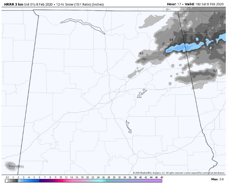
Accumulations of a quarter-inch to an inch are possible in mainly
the higher elevations in the northern half of Cherokee County
where minor impacts could occur. Accumulations of a tenth of an
inch are possible in isolated portions of Cleburne and northern
Etowah Counties with little to no impacts.
* WHAT…Snow expected. Total snow accumulations of up to one inch
in northernmost areas of Cherokee County.
* WHERE…Northern Cherokee County.
* WHEN…From 4 AM to 11 AM CST Saturday.
* IMPACTS…Plan on slippery road conditions.
PRECAUTIONARY/PREPAREDNESS ACTIONS…
Slow down and use caution while traveling.
The latest road conditions for the state you are calling from can
be obtained by calling 5 1 1.
Category: Alabama's Weather, ALL POSTS, Winter Weather
About the Author (Author Profile)
Bill Murray is the President of The Weather Factory. He is the site's official weather historian and a weekend forecaster. He also anchors the site's severe weather coverage. Bill Murray is the proud holder of National Weather Association Digital Seal #0001 @wxhistorianSubscribe
If you enjoyed this article, subscribe to receive more just like it.


