Here We Go Again: Excessive Rainfall and Flooding Likely Again This Week
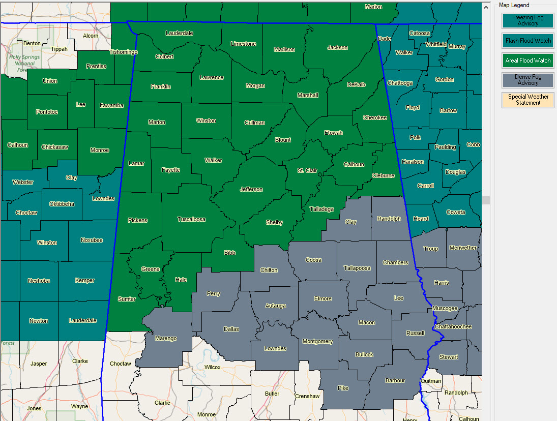
Flood watches have been issued for all of Alabama along and north of the I-20 Corridor for Monday through Tuesday.
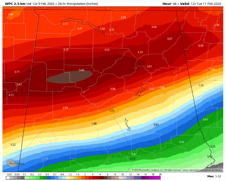
WPC QPF through Tuesday morning
The first wave will come in Monday and last into Tuesday. Another storm system will come in on Wednesday.
3-5 inches of rain is expected across the watch area, with a sharply diminishing gradient to the south.
With saturated ground and rivers and streams at or above bankfull, there will be significant flooding concerns.
More rain on Wednesday may push the totals to 8-10 inches in some places.
Elsewhere this morning, a dense fog advisory covers much of Central Alabama as well until 9 a.m. The following counties were added to the original advisory: Bibb, Cherokee, Etowah, Hale, Marengo, Perry, Shelby, and St. Clair. It was already in effect for Autauga, Barbour, Bullock, Calhoun, Chambers, Chilton, Clay, Cleburne, Coosa, Dallas, Elmore, Lee, Lowndes, Macon, Montgomery, Pike, Randolph, Russell, Talladega, and Tallapoosa.
Category: Alabama's Weather, ALL POSTS
About the Author (Author Profile)
Bill Murray is the President of The Weather Factory. He is the site's official weather historian and a weekend forecaster. He also anchors the site's severe weather coverage. Bill Murray is the proud holder of National Weather Association Digital Seal #0001 @wxhistorianSubscribe
If you enjoyed this article, subscribe to receive more just like it.


