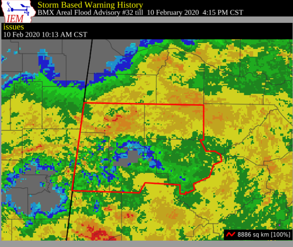
Areal Flood Advisory for Parts of Walker, Marion, Winston, Fayette, Lamar Counties Until 4:15 PM
The National Weather Service in Birmingham has issued a
* Flood Advisory for…
Walker County in central Alabama…
Marion County in northwestern Alabama…
Winston County in northwestern Alabama…
Fayette County in west central Alabama…
Lamar County in west central Alabama…
* Until 415 PM CST Monday.
* At 1009 AM CST, Doppler radar indicated heavy rain due to
thunderstorms. This will cause minor flooding in the advisory
area. These same locations will continue to be monitored for the
possibility of Flash Flood Warnings later on this morning, and all
interests should closely monitor this ongoing flood situation over
the next couple of days.
* Some locations that will experience flooding include…
Jasper, Hamilton, Winfield, Fayette, Haleyville, Sumiton, Cordova,
Dora, Carbon Hill, Vernon, Sulligent, Millport, Lynn, Arley, Guin,
Hackleburg, Berry, Double Springs, Parrish and Brilliant.
PRECAUTIONARY/PREPAREDNESS ACTIONS…
Turn around, don’t drown when encountering flooded roads. Most flood
deaths occur in vehicles.
Please report flooding to your local law enforcement agency when you
can do so safely.
A Flood Advisory means river or stream flows are elevated, or ponding
of water in urban or other areas is occurring or is imminent.
Category: Alabama's Weather, ALL POSTS, Severe Weather
About the Author (Author Profile)
Scott Martin is an operational meteorologist, professional graphic artist, musician, husband, and father. Not only is Scott a member of the National Weather Association, but he is also the Central Alabama Chapter of the NWA president. Scott is also the co-founder of Racecast Weather, which provides forecasts for many racing series across the USA. He also supplies forecasts for the BassMaster Elite Series events including the BassMaster Classic.Subscribe
If you enjoyed this article, subscribe to receive more just like it.


