Strong Storms Moving Into NW Alabama; Damage Already Reported
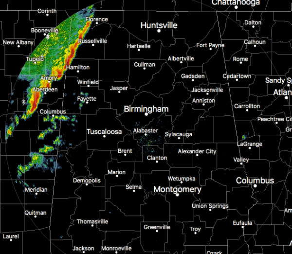
Lauderdale, Colbert, and Franklin counties have already started feeling the effects of the squall line moving in, and Marion and Lamar counties will be next. Gusty winds are occurring with these storms, possibly up to 50 MPH.
We have already received a damage report as power lines have been downed in Cherokee (Lauderdale Co.) on Waterloo Road (as of 4:41 pm).
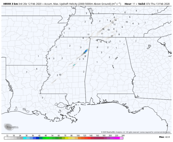
No active severe warnings at this point, but we’ll have to really watch this section of the squall line as the last few runs of the HRRR has shown stronger updraft helicity tracks over the northeastern parts of Mississippi and into northwest Alabama. That means the potential for severe storms has been forecast for those locations.
Category: Alabama's Weather, ALL POSTS, Severe Weather
About the Author (Author Profile)
Scott Martin is an operational meteorologist, professional graphic artist, musician, husband, and father. Not only is Scott a member of the National Weather Association, but he is also the Central Alabama Chapter of the NWA president. Scott is also the co-founder of Racecast Weather, which provides forecasts for many racing series across the USA. He also supplies forecasts for the BassMaster Elite Series events including the BassMaster Classic.Subscribe
If you enjoyed this article, subscribe to receive more just like it.


