Quick Check At 4:00 AM; Heavy Rain & Storms Continue To Move Through The Area
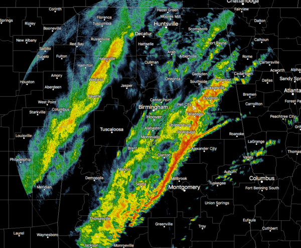
As of 3:44 am this morning, we have two lines of rain and a few embedded thunderstorms moving across North/Central Alabama. The first line stretches from Piedmont down to Sylacauga and down to Autaugaville. The second line stretches from Athens to Haleyville to Carrollton.
A few storms are trying to misbehave out there this morning, even though the threat of severe storms ended hours ago. Strong thunderstorms along
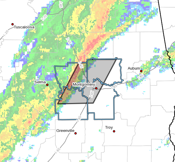
a line extending from near Billingsley to near Belknap. Movement was
east at 40 mph. Therefore, a Significant Weather Advisory was issued for parts of Autauga, Elmore, Lowndes, and Montgomery counties until 4:30 am.
Wide range of temperatures across the area as well, with mid-50s to the lower 70s being reported at this time. Haleyville was the cold spot at 54 degrees, Birmingham was at 61 degrees, and the warm spot of Montgomery at 73 degrees.
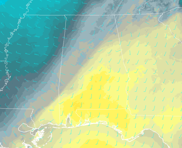
You can clearly see where the cold front is on this temperature gradient map. It is just a few miles east of the I-59 corridor through North/Central Alabama. It will take the front a while to make it through the rest of the area so highs today will range from the lower 50s in the northwest to the upper 60s in the southeast. Most of the locations behind the front will see their official highs recorded early this morning as those temperatures will be heading in the wrong direction.
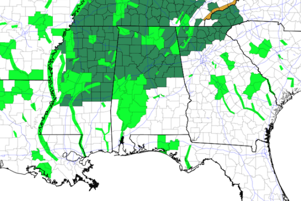
Flash Flood Watches remain in effect until 6:00 pm this evening for all counties in North Alabama and for the northern 2/3rds of the counties in Central Alabama. More than likely, the NWS offices will probably let those watches ride to the expiration time with the rainfall taking its time moving out of the area.
Category: Alabama's Weather, ALL POSTS, Severe Weather
About the Author (Author Profile)
Scott Martin is an operational meteorologist, professional graphic artist, musician, husband, and father. Not only is Scott a member of the National Weather Association, but he is also the Central Alabama Chapter of the NWA president. Scott is also the co-founder of Racecast Weather, which provides forecasts for many racing series across the USA. He also supplies forecasts for the BassMaster Elite Series events including the BassMaster Classic.Subscribe
If you enjoyed this article, subscribe to receive more just like it.


