A Quick Update At 8:45 AM; Rain Winding Down
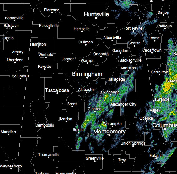
As of 8:34 am this morning, much of the shower activity has exited the state and has moved over into Georgia. We do have some lingering showers stretching from roughly Heflin down to Prattville and over to Selma, Clanton, and Sylacauga. This activity is light and is moving to the northeast at around 65 MPH.
Flash Flood Watches have been allowed to expire as the threat of flash flooding has come to an end as much of the rain has moved out of the area. We do still have a few Areal Flood Warnings in effect. Here is a list of those active flood warnings:
Dekalb County – Until 10:15 AM
Southwestern Madison County – Until 10:45 AM
Colbert, Franklin, Lauderdale, Lawrence Counties – Until 1:30 PM
With the warmth that we had across the area on Wednesday, we did have a few record highs reset…
Anniston’s high reached 75 degrees, which ties the previous record set back in 1962.
Montgomery’s high reached 81 degrees, which breaks the previous record of 80 degrees set back in 1922.
NWS Huntsville will be sending out a team to survey the damage that occurred in Lauderdale county last night.
Category: Alabama's Weather, ALL POSTS
About the Author (Author Profile)
Scott Martin is an operational meteorologist, professional graphic artist, musician, husband, and father. Not only is Scott a member of the National Weather Association, but he is also the Central Alabama Chapter of the NWA president. Scott is also the co-founder of Racecast Weather, which provides forecasts for many racing series across the USA. He also supplies forecasts for the BassMaster Elite Series events including the BassMaster Classic.Subscribe
If you enjoyed this article, subscribe to receive more just like it.


