Cloudy With Dropping Temperatures At Midday
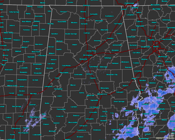
As of 12:15 pm, we have a few lingering showers over the extreme southeastern portions of the area. All of that activity looks to be very light at this point and should be out of the area within the next hour or so.
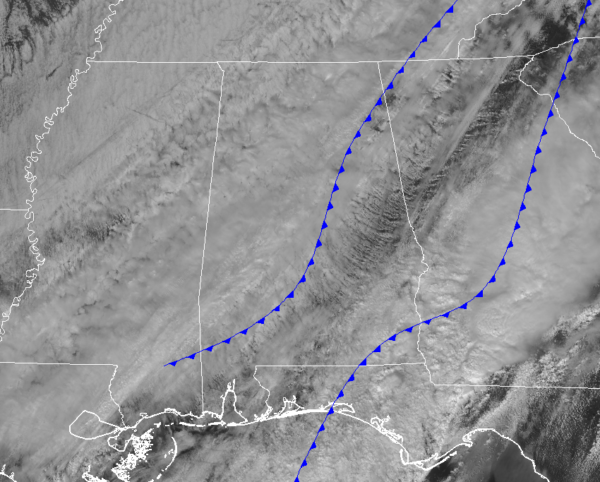
For the rest of Central Alabama, we see that cloud cover continues to hamper any sunshine from reaching and warming the surface to help evaporate any standing water. The lead cold front has already moved through much of the state and a secondary cold front is moving through the eastern parts of the area.
Temperatures are in the lower 40s to the lower 60s across the area. Haleyville has already dropped to 41 degrees as the cool spot. Troy and Auburn were the warm spots at 61 degrees. Birmingham is down to 49 degrees.
Skies will stay mainly cloudy throughout the rest of the day but some clearing will start occurring during the early evening hours. Skies will continue the slow clearing process through the late-night and overnight hours. Temperatures will fall to around the lower 40s to the lower 50s by 6:00 pm and into the upper 30s to the upper 40s by 9:00 pm. Overnight lows will be in the mid-20s to the upper 30s from north to south.
We’ll finally get to see plenty of sunshine to end off the workweek and a day with no rain. Friday’s highs will be in the mid40s to the upper 50s across the area from northwest to southeast.
Category: Alabama's Weather, ALL POSTS
About the Author (Author Profile)
Scott Martin is an operational meteorologist, professional graphic artist, musician, husband, and father. Not only is Scott a member of the National Weather Association, but he is also the Central Alabama Chapter of the NWA president. Scott is also the co-founder of Racecast Weather, which provides forecasts for many racing series across the USA. He also supplies forecasts for the BassMaster Elite Series events including the BassMaster Classic.Subscribe
If you enjoyed this article, subscribe to receive more just like it.


