Flash Flood Watch Extended To Cover Northern Counties In Central Alabama
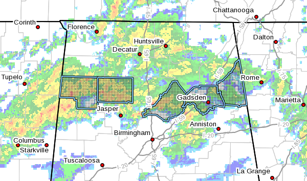
NWS Birmingham has extended the FLASH FLOOD WATCH northward to cover Blount, Cherokee, Etowah, Marion, and Winston counties as localized flash flooding will become possible throughout the day.
Several rounds of showers and storms may produce rainfall totals of one and one-half to two and one-half inches, with locally higher totals in a short period of time. With the saturated soils already in place, even an inch of rain may cause localized flash flooding. Use caution while driving.
The FLASH FLOOD WATCH continues for Autauga, Bibb, Calhoun, Chambers, Chilton, Clay, Cleburne, Coosa, Elmore, Fayette, Greene, Hale, Jefferson, Lamar, Lee, Perry, Pickens, Randolph, Shelby, St. Clair, Sumter, Talladega, Tallapoosa, Tuscaloosa, and Walker counties until 6:00 am Wednesday morning.
Category: Alabama's Weather, ALL POSTS, Severe Weather
About the Author (Author Profile)
Scott Martin is an operational meteorologist, professional graphic artist, musician, husband, and father. Not only is Scott a member of the National Weather Association, but he is also the Central Alabama Chapter of the NWA president. Scott is also the co-founder of Racecast Weather, which provides forecasts for many racing series across the USA. He also supplies forecasts for the BassMaster Elite Series events including the BassMaster Classic.Subscribe
If you enjoyed this article, subscribe to receive more just like it.


