Marginal Risk Continues For The Southern 2/3rds Of Central Alabama Through The Night
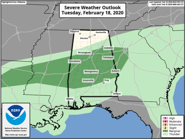
The Storm Prediction Center continues a MARGINAL RISK for severe storms through the remainder of tonight for the southern 2/3rds of Central Alabama.
Over the past couple of hours, we have seen some cells rotate, but so far, those have been either too week or too broad to produce a tornado.
Isolated damaging winds up to 60 MPH remains to be the main threat across the risk locations, while a non-zero threat of a brief tornado and small hail remains possible as well.
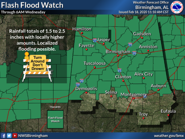
A Flash Flood Watch continues for the southern tier of counties in North Alabama until 8:00 pm tonight, while another Flash Flood Watch continues for much of Central Alabama until 6:00 am Wednesday morning.
A Flash Flood Warning continues until 8:45 pm tonight for portions of Tuscaloosa, Jefferson, and Shelby counties. While the heaviest rainfall has now moved south of the warning location, a shield of light to moderate rainfall remains.
Category: Alabama's Weather, ALL POSTS, Severe Weather
About the Author (Author Profile)
Scott Martin is an operational meteorologist, professional graphic artist, musician, husband, and father. Not only is Scott a member of the National Weather Association, but he is also the Central Alabama Chapter of the NWA president. Scott is also the co-founder of Racecast Weather, which provides forecasts for many racing series across the USA. He also supplies forecasts for the BassMaster Elite Series events including the BassMaster Classic.Subscribe
If you enjoyed this article, subscribe to receive more just like it.


