Some Accumulating Snowfall Possible In Portions Of North Alabama Today
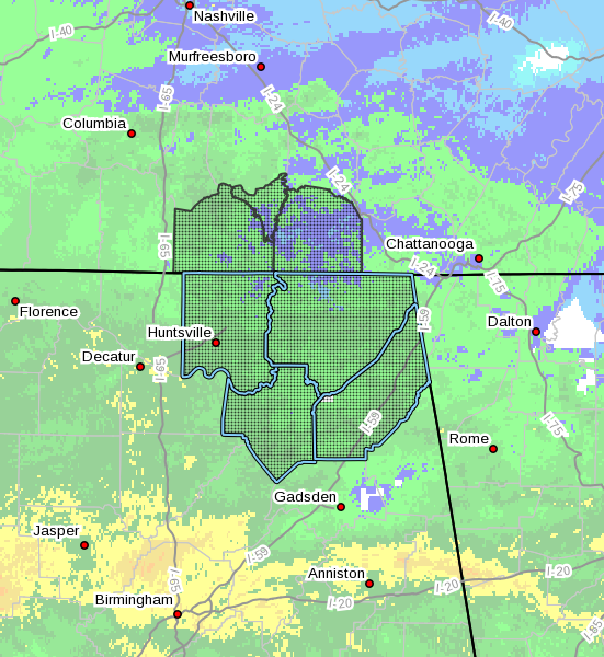
Accumulating snowfall possible in portions of northeast Alabama and southern middle Tennessee today.
Rainfall coverage and intensity will increase across the region early this morning as a low pressure system begins to shift eastward across the northern Gulf of Mexico. As the lower portion of the atmosphere cools, conditions will become increasingly favorable for rain to transition to a mixture of rain and snow between 9 and 11 AM CST, with this mixture expected to continue until precipitation ends this afternoon. Minor snowfall accumulations will be possible in elevations above 1500 ft, with a few locations atop the Cumberland Plateau perhaps receiving 1 to 2 inches of snow. Although accumulating snow will generally be confined to grassy and elevated surfaces, a few slick spots could develop on local roads, and motorists are urged to use caution if traveling in these areas this morning.
Category: Alabama's Weather, ALL POSTS, Winter Weather
About the Author (Author Profile)
Scott Martin is an operational meteorologist, professional graphic artist, musician, husband, and father. Not only is Scott a member of the National Weather Association, but he is also the Central Alabama Chapter of the NWA president. Scott is also the co-founder of Racecast Weather, which provides forecasts for many racing series across the USA. He also supplies forecasts for the BassMaster Elite Series events including the BassMaster Classic.Subscribe
If you enjoyed this article, subscribe to receive more just like it.


