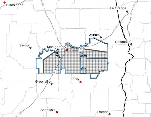
EXPIRED – Flood Advisory For Parts Of Pike, Bullock, Lowndes, Macon, & Montgomery Counties Until 6:00 PM

The National Weather Service in Birmingham has issued a
* Urban and Small Stream Flood Advisory for…
Northwestern Pike County in southeastern Alabama…
Bullock County in southeastern Alabama…
Lowndes County in south central Alabama…
Southern Macon County in southeastern Alabama…
Montgomery County in south central Alabama…
* Until 600 PM CST.
* At 203 PM CST, Doppler radar indicated heavy rain that will cause
urban and small stream flooding in the advisory area. Up to two
inches of rain have already fallen.
* Some locations that will experience flooding include…
Montgomery, Union Springs, Fort Deposit, Mosses, Hayneville,
Midway, Meadville, Pike Road, Coosada, Shorter, Gordonville,
Lowndesboro, Pickett, Hyundai Motors Of Alabama, Auburn University
In Montgomery, Dublin, Woodcrest, Beans Crossroads, Guerryton and
Snowdoun.
PRECAUTIONARY/PREPAREDNESS ACTIONS…
Turn around, don’t drown when encountering flooded roads. Most flood
deaths occur in vehicles.
Excessive runoff from heavy rainfall will cause flooding of small
creeks and streams, urban areas, highways, streets and underpasses as
well as other drainage areas and low lying spots.
A Flood Advisory means river or stream flows are elevated, or ponding
of water in urban or other areas is occurring or is imminent.
Category: Alabama's Weather, ALL POSTS, Severe Weather


