More Heavy Rain Likely & Some Strong/Severe Storms Possible For Your Wednesday
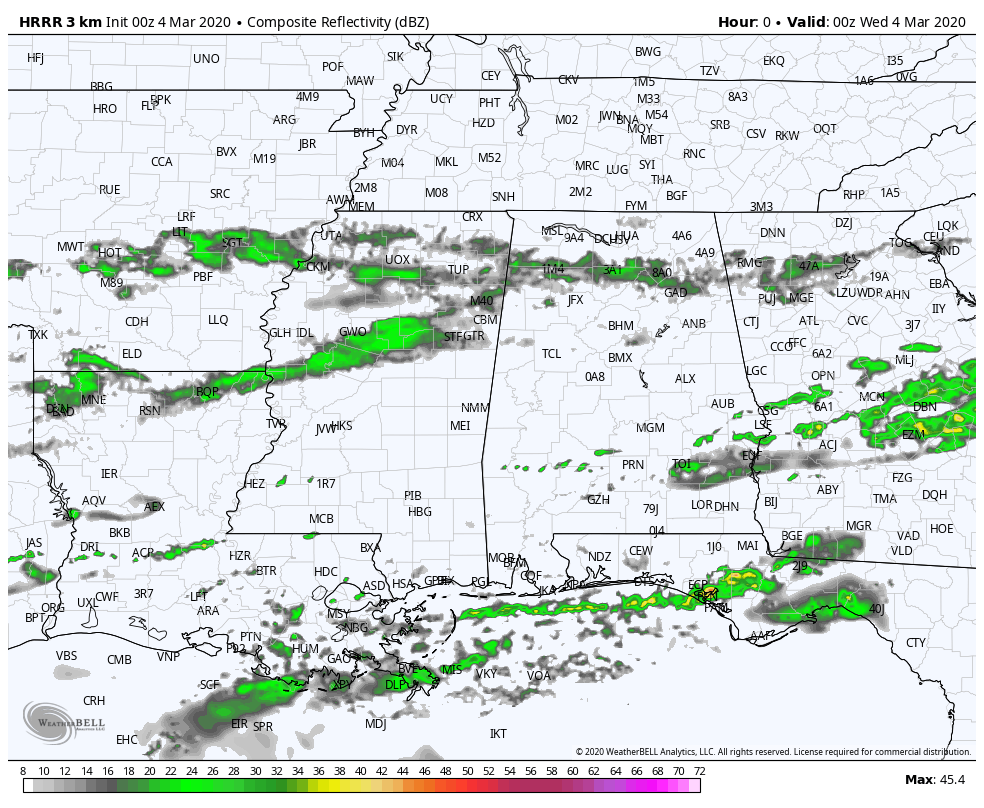
The above animation is from the latest complete run of the HRRR which is valid from 6:00 pm tonight through 12:00 pm Wednesday. It shows that we’ll continue to have the chance of light showers move across the northern portions of the area through midnight tonight before more rain moves in from the west. Also, a surface low moves from southern parts of Texas to just offshore of Louisiana and moisture will begin flowing up from the south and will increase rain and thunderstorm chances through the overnight hours.
By 6:00 am, a band of moderate to heavy rain and thunderstorms will have set up just to the south of the I-20 corridor. For the rest of the morning, rain and thunderstorm chances will increase for the rest of Central Alabama and will make the rest of your Wednesday a wet and gloomy day. With the heavy rainfall and the potential of those heavier cells training over the same locations, we could see some flooding issues.
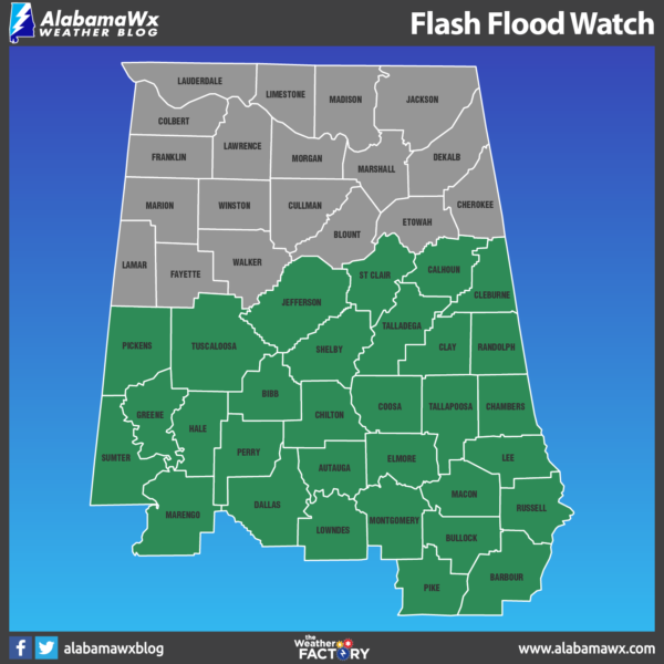
For that reason, NWS Birmingham has issued a FLASH FLOOD WATCH for the majority of Central Alabama starting at 6:00 am Wednesday morning and set to expire at 12:00 pm Thursday. With much of the area along and south of the I-20 corridor already receiving 1.00 to 2.00 inches of rainfall over the past day or two, creeks and waterways are nearing bankfull. Adding another 1.00 to 3.00 additional inches between Wednesday morning and Thursday morning brings the potential of flash flooding to the watch area.
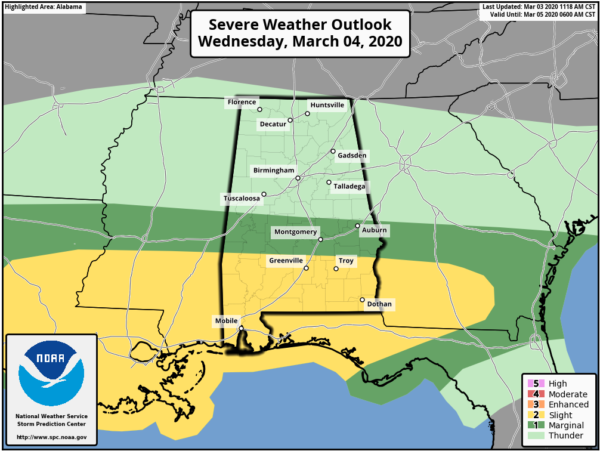
The Storm Prediction Center also has a Marginal Risk for severe storms for Wednesday for locations south of a line from Geiger (Sumter Co.) to Billingsley (Autauga Co.) to just north of Opelika (Lee Co.), while a Slight Risk is up for the extreme southern parts of Central Alabama south of a line from Sweet Water (Marengo Co.) to Fort Deposit (Lowndes Co.) to just south of Clayton (Barbour Co.).
The potential for severe storms will be there starting in the early afternoon hours on Wednesday and will persist through the remainder of the day and into the pre-dawn hours on Thursday. Damaging winds, quarter-size hail, and a few brief tornadoes may be possible over the risk locations during that time frame.
The rest of Central Alabama will have general rain and a few thunderstorms, but no organized severe weather is expected at this time, while we may have a strong storm or two with gusty winds and/or some small hail.
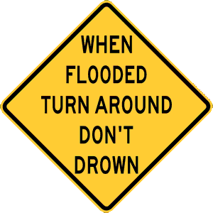 Play it smart, play it safe. Whether driving or walking, any time you come to a flooded road, TURN AROUND, DON’T DROWN! Each year, more deaths occur due to flooding than from any other severe weather-related hazard. The Centers for Disease Control report that over half of all flood-related drownings occur when a vehicle is driven into hazardous flood water. The next highest percentage of flood-related deaths is due to walking into or near floodwaters.
The reason that so many people drown during flooding is that few of them realize the incredible power of water. A mere six inches of fast-moving flood water can knock over an adult. It takes only two feet of rushing water to carry away most vehicles. This includes pickups and SUVs. If you come to an area that is covered with water, you will not know the depth of the water or the condition of the ground under the water. This is especially true at night when your vision is more limited.
We’ll have another update on the upcoming weather for your Wednesday in a few hours.
Category: Alabama's Weather, ALL POSTS, Severe Weather
About the Author (Author Profile)
Scott Martin is an operational meteorologist, professional graphic artist, musician, husband, and father. Not only is Scott a member of the National Weather Association, but he is also the Central Alabama Chapter of the NWA president. Scott is also the co-founder of Racecast Weather, which provides forecasts for many racing series across the USA. He also supplies forecasts for the BassMaster Elite Series events including the BassMaster Classic.Subscribe
If you enjoyed this article, subscribe to receive more just like it.


