

EXPIRED Severe Thunderstorm Warning for Parts of Lowndes and Montgomery Counties Until 6:30 a.m.
Hail and 60 mph winds are likely with this storm.
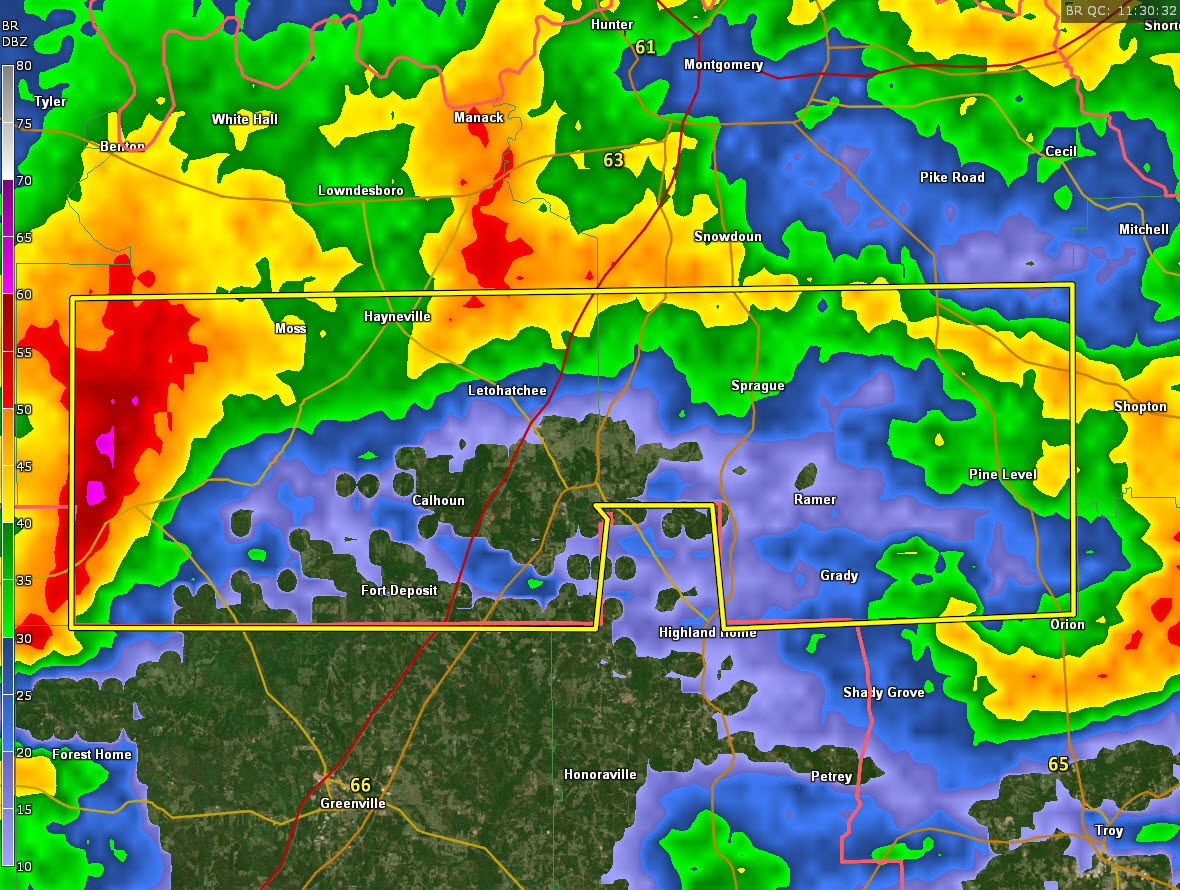
The National Weather Service in Birmingham has issued a
* Severe Thunderstorm Warning for…
Lowndes County in south central Alabama…
Southern Montgomery County in south central Alabama…
* Until 630 AM CST.
* At 531 AM CST, a severe thunderstorm was located near Gordonville,
or 7 miles southwest of Mosses, moving east at 50 mph.
HAZARD…60 mph wind gusts and quarter size hail.
SOURCE…Radar indicated.
IMPACT…Hail damage to vehicles is expected. Expect wind damage
to roofs, siding, and trees.
* Locations impacted include…
Fort Deposit, Mosses, Hayneville, Meadville, Gordonville, Pine
Level, Beechwood, Dublin, Grady, Sellers, Davenport, Ramer,
Pintlala, Lowndes County Airport, Strata, Naftel, Logan, Sprague,
Lapine and Calhoun.
Category: Alabama's Weather, ALL POSTS, Severe Weather
About the Author (Author Profile)
Bill Murray is the President of The Weather Factory. He is the site's official weather historian and a weekend forecaster. He also anchors the site's severe weather coverage. Bill Murray is the proud holder of National Weather Association Digital Seal #0001 @wxhistorianSubscribe
If you enjoyed this article, subscribe to receive more just like it.


