

Strong Storms Continue over South Central Alabama
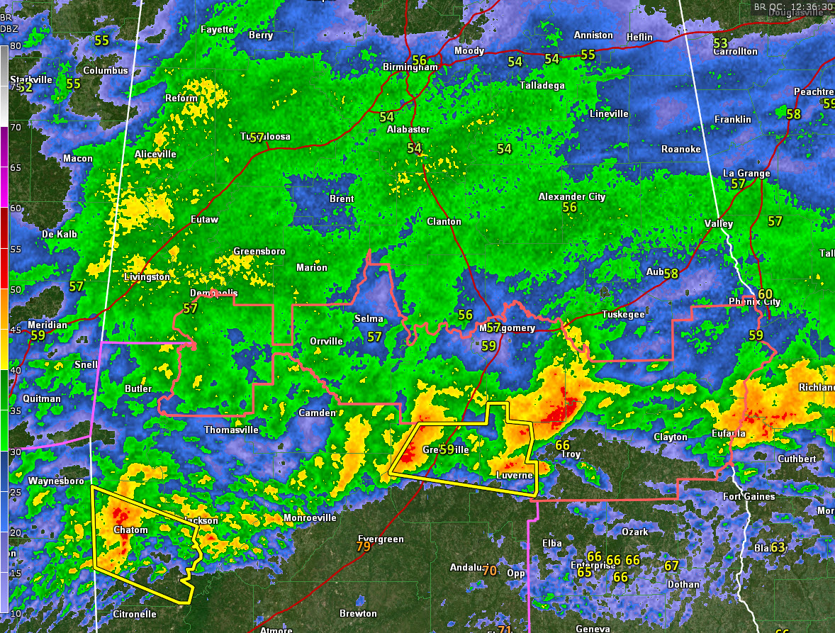
There is a severe thunderstorm warning in effect until 7:15 a.m. for parts of Butler, Crenshaw, Monrow, and Willcox counties. Strong thunderstorms continue over South and South Central Alabama this morning.
Another severe thunderstorm warning is in effect for Washington County in Southwest Alabama for storms approaching Chatom.
Elsewhere, strong storms are southeast of Montgomery, passing north of Troy. A severe thunderstorm warning was just issued for Barbour, Bullock, and Pike Counties till 7:30 AM CST
Moderate to heavy rain is affecting West Alabama from southern Lamar and Pickens Counties southward into Sumter and Marengo Counties and across Chilton and southern Shelby Counties. This activity will push eastward across much of Central Alabama over the next 3-4 hours. Some minor flooding may occur, but nothing major is expected at this time. There have been a few lightning strikes across southwestern Jefferson and northern Shelby Counties, but these storms pose no severe threat.
Storms have weakened across Miississippii fro the time being.
Additional waves of rain and storms will affect Central Alabama today, tonight and tomorrow. Flash flood watches are in effect for the southern half of the area.
A severe thunderstorm watch continues for 8 counties across South Central Alabama, including Marengo, Dallas, Lowndes, Montgomery, Pike, Bullock, Barbour, and Russell. A tornado watch covers the rest of Southwest Alabama,
Category: Alabama's Weather, ALL POSTS, Severe Weather
About the Author (Author Profile)
Bill Murray is the President of The Weather Factory. He is the site's official weather historian and a weekend forecaster. He also anchors the site's severe weather coverage. Bill Murray is the proud holder of National Weather Association Digital Seal #0001 @wxhistorianSubscribe
If you enjoyed this article, subscribe to receive more just like it.


