Severe Threat Ending For Southern Parts Of The Area
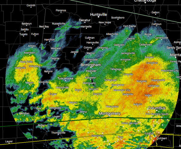
As of 7:53 am, the severe thunderstorm warning has been canceled for Barbour County as the strongest part of the storm has now moved into Georgia. With that occurring, it looks like the severe weather threat for the southern parts of Central Alabama has now come to an end and it’s likely that the remaining counties in the severe thunderstorm watch will be canceled shortly as well.
At this point, there is a big shield of moderate to heavy rainfall over the southern half of the area with only some light shower activity occurring north of the I-20 corridor. Don’t let your guard down yet on the heavy rainfall as more are expected to move through the area later today and through tonight and into tomorrow morning.
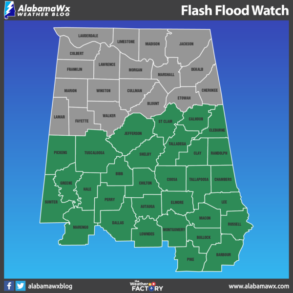
A Flash Flood Watch continues for much of Central Alabama through 12:00 pm Thursday as we could see an additional 1-3 inches of rainfall across the area. That amount of rain could lead to the rise in rivers and streams across the area and could lead to some flash flooding issues.
We’ll continue to have updates throughout the day and we’ll let you know if any flood warnings or advisories are issued for any locations in North/Central Alabama.
Category: Alabama's Weather, ALL POSTS, Severe Weather
About the Author (Author Profile)
Scott Martin is an operational meteorologist, professional graphic artist, musician, husband, and father. Not only is Scott a member of the National Weather Association, but he is also the Central Alabama Chapter of the NWA president. Scott is also the co-founder of Racecast Weather, which provides forecasts for many racing series across the USA. He also supplies forecasts for the BassMaster Elite Series events including the BassMaster Classic.Subscribe
If you enjoyed this article, subscribe to receive more just like it.


