

Quick 2:10 p.m. Check on the Alabama Weather Situation
The cluster of thunderstorms moving southeastward into Alabama continues to maintain itself as it moves deeper into the severe thunderstorms watch.
Just after 2 p.m., the leading edge of storms extends from eastern Franklin County, just to the west of Moulton in Lawrence county, to west of Haleyville to west of Hamiton to Amory and Winona in Mississippi. It is pushing southeast at 45 mph
There is a good bit of lightning, especially west of Aberdeen, Mississippi and along the Marion, Franklin County line in Alabama up into Lawrence County.
A few showers have formed in northern Jefferson County, north of Pinson.
The atmosphere ahead of the complex is weakly to moderately unstable, with CAPE values between 500-1,200 joules/kg. There is strong bulk wind shear, which would tend to help keep the storms organized, but very little low-level helicity, so there is almost no tornado threat.
Lapse rates are pretty steep, meaning storm updrafts could become strong. Instability in the hail producing region aloft is decent as well. The main threats will, therefore, be damaging winds and hail.
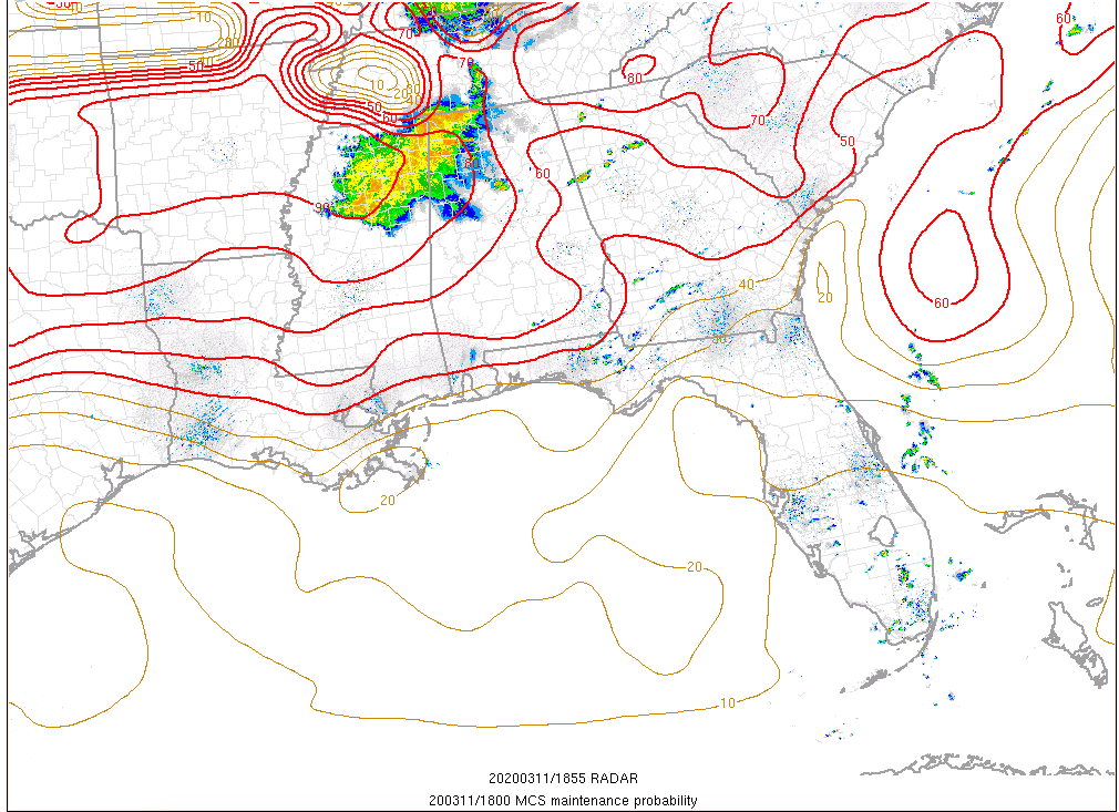
SPC MCS Maintenance Probability Product showing probability these storms hold together
The MCS Maintenance Probability product from the SPC shows the system should slowly weaken as it pushes southeastward. Mesoscale modeling indicates it should begin breaking up as it reaches I-59 around 5 p.m.
A severe thunderstorm watch continues from parts of western Alabama until 7 p.m.
We will be continuously monitoring the storms.
Category: Alabama's Weather, ALL POSTS, Severe Weather
About the Author (Author Profile)
Bill Murray is the President of The Weather Factory. He is the site's official weather historian and a weekend forecaster. He also anchors the site's severe weather coverage. Bill Murray is the proud holder of National Weather Association Digital Seal #0001 @wxhistorianSubscribe
If you enjoyed this article, subscribe to receive more just like it.


