A Quick Check On Our Weather Just Before 9:30 AM; A Few Strong Storms Remain Possible Later Today
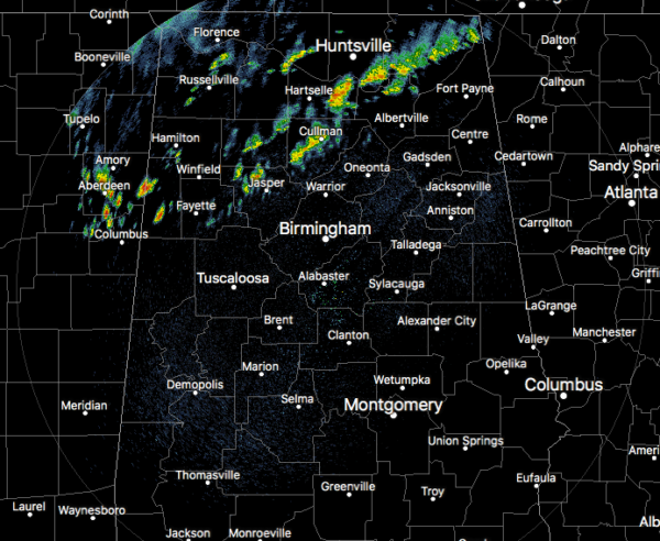
As of 9:15 am, we have shower activity located over portions of North Alabama and down into the northwestern parts of Central Alabama. There may be a clap of thunder or two involved with this activity, but at the moment, no lightning was being detected on radar. All of the activity is slowly moving eastward while the cells in the activity are moving northeast.
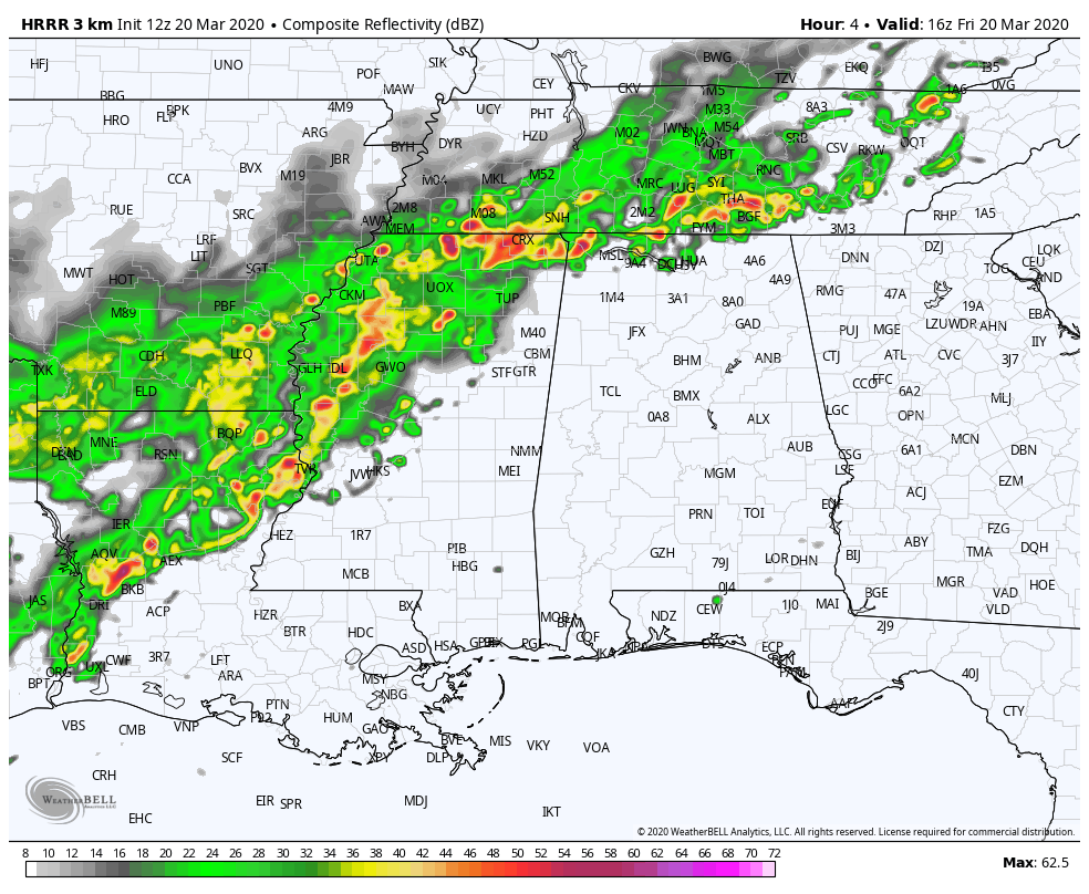
The latest full run of the HRRR shows that a line of showers and thunderstorms will be slowly moving into the northwestern parts of the state and will eventually move across all of Central Alabama. Rainfall could be heavy in a few of these thunderstorms, but an overall flood threat does not look likely as most locations will stay below 1.00 inch in rainfall. There may be a swath along and just north of the I-59 corridor that may see 1.00 inch or a little more throughout the day, but it will be very manageable.
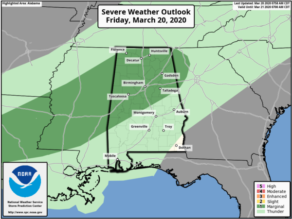
We will have to watch for the possibility of a few stronger to severe thunderstorms. The Storm Prediction Center has all of North Alabama and much of Central Alabama in a Marginal Risk for severe storms throughout the day today, but the main window for that potential will be from roughly 12:00 pm through 7:00 pm. Isolated damaging wind gusts up to 60 MPH and some hail reaching as large as 1.00 inch in diameter will be possible. If you are north of a line from Sweet Water (Marengo Co.) to Billingsley (Autauga Co.) to Wedowee (Randolph Co.), you are included in the Marginal Risk. South of that line, there is no risk for organized severe storms at this time.
To break that timing down just a little bit further, locations north of a line from Aliceville (Pickens Co.) to Cullman (Cullman Co.) to Stevenson (Jackson Co.) could see stronger to severe storms during the 12:00 pm to 4:00 pm time frame. This includes Huntsville, Florence, Muscle Shoals, Hamilton, Haleyville, Jasper, Reform, and Sulligent. Locations south of that stretching south to a line from Sweet Water to Billingsley to Wedowee could see stronger to severe storms in the 3:00 pm to 7:00 pm time frame. This would include the cities of Birmingham, Tuscaloosa, Gadsden, Demopolis, Marion, Brent, Montevallo, Talladega, Oneonta, Anniston, and Clanton.
We’ll keep you posted throughout the day with updates and if any warnings are issued.
Category: Alabama's Weather, ALL POSTS, Severe Weather
About the Author (Author Profile)
Scott Martin is an operational meteorologist, professional graphic artist, musician, husband, and father. Not only is Scott a member of the National Weather Association, but he is also the Central Alabama Chapter of the NWA president. Scott is also the co-founder of Racecast Weather, which provides forecasts for many racing series across the USA. He also supplies forecasts for the BassMaster Elite Series events including the BassMaster Classic.Subscribe
If you enjoyed this article, subscribe to receive more just like it.


