Rain, Storms Entering West Alabama with Rain, Lightning, Winds to 30 mph
An area of rain and storms over southeastern Mississippi is moving up into Southwest Alabama this morning and will be pushing east-northeastward across Central Alabama this morning.
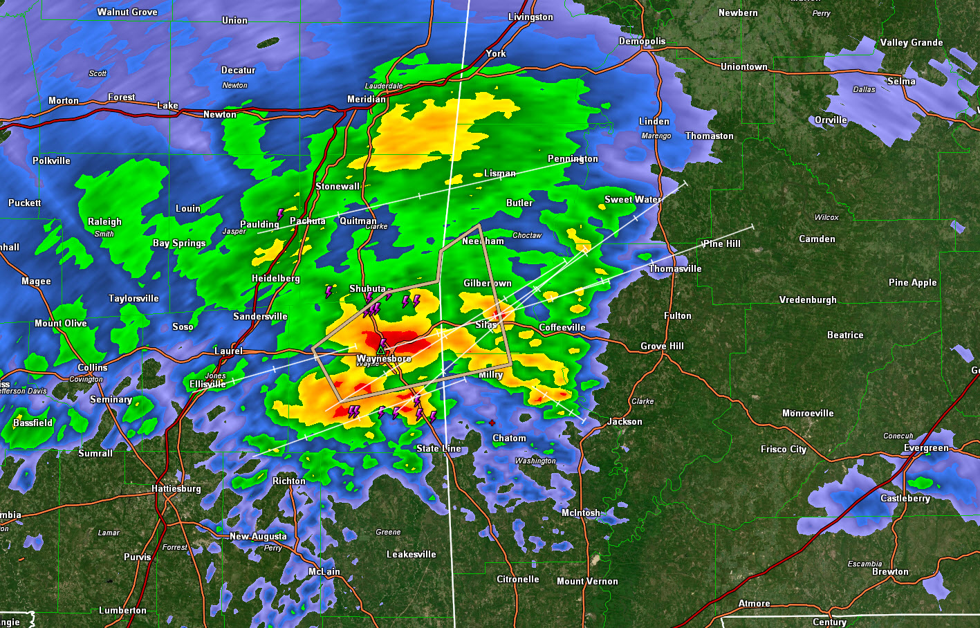
The strongest storm, which is not severe, is near Waynesboro, in Wayne County, Mississippi. This storm will affect parts of Choctaw County, Alabama, from Needham to Gilberttown to Silas and Millry. This same storm will move toward Thomasville and Camden. It has lightning and winds of 30 mph. That peach-colored polygon is a significant weather advisory.
The main rain area will reach the Tuscaloosa area between 930-1030 and the Birmingham area between 1030-1130. There will be some showers before then as well though.
There could be a little isolated thunder as far north as I-20, with a little more to the south of Clanton.
The storms are not expected to become severe.
Rain will move out this afternoon. Highs will be in the middle 60s.
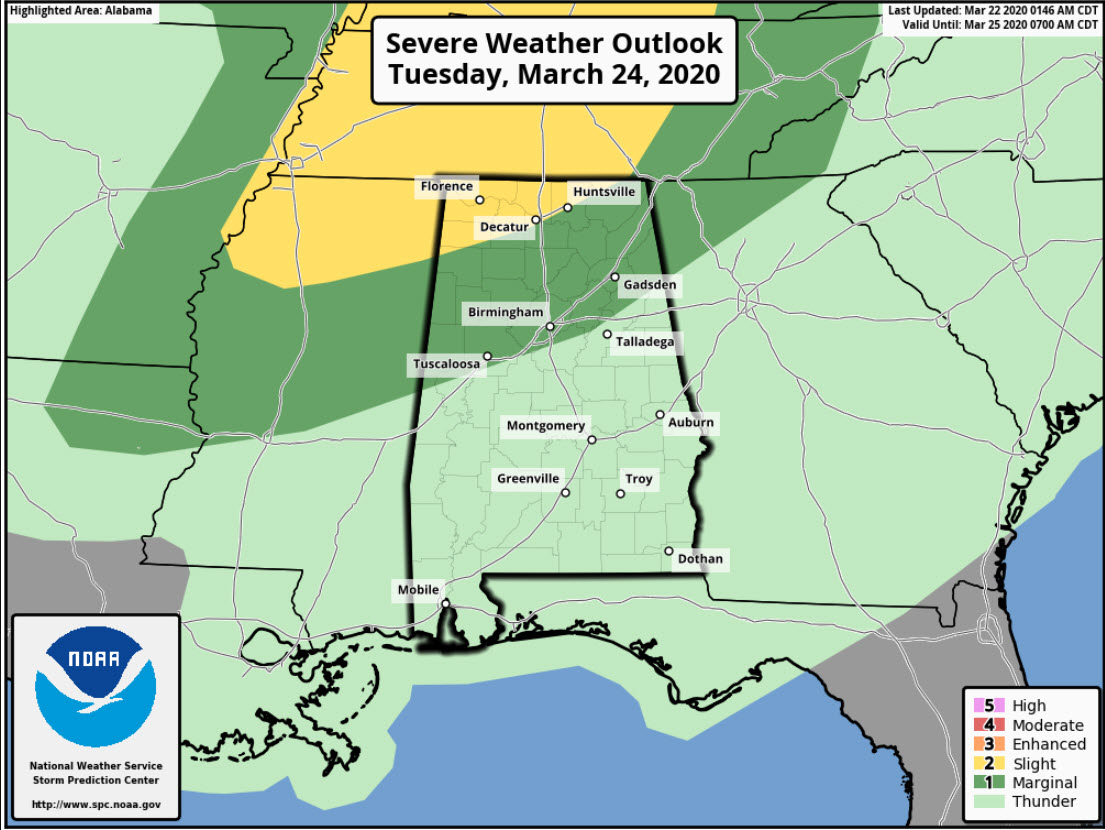
There is a severe weather threat on Tuesday for parts of Alabama. We will be breaking it down more later today, but the threats will be damaging wind and hail. The main areas affected will be north of I-59.
Category: Alabama's Weather, ALL POSTS
About the Author (Author Profile)
Bill Murray is the President of The Weather Factory. He is the site's official weather historian and a weekend forecaster. He also anchors the site's severe weather coverage. Bill Murray is the proud holder of National Weather Association Digital Seal #0001 @wxhistorianSubscribe
If you enjoyed this article, subscribe to receive more just like it.


