

Some Hail Possible Over The Northwestern Parts Of Alabama Over The Next Few Hours
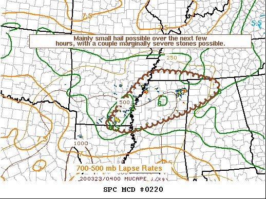
Latest Mesoscale Discussion from the Storm Prediction Center…
Areas affected…Far southeast Arkansas…southwest
Tennessee…northern Mississippi…northern Alabama
Concerning…Severe potential…Watch unlikely
Probability of Watch Issuance…5 percent
SUMMARY…Mainly small hail, with a couple stones over 1 inch in diameter, will be possible with elevated storms over the next few hours. A WW issuance is not anticipated.
DISCUSSION…Discrete cells have recently developed and intensified within a low-level WAA advection regime, atop a relatively stable boundary layer. Modest forcing for ascent, combined with very strong deep-layer shear (bulk effective shear values exceeding 50 knots) has allowed for some of the stronger cores to become organized and achieve very modest mid-level rotation. Nonetheless, the ambient environment is weakly buoyant, with poor lapse rates throughout the troposphere and only modest 925-850 mb moisture driving MUCAPE values that barely exceed 500 J/kg. While current storm structures may promote hail development, the weak mid-level lapse rates and aforementioned buoyancy suggest that most hail will be relatively small in nature, though a couple stones may briefly exceed 1 inch in diameter in the strongest, most organized storms.
The very sparse and brief nature of the severe hail threat precludes
a WW issuance.
Category: Alabama's Weather, ALL POSTS, Severe Weather
About the Author (Author Profile)
Scott Martin is an operational meteorologist, professional graphic artist, musician, husband, and father. Not only is Scott a member of the National Weather Association, but he is also the Central Alabama Chapter of the NWA president. Scott is also the co-founder of Racecast Weather, which provides forecasts for many racing series across the USA. He also supplies forecasts for the BassMaster Elite Series events including the BassMaster Classic.Subscribe
If you enjoyed this article, subscribe to receive more just like it.


