Some Sun, Some Clouds, & Maybe A Rain Drop Or Two At Midday
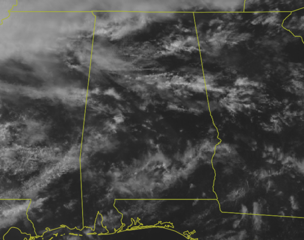
Good afternoon to all you cool cats and kittens… it is a really nice Monday across Central Alabama as we have reached the midday hour. Most locations are receiving a decent amount of sunshine but we do have some clouds floating overhead, mostly concentrated over the northwestern parts of the area. A few showers are falling over the northern parts of the state mainly north of the Tennessee River, but I believe everything else showing up is not reaching the ground. Temperatures were in the upper 60s to the upper 70s across the area as of 11:55 am. Cullman was the cool spot at 69 degrees while Montgomery was the warm spot at 77 degrees. Birmingham was at 72 degrees.
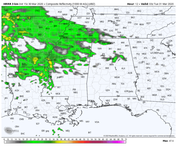
HRRR valid tonight at 10:00 pm.
We should stay mainly dry through the rest of the daylight hours and into the evening, but showers will start to move in during the late-night and overnight hours. Rain chances will be the highest west of I-59 through the overnight hours and some thunder will be possible, but all of the area will have some chance of rain. Afternoon highs will reach the lower 70s to the lower 80s across the area from northwest to southeast.
A surface low will move across the central parts of the area on Tuesday during the morning and into the early afternoon hours, bringing rain and thunderstorms to Central Alabama at least through much of the day with rain moving out and into Georgia during the evening hours. North of the low’s track, storms will stay below severe limits. A few stronger to severe storms will be possible along and south of the low’s track. Highs will top out in the upper 50s in the northwest to the upper 70s in the southeast.
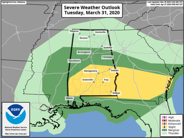
A Marginal Risk is up for locations along and south of a line from Detroit (Lamar Co.) to Locust Fork (Blount Co.) to Piedmont (Calhoun Co.). A Slight Risk is up for locations along and south of a line from Linden (Marengo Co.) to Lawley (Bibb Co.) to Cusetta (Chambers Co.). All modes of severe weather will be possible in the Slight Risk locations (tornadoes, damaging winds up to 60 MPH, quarter-size hail). Threats in the Marginal Risk will be less likely but cannot be ruled out.
Timing on the potential for stronger to severe storms will start around 9:00 am in the western parts of the risks areas and should come to an end around 3:00 pm in the eastern parts as the storms exit the state and move into Georgia. While there is a threat for severe storms in the risk locations west of I-65, storms will probably end up a little more active along and east of I-65 as we’ll be reaching the peak heating of the day in those locations.
We’ll have updates on the potential for strong to severe storms throughout the day on Monday and we’ll be with you with any watches, warnings, and important updates on Tuesday. Be prepared and stay weather aware. Just remember, any northward progression in the track of the low will pull the severe risks farther north.
Category: Alabama's Weather, ALL POSTS, Severe Weather
About the Author (Author Profile)
Scott Martin is an operational meteorologist, professional graphic artist, musician, husband, and father. Not only is Scott a member of the National Weather Association, but he is also the Central Alabama Chapter of the NWA president. Scott is also the co-founder of Racecast Weather, which provides forecasts for many racing series across the USA. He also supplies forecasts for the BassMaster Elite Series events including the BassMaster Classic.Subscribe
If you enjoyed this article, subscribe to receive more just like it.


